![](/images/other/stat-length.png)
MARCHIN - Val d'Ereffe
tourcondroz
User
![Length](/images/other/stat-length.png)
![Max alt](https://static1.geolcdn.com/siteimages/upload/files/1508320355ic_sort_altitude_max_24dp.png)
![Uphill gradient](https://static1.geolcdn.com/siteimages/upload/files/1508320355ic_sort_den_pos_24dp.png)
![Km-Effort](/images/other/stat-length.png)
![Min alt](https://static1.geolcdn.com/siteimages/upload/files/1508320355ic_sort_altitude_min_24dp.png)
![Downhill gradient](https://static1.geolcdn.com/siteimages/upload/files/1508320355ic_sort_den_neg_24dp.png)
![Boucle](https://static1.geolcdn.com/siteimages/upload/files/16400158638029165_repeat_loop_refresh_sync_direction_icon.png)
![Signpost](https://services.sitytrail.com/GeolivesWS/DownloadMedia.ashx?TrailID=144729&Media=balise.png)
![Equestrian](https://static1.geolcdn.com/sitytour/trail-icons/300.png)
1h40
Difficulty : Medium
![Scan this QR Code to open this trail in the SityTrail application](https://capi.geolives.com/qq0zvz2zws4bq2lad0pu/sitytour/trails/144729/qr.png?size=200)
FREE GPS app for hiking
About
Trail Equestrian of 7.5 km to be discovered at Wallonia, Liège, Marchin. This trail is proposed by tourcondroz.
Description
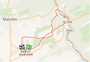
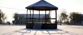
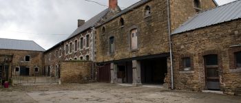
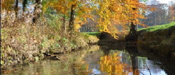
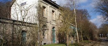
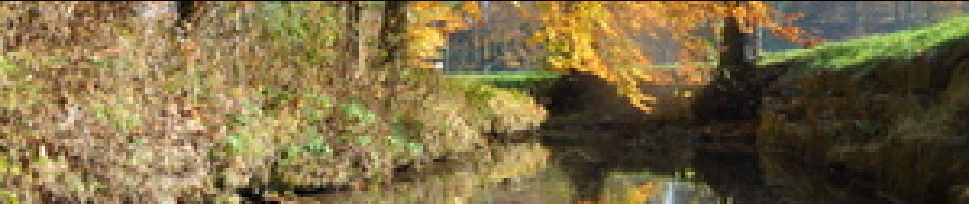
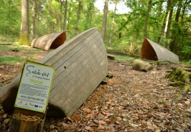
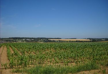
Au départ de la place de Grand-Marchin, cette promenade vous donne l''occasion de visiter le hameau d''Ereffe, situé en contre-bas de Grand-Marchin. Pour cela, vous serez guidés au travers des campagnes et du bois de Séchamp pour atteindre le Fond du Fourneau. Ensuite, vous longerez le RAVeL, et la rivière du Hoyoux. Enfin, pour récompenser vos efforts, votre marche se terminera par la remontée vers Ereffe et Grand-Marchin, en vous offrant de splendides vues panoramiques.
Cette promenade est à éviter en hiver et peut être boueuse par temps humide.
BALISE: rond bleu
Sources: Syndicat d''initiative de la Vallée du Hoyoux/Contrat Rivière Meuse-Aval/Pourvu que longtemps encore... Cr. photos : C. Robert - S. Pêcheur
Points of interest
Positioning
Comments
Trails nearby
![Trail Walking Clavier - RB-Lg-01 - Raccourci - Photo](https://media.geolcdn.com/t/375/260/ext.jpg?maxdim=2&url=https%3A%2F%2Fservices.sitytrail.com%2FGeolivesWS%2FDownloadMedia.ashx%3FTrailID%3D209390%26Media%3D22266d26-9089-4b3a-b5ae-a6da953afba4.jpg)
![Walking Walking](https://static1.geolcdn.com/sitytour/trail-icons/101.png)
Walking
![](/images/other/stat-length.png)
![](https://static1.geolcdn.com/siteimages/upload/files/16400158638029165_repeat_loop_refresh_sync_direction_icon.png)
![Trail Walking Clavier - RB-Lg-01 - Dans les vallées du Hoyoux et du ruisseau de Pailhe - Photo](https://media.geolcdn.com/t/375/260/ext.jpg?maxdim=2&url=https%3A%2F%2Fservices.sitytrail.com%2FGeolivesWS%2FDownloadMedia.ashx%3FTrailID%3D179556%26Media%3D22266d26-9089-4b3a-b5ae-a6da953afba4.jpg)
![Walking Walking](https://static1.geolcdn.com/sitytour/trail-icons/101.png)
Walking
![](/images/other/stat-length.png)
![](https://static1.geolcdn.com/siteimages/upload/files/16400158638029165_repeat_loop_refresh_sync_direction_icon.png)
![Trail Walking Modave - Modave. Natura 2000, des sites qui valent le détour ! Lg4 - Photo](https://media.geolcdn.com/t/375/260/ext.jpg?maxdim=2&url=https%3A%2F%2Fservices.sitytrail.com%2FGeolivesWS%2FDownloadMedia.ashx%3FTrailID%3D161410%26Media%3Dd7c559bb-fafd-4624-b5f1-8908c3c540dc.JPG)
![Walking Walking](https://static1.geolcdn.com/sitytour/trail-icons/101.png)
Walking
![](/images/other/stat-length.png)
![](https://static1.geolcdn.com/siteimages/upload/files/16400158638029165_repeat_loop_refresh_sync_direction_icon.png)
![Trail Walking Clavier - CLAVIER - La Romantique - Photo](https://media.geolcdn.com/t/375/260/ext.jpg?maxdim=2&url=https%3A%2F%2Fservices.sitytrail.com%2FGeolivesWS%2FDownloadMedia.ashx%3FTrailID%3D162888%26Media%3D9ae93777-447a-4289-aab4-f0814b4e414d.jpg)
![Walking Walking](https://static1.geolcdn.com/sitytour/trail-icons/101.png)
Walking
![](/images/other/stat-length.png)
![](https://static1.geolcdn.com/siteimages/upload/files/16400158638029165_repeat_loop_refresh_sync_direction_icon.png)
![Trail Walking Marchin - MARCHIN - Chemin de la Mémoire - Photo](https://media.geolcdn.com/t/375/260/ext.jpg?maxdim=2&url=https%3A%2F%2Fservices.sitytrail.com%2FGeolivesWS%2FDownloadMedia.ashx%3FTrailID%3D134945%26Media%3D9baec6a8-ffff-4223-8cd2-41c1e7b6afda.jpg)
![Walking Walking](https://static1.geolcdn.com/sitytour/trail-icons/101.png)
Walking
![](/images/other/stat-length.png)
![](https://static1.geolcdn.com/siteimages/upload/files/16400158638029165_repeat_loop_refresh_sync_direction_icon.png)
![Trail Walking Modave - Circuit de Petit-Modave - Modave(MD 01) - Photo](https://media.geolcdn.com/t/375/260/ext.jpg?maxdim=2&url=https%3A%2F%2Fservices.sitytrail.com%2FGeolivesWS%2FDownloadMedia.ashx%3FTrailID%3D211950%26Media%3D225bb37c-a1e6-4f9b-b5fa-27b4f60e72ba.JPG)
![Walking Walking](https://static1.geolcdn.com/sitytour/trail-icons/101.png)
Walking
![](/images/other/stat-length.png)
![](https://static1.geolcdn.com/siteimages/upload/files/16400158638029165_repeat_loop_refresh_sync_direction_icon.png)
![Trail Walking Modave - Balade à Modave - Photo](https://media.geolcdn.com/t/375/260/ext.jpg?maxdim=2&url=https%3A%2F%2Fmedia.geolcdn.com%2Ff%2Fefa446e4-aa4c-4b7a-afaa-1e1b5351db79.jpeg)
![Walking Walking](https://static1.geolcdn.com/sitytour/trail-icons/101.png)
Walking
![](/images/other/stat-length.png)
![](https://static1.geolcdn.com/siteimages/upload/files/16400158638029165_repeat_loop_refresh_sync_direction_icon.png)
![Trail Walking Ohey - Sentiers d'Art : Boucle 13 - Jallet - Photo](https://media.geolcdn.com/t/375/260/ext.jpg?maxdim=2&url=https%3A%2F%2Fmedia.geolcdn.com%2Ff%2Fa759f816-4e45-4141-b3b0-3fdc8cbc0aa1.JPG)
![Walking Walking](https://static1.geolcdn.com/sitytour/trail-icons/101.png)
Walking
![](/images/other/stat-length.png)
![](https://static1.geolcdn.com/siteimages/upload/files/16400158638029165_repeat_loop_refresh_sync_direction_icon.png)
![Trail Walking Ohey - OHEY- Jallet (Hodoumont) N°14 Patrimoine - Photo](https://media.geolcdn.com/t/375/260/ext.jpg?maxdim=2&url=https%3A%2F%2Fservices.sitytrail.com%2FGeolivesWS%2FDownloadMedia.ashx%3FTrailID%3D121421%26Media%3D17893d9b-46b6-4b6b-a31d-e8bf45aab994.jpg)
![Walking Walking](https://static1.geolcdn.com/sitytour/trail-icons/101.png)
Walking
![](/images/other/stat-length.png)
![](https://static1.geolcdn.com/siteimages/upload/files/16400158638029165_repeat_loop_refresh_sync_direction_icon.png)