


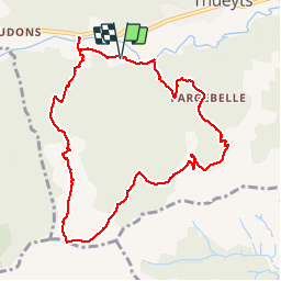


13.6 km | 23 km-effort


User


FREE GPS app for hiking
 SityTrail
IGN / Geographical institutes
SityTrail World
The world is yours!
Trail Walking of 10.3 km to be discovered at Auvergne-Rhône-Alpes, Ardèche, Thueyts. This trail is proposed by philoustetou.
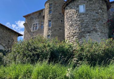
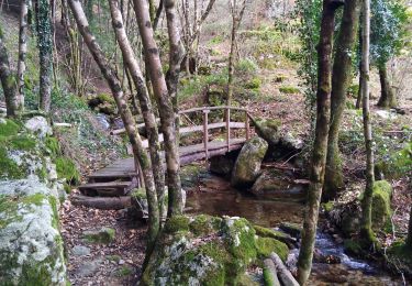
Ballade du "chemin des plaideurs" en partant du camping. Fort dénivellé montant et descendant sur sentiers et drailles, des framboises sur le chemin et température idéale pour marcher. Fin du circuit par la passerelle de Luzet au-dessus de l'Ardèche.


Walking

Walking

Walking
Walking

Walking

sport

Walking
Walking
Walking