Trail Walking Saint-Mury-Monteymond - Lac Blanc - Photo
 Noiraude
Noiraude

User

© OpenStreetMap contributors
Length
Length
14.8 km
Max alt
Max alt
2201 m
Uphill gradient
Uphill gradient
1629 m
Km-Effort
Km-Effort  
37 km
Min alt
Min alt
929 m
Downhill gradient
Downhill gradient
1629 m
Boucle
Boucle
Yes
Creation date :
2014-12-10 00:00:00.0
Updated on :
2014-12-10 00:00:00.0

(0 Reviews)

Walking
Walking
6h46
Difficulty : Difficult

Scan this QR Code to open this trail in the SityTrail application

FREE GPS app for hiking

Logo SityTrail SityTrail

IGN / Geographical institutes

Download SityTrail from the App Store Download SityTrail from Google Play

Logo SityTrail SityTrail World

The world is yours!

Download SityTrail from the App Store Download SityTrail from Google Play Download SityTrail on Huawei AppGallery

About

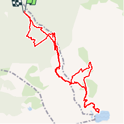
Trail Walking of 14.8 km to be discovered at Auvergne-Rhône-Alpes, Isère, Saint-Mury-Monteymond. This trail is proposed by Noiraude.

Description

Depart par la Gorge (Parking le Chenevrey).
Très belle balade le long du torrent avec de nombreuses cascades mais le dénivelé est soutenu (1000m sur les 4 premiers km).
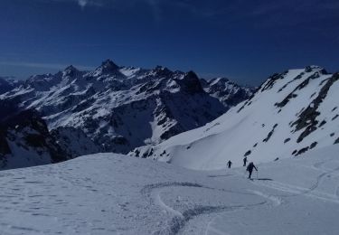
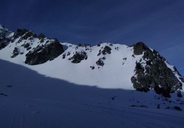
La vue et le Lac blanc sont magnifiques

Elevation profile

Positioning

Country:
France
Region :
Auvergne-Rhône-Alpes
Department/Province :
Isère
Municipality :
Saint-Mury-Monteymond
Location:
Unknown
Start:(UTM)
731289 ; 5009921 (31T) N.

Trails nearby

Trail On foot La Combe-de-Lancey - Chemin de Découverte (boucle Basse) - Photo
On foot
GUIDE+

On foot

Easy
La Combe-de-Lancey, Auvergne-Rhône-Alpes, Isère, France
3.5 km | 5.1 km-effort
1h 9min
Yes
Trail On foot La Combe-de-Lancey - Chemin de Découverte (boucle Haute) - Photo
On foot
GUIDE+

On foot

Easy
La Combe-de-Lancey, Auvergne-Rhône-Alpes, Isère, France
3.5 km | 5.4 km-effort
1h 13min
Yes
Trail Touring skiing Les Adrets - le jas de lièvre et vol de Bédina - Photo
Touring skiing
GUIDE
nadd73

Touring skiing

Difficult
Les Adrets, Auvergne-Rhône-Alpes, Isère, France
12.6 km | 30 km-effort
7h 10min
Yes
Trail Touring skiing Laval-en-Belledonne - col du Rafour et couloir ouest de la montagne de Barlet - Photo
Touring skiing
GUIDE
nadd73

Touring skiing

Difficult
Laval-en-Belledonne, Auvergne-Rhône-Alpes, Isère, France
10.9 km | 26 km-effort
6h 29min
No
Trail Touring skiing Laval-en-Belledonne - la dent du Pra par le col de l'Aigleton - Photo
Touring skiing
GUIDE
nadd73

Touring skiing

Difficult
Laval-en-Belledonne, Auvergne-Rhône-Alpes, Isère, France
12.7 km | 31 km-effort
7h 34min
Yes
Trail Touring skiing Laval-en-Belledonne - couloir Est du sifflet et pas du pin par couloir ouest - Photo
Touring skiing
GUIDE
nadd73

Touring skiing

Difficult
Laval-en-Belledonne, Auvergne-Rhône-Alpes, Isère, France
13.2 km | 31 km-effort
8h 22min
Yes
Trail Walking Laval-en-Belledonne - PETITE RANDONNEE AU DEPART DU PONT DE LA BETTA  - Photo
Walking
walrou63

Walking

Medium
Laval-en-Belledonne, Auvergne-Rhône-Alpes, Isère, France
6.1 km | 9.9 km-effort
1h 35min
Yes
Trail Walking La Combe-de-Lancey - Col du Pré du Molard - Photo
Walking
flip38

Walking

Difficult
La Combe-de-Lancey, Auvergne-Rhône-Alpes, Isère, France
17.8 km | 33 km-effort
5h 19min
Yes
Trail Walking Saint-Mury-Monteymond - Lac Blanc au pied de Belledonne - Photo
Walking
GuyVachet

Walking

Very difficult
Saint-Mury-Monteymond, Auvergne-Rhône-Alpes, Isère, France
12.2 km | 26 km-effort
5h 49min
Yes


Close
My subscriptions