


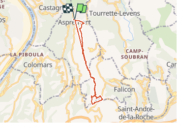

7.5 km | 12 km-effort


User


FREE GPS app for hiking
 SityTrail
IGN / Geographical institutes
SityTrail World
The world is yours!
Trail Running of 12.7 km to be discovered at Provence-Alpes-Côte d'Azur, Maritime Alps, Aspremont. This trail is proposed by chrisrando.
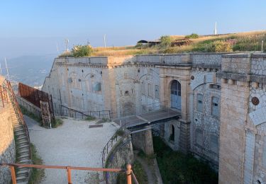
Dommage données un peu faussées l'application a beugué, sinon parcours sympa, des passages techniques très pierreux donc un bon équipement indispensable (chaussures running trail)

Walking
Walking

On foot

Running

Walking

Walking

Walking

Walking

Walking