Circuit des Verriers - Meisenthal
tracegps
User
Length
6.2 km
Max alt
392 m
Uphill gradient
169 m
Km-Effort
8.4 km
Min alt
282 m
Downhill gradient
169 m
Boucle
Yes
Creation date :
2014-12-10 00:00:00.0
Updated on :
2014-12-10 00:00:00.0
1h30
Difficulty : Medium
FREE GPS app for hiking
About
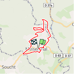
Trail Walking of 6.2 km to be discovered at Grand Est, Moselle, Meisenthal. This trail is proposed by tracegps.
Description
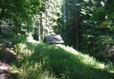
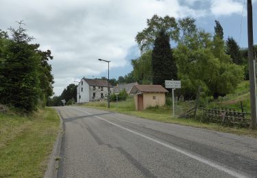
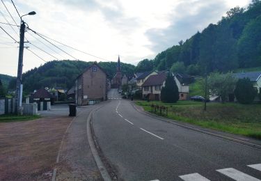
Meisenthal est une ancienne cité verrière (musée, CIAV); la randonnée démarre place E. Gallé et suit un fléchage anneau rouge du Club Vosgien, monte au Schieresthal (château Lancy et chapelle ND des Neiges); retour par la rue des Tiseurs, la rue de Soucht et la rue de l'Ancienne Paroisse.
Positioning
Country:
France
Region :
Grand Est
Department/Province :
Moselle
Municipality :
Meisenthal
Location:
Unknown
Start:(Dec)
Start:(UTM)
379450 ; 5425010 (32U) N.
Comments
Trails nearby
Saint-Louis-Lès-Bitche et le pays du verre et du cristal
Walking
Medium
(2)
Saint-Louis-lès-Bitche,
Grand Est,
Moselle,
France
13.1 km | 17.5 km-effort
3h 19min
Yes
Wayside crosses tour No. 4
On foot
Easy
Montbronn,
Grand Est,
Moselle,
France
4.9 km | 6.2 km-effort
1h 24min
No
Losange vert
On foot
Easy
Volksberg,
Grand Est,
Bas-Rhin,
France
9.1 km | 12.3 km-effort
2h 48min
Yes
Following in the footsteps of the Glass and Clog makers - Tour 2
On foot
Easy
Meisenthal,
Grand Est,
Moselle,
France
12.2 km | 16.7 km-effort
3h 47min
Yes
Mooncatchers permanent trail - 20 km
On foot
Easy
Meisenthal,
Grand Est,
Moselle,
France
8.8 km | 11.7 km-effort
2h 39min
No
Mooncatchers permanent trail - 10 km
On foot
Easy
Soucht,
Grand Est,
Moselle,
France
9.3 km | 12.5 km-effort
2h 50min
Yes
Goetzenbruck fountains and washing places tour
On foot
Easy
Goetzenbruck,
Grand Est,
Moselle,
France
6.7 km | 9.1 km-effort
2h 4min
Yes