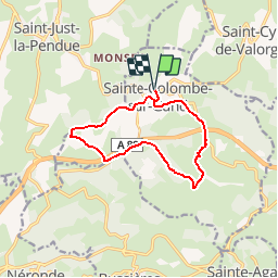
![](/images/other/stat-length.png)
![Trail Walking Sainte-Colombe-sur-Gand - Le Pont Marteau et la vallée du Bernand - Sainte Colombe sur Gand - Photo](https://media.geolcdn.com/t/1900/400/ext.pjpeg?maxdim=2&url=https%3A%2F%2Fservices.sitytrail.com%2FGeolivesWS%2FDownloadMedia.ashx%3FTrailID%3D129917%26Media%3D13470_6.jpg)
Le Pont Marteau et la vallée du Bernand - Sainte Colombe sur Gand
tracegps
User
![Length](/images/other/stat-length.png)
![Max alt](https://static1.geolcdn.com/siteimages/upload/files/1508320355ic_sort_altitude_max_24dp.png)
![Uphill gradient](https://static1.geolcdn.com/siteimages/upload/files/1508320355ic_sort_den_pos_24dp.png)
![Km-Effort](/images/other/stat-length.png)
![Min alt](https://static1.geolcdn.com/siteimages/upload/files/1508320355ic_sort_altitude_min_24dp.png)
![Downhill gradient](https://static1.geolcdn.com/siteimages/upload/files/1508320355ic_sort_den_neg_24dp.png)
![Boucle](https://static1.geolcdn.com/siteimages/upload/files/16400158638029165_repeat_loop_refresh_sync_direction_icon.png)
![Walking](https://static1.geolcdn.com/sitytour/trail-icons/101.png)
3h00
Difficulty : Medium
![Scan this QR Code to open this trail in the SityTrail application](https://capi.geolives.com/qq0zvz2zws4bq2lad0pu/sitytour/trails/129917/qr.png?size=200)
FREE GPS app for hiking
About
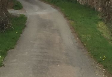
Trail Walking of 10.9 km to be discovered at Auvergne-Rhône-Alpes, Loire, Sainte-Colombe-sur-Gand. This trail is proposed by tracegps.
Description
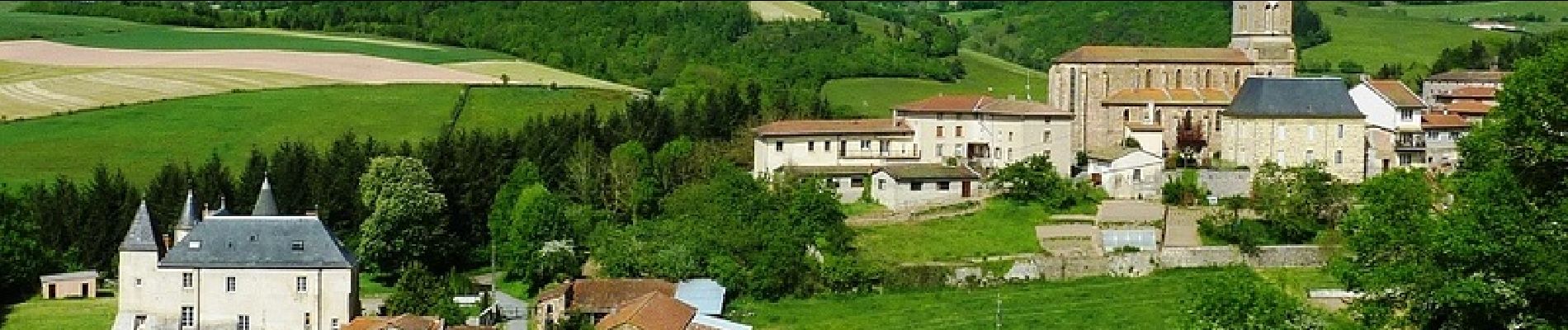
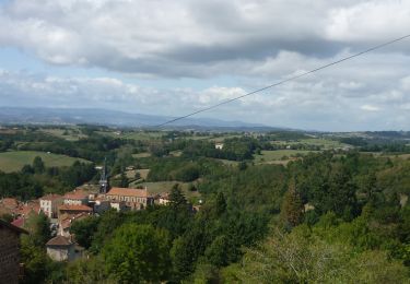
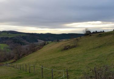
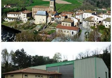
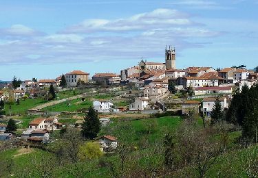
Parking et départ de la place de l'église de Sainte Colombe sur Gand. Au départ, avec un joli coup d’œil sur le village perché de Saint-Just-la-Pendue, cette belle balade paisible et champêtre vous fera découvrir le "Pont Marteau", ses bois, ses prairies et ses vallées verdoyantes mais également l’artère de l'autoroute A 89 (mise en service fin 2012). Le "Pont Marteau" est un viaduc long de 312 m. et haut de 50 m. sous lequel serpente le ruisseau du Bernand. Cet ouvrage imposant fut construit par les prisonniers de la première guerre et il fut inauguré en 1923. Il servait à la ligne de chemin de fer qui reliait Balbigny à Saint-Just-en-Chevalet puis jusqu'à Vichy. C'est en 1939 que la ligne fut supprimée. Ce bel ouvrage a bien failli disparaitre avec la construction de l'autoroute A89, ce qui aurait été fort dommage. Topo-guide : Randonnée Pédestre des Montagnes du Matin, 29 communes, 54 circuits et 550 km de sentiers balisés.
Positioning
Comments
Trails nearby
![Walking Walking](https://static1.geolcdn.com/sitytour/trail-icons/101.png)
Walking
![](/images/other/stat-length.png)
![](https://static1.geolcdn.com/siteimages/upload/files/16400158638029165_repeat_loop_refresh_sync_direction_icon.png)
![Trail Walking Sainte-Agathe-en-Donzy - Sentier botanique de la Belette - Photo](https://media.geolcdn.com/t/375/260/ext.jpg?maxdim=2&url=https%3A%2F%2Fstatic1.geolcdn.com%2Fsiteimages%2Fupload%2Ffiles%2F1553511878bg_sport_marche.png)
![Walking Walking](https://static1.geolcdn.com/sitytour/trail-icons/101.png)
Walking
![](/images/other/stat-length.png)
![](https://static1.geolcdn.com/siteimages/upload/files/16400158638029165_repeat_loop_refresh_sync_direction_icon.png)
![Trail Walking Néronde - Néronde - Pouilly les Feurs - Photo](https://media.geolcdn.com/t/375/260/ext.jpg?maxdim=2&url=https%3A%2F%2Fstatic1.geolcdn.com%2Fsiteimages%2Fupload%2Ffiles%2F1553511878bg_sport_marche.png)
![Walking Walking](https://static1.geolcdn.com/sitytour/trail-icons/101.png)
Walking
![](/images/other/stat-length.png)
![](https://static1.geolcdn.com/siteimages/upload/files/16400158638029165_repeat_loop_refresh_sync_direction_icon.png)
![Trail Walking Saint-Just-la-Pendue - St Just la Pendue, départ à la chapelle - Photo](https://media.geolcdn.com/t/375/260/d9e557db-285e-474a-a80e-c32ca6be6af3.jpg&format=jpg&maxdim=2)
![Walking Walking](https://static1.geolcdn.com/sitytour/trail-icons/101.png)
Walking
![](/images/other/stat-length.png)
![](https://static1.geolcdn.com/siteimages/upload/files/16400158638029165_repeat_loop_refresh_sync_direction_icon.png)
![Trail Walking Néronde - Neronde vers Chapelle Notre Damem - Photo](https://media.geolcdn.com/t/375/260/1736485a-ae7b-45e4-b3f7-5e95bea0e1e5.jpg&format=jpg&maxdim=2)
![Walking Walking](https://static1.geolcdn.com/sitytour/trail-icons/101.png)
Walking
![](/images/other/stat-length.png)
![](https://static1.geolcdn.com/siteimages/upload/files/16400158638029165_repeat_loop_refresh_sync_direction_icon.png)
![Trail Walking Sainte-Colombe-sur-Gand - viaduc du marteau - Photo](https://media.geolcdn.com/t/375/260/ext.jpg?maxdim=2&url=https%3A%2F%2Fservices.sitytrail.com%2FGeolivesWS%2FDownloadMedia.ashx%3FTrailID%3D505449%26Media%3Dfix__20151223160521.jpg)
![Walking Walking](https://static1.geolcdn.com/sitytour/trail-icons/101.png)
Walking
![](/images/other/stat-length.png)
![](https://static1.geolcdn.com/siteimages/upload/files/16400158638029165_repeat_loop_refresh_sync_direction_icon.png)
![Trail Mountain bike Sainte-Colombe-sur-Gand - Le viaduc du Pont Marteau - Sainte Colombe sur Gand - Photo](https://media.geolcdn.com/t/375/260/ext.jpg?maxdim=2&url=https%3A%2F%2Fservices.sitytrail.com%2FGeolivesWS%2FDownloadMedia.ashx%3FTrailID%3D317753%26Media%3D17064_6.jpg)
![Mountain bike Mountain bike](https://static1.geolcdn.com/sitytour/trail-icons/202.png)
Mountain bike
![](/images/other/stat-length.png)
![](https://static1.geolcdn.com/siteimages/upload/files/16400158638029165_repeat_loop_refresh_sync_direction_icon.png)
![Trail Walking Sainte-Colombe-sur-Gand - Le viaduc du Pont Marteau - Sainte Colombe sur Gand - Photo](https://media.geolcdn.com/t/375/260/ext.jpg?maxdim=2&url=https%3A%2F%2Fservices.sitytrail.com%2FGeolivesWS%2FDownloadMedia.ashx%3FTrailID%3D317752%26Media%3D17064_6.jpg)
![Walking Walking](https://static1.geolcdn.com/sitytour/trail-icons/101.png)
Walking
![](/images/other/stat-length.png)
![](https://static1.geolcdn.com/siteimages/upload/files/16400158638029165_repeat_loop_refresh_sync_direction_icon.png)
![Trail Mountain bike Saint-Just-la-Pendue - VTT Sportif à Saint Just la Pendue - Photo](https://media.geolcdn.com/t/375/260/ext.jpg?maxdim=2&url=https%3A%2F%2Fservices.sitytrail.com%2FGeolivesWS%2FDownloadMedia.ashx%3FTrailID%3D191587%26Media%3D15216_6.jpg)
![Mountain bike Mountain bike](https://static1.geolcdn.com/sitytour/trail-icons/202.png)
Mountain bike
![](/images/other/stat-length.png)
![](https://static1.geolcdn.com/siteimages/upload/files/16400158638029165_repeat_loop_refresh_sync_direction_icon.png)
Belle randonnée avec vue sur le Viaduc de Pont Marteau et passage sur le Viaduc de Gonon, on peut voir st Just la Pendue et sur la fin Violay, difficultés 2 côtes assez raides