![](/images/other/stat-length.png)
![Trail Walking Saint-Pé-de-Bigorre - Les Soums Saint-Péens - Saint Pé de Bigorre - Photo](https://media.geolcdn.com/t/1900/400/ext.pjpeg?maxdim=2&url=https%3A%2F%2Fstatic1.geolcdn.com%2Fsiteimages%2Fupload%2Ffiles%2F1553511878bg_sport_marche.png)
Les Soums Saint-Péens - Saint Pé de Bigorre
tracegps
User
![Length](/images/other/stat-length.png)
![Max alt](https://static1.geolcdn.com/siteimages/upload/files/1508320355ic_sort_altitude_max_24dp.png)
![Uphill gradient](https://static1.geolcdn.com/siteimages/upload/files/1508320355ic_sort_den_pos_24dp.png)
![Km-Effort](/images/other/stat-length.png)
![Min alt](https://static1.geolcdn.com/siteimages/upload/files/1508320355ic_sort_altitude_min_24dp.png)
![Downhill gradient](https://static1.geolcdn.com/siteimages/upload/files/1508320355ic_sort_den_neg_24dp.png)
![Boucle](https://static1.geolcdn.com/siteimages/upload/files/16400158638029165_repeat_loop_refresh_sync_direction_icon.png)
![Walking](https://static1.geolcdn.com/sitytour/trail-icons/101.png)
7h00
Difficulty : Difficult
![Scan this QR Code to open this trail in the SityTrail application](https://capi.geolives.com/qq0zvz2zws4bq2lad0pu/sitytour/trails/129863/qr.png?size=200)
FREE GPS app for hiking
About
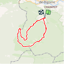
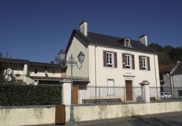
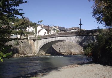
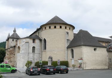
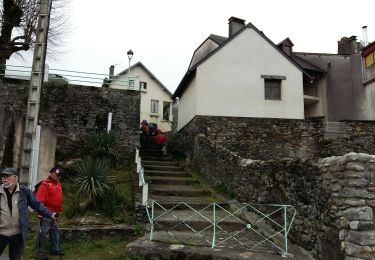
Trail Walking of 15.3 km to be discovered at Occitania, Hautespyrenees, Saint-Pé-de-Bigorre. This trail is proposed by tracegps.
Description
Le circuit se fait dans le sens inverse des aiguilles d'une montre. Premier panorama au plateau de L'Isarce sur les plaines de Tarbes et Pau. Puis on enchaine le Clot det Haboub, Le Soum de Marti Peyras, Le Soum de Male Taule, Le Soum de la Génie Braque et le col de Miqueu avec de très belles vues sur la chaîne Pyrénéenne. Longueur 15520 m et dénivelée de 1450m.
Positioning
Comments
Trails nearby
![Trail Walking Lestelle-Bétharram - Lestelle les grottes G4 - Photo](https://media.geolcdn.com/t/375/260/7f7b50d2-f2bb-47c5-8f12-711bf0f3d7e6.jpg&format=jpg&maxdim=2)
![Walking Walking](https://static1.geolcdn.com/sitytour/trail-icons/101.png)
Walking
![](/images/other/stat-length.png)
![](https://static1.geolcdn.com/siteimages/upload/files/16400158638029165_repeat_loop_refresh_sync_direction_icon.png)
![Trail Walking Saint-Pé-de-Bigorre - SAINT PE DE BIGORRE les rives du gave LLD](https://media.geolcdn.com/t/375/260/edfdbf73-4a36-4e9b-a3e8-98ab4e0559d4.jpg&format=jpg&maxdim=2)
![Walking Walking](https://static1.geolcdn.com/sitytour/trail-icons/101.png)
Walking
![](/images/other/stat-length.png)
![](https://static1.geolcdn.com/siteimages/upload/files/16400158638029165_repeat_loop_refresh_sync_direction_icon.png)
![Trail On foot Saint-Pé-de-Bigorre - SAINT PE DE BIGORRE Le grand tour de saint pe](https://media.geolcdn.com/t/375/260/d4e35e12-fcd4-45d8-ab2c-c6eef77cd69d.jpg&format=jpg&maxdim=2)
![On foot On foot](https://static1.geolcdn.com/sitytour/trail-icons/100.png)
On foot
![](/images/other/stat-length.png)
![](https://static1.geolcdn.com/siteimages/upload/files/16400158638029165_repeat_loop_refresh_sync_direction_icon.png)
![Trail On foot Saint-Pé-de-Bigorre - Le Plateau du Mousqué - Photo](https://media.geolcdn.com/t/375/260/42583d43-4f8c-4618-a872-ff80c3533f76.jpeg&format=jpg&maxdim=2)
![On foot On foot](https://static1.geolcdn.com/sitytour/trail-icons/100.png)
On foot
![](/images/other/stat-length.png)
![](https://static1.geolcdn.com/siteimages/upload/files/16400158638029165_repeat_loop_refresh_sync_direction_icon.png)
![Trail On foot Peyrouse - Le Chemin du Bédouret - Photo](https://media.geolcdn.com/t/375/260/410ed0c7-f304-4562-a01b-d18ec14f94a1.jpeg&format=jpg&maxdim=2)
![On foot On foot](https://static1.geolcdn.com/sitytour/trail-icons/100.png)
On foot
![](/images/other/stat-length.png)
![](https://static1.geolcdn.com/siteimages/upload/files/16400158638029165_repeat_loop_refresh_sync_direction_icon.png)
![Trail On foot Saint-Pé-de-Bigorre - Lengous et Montagnou - Photo](https://media.geolcdn.com/t/375/260/3d171576-7edb-45cf-8fd4-ef8c6e3c3bb3.jpeg&format=jpg&maxdim=2)
![On foot On foot](https://static1.geolcdn.com/sitytour/trail-icons/100.png)
On foot
![](/images/other/stat-length.png)
![](https://static1.geolcdn.com/siteimages/upload/files/16400158638029165_repeat_loop_refresh_sync_direction_icon.png)
![Trail On foot Saint-Pé-de-Bigorre - Les Coteaux de Saint-Pé - Photo](https://media.geolcdn.com/t/375/260/a489e4e4-1a5e-4103-b616-7e0cacda4ef5.jpeg&format=jpg&maxdim=2)
![On foot On foot](https://static1.geolcdn.com/sitytour/trail-icons/100.png)
On foot
![](/images/other/stat-length.png)
![](https://static1.geolcdn.com/siteimages/upload/files/16400158638029165_repeat_loop_refresh_sync_direction_icon.png)
![Trail Walking Saint-Pé-de-Bigorre - SAINT PE de BIGORRE et ses côteaux G4 faite avec LPC](https://media.geolcdn.com/t/375/260/80dcc544-2fa3-498d-9bdc-669b61c91573.jpg&format=jpg&maxdim=2)
![Walking Walking](https://static1.geolcdn.com/sitytour/trail-icons/101.png)
Walking
![](/images/other/stat-length.png)
![](https://static1.geolcdn.com/siteimages/upload/files/16400158638029165_repeat_loop_refresh_sync_direction_icon.png)
![Trail Walking Lestelle-Bétharram - 2023 10 10 CHEMIN du PIÉMONT PYRÉNÉEN - 18ème étape : Lestelle-Bétharram - Asson - Bruges - Mifaget - Ste Colome - Arudy - Photo](https://media.geolcdn.com/t/375/260/cf775eff-bc3f-4ffa-8e7c-bf58d3fbf382.jpg&format=jpg&maxdim=2)
![Walking Walking](https://static1.geolcdn.com/sitytour/trail-icons/101.png)
Walking
![](/images/other/stat-length.png)
![](https://static1.geolcdn.com/siteimages/upload/files/16400158638029165_repeat_loop_refresh_sync_direction_icon.png)