


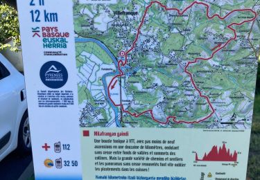
9.6 km | 13.2 km-effort


User


FREE GPS app for hiking
 SityTrail
IGN / Geographical institutes
SityTrail World
The world is yours!
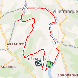
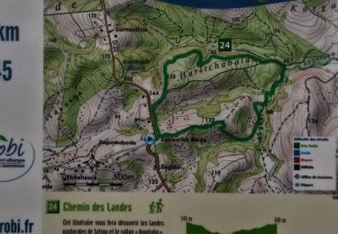
Trail Walking of 10.3 km to be discovered at New Aquitaine, Pyrénées-Atlantiques, Ustaritz. This trail is proposed by tracegps.
Petit circuit en boucle aux environs d'Ustaritz. Idéal en famille. Circuit tiré du livre "52 randonnées en Pays Basque de la Nive à la Nivelle" édité par le Syndicat intercommunal Nive-Nivelle (N°50 Page 113).


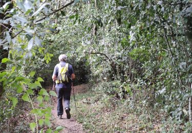
Walking
Walking
Walking
Walking

Walking
Walking

Walking
Walking
Mountain bike