![](/images/other/stat-length.png)
![Trail Mountain bike Trambly - Les Serpentines (2012-VTT-25km) - Trambly - Photo](https://media.geolcdn.com/t/1900/400/ext.pjpeg?maxdim=2&url=https%3A%2F%2Fservices.sitytrail.com%2FGeolivesWS%2FDownloadMedia.ashx%3FTrailID%3D129628%26Media%3D13145_6.jpg)
Les Serpentines (2012-VTT-25km) - Trambly
tracegps
User
![Length](/images/other/stat-length.png)
![Max alt](https://static1.geolcdn.com/siteimages/upload/files/1508320355ic_sort_altitude_max_24dp.png)
![Uphill gradient](https://static1.geolcdn.com/siteimages/upload/files/1508320355ic_sort_den_pos_24dp.png)
![Km-Effort](/images/other/stat-length.png)
![Min alt](https://static1.geolcdn.com/siteimages/upload/files/1508320355ic_sort_altitude_min_24dp.png)
![Downhill gradient](https://static1.geolcdn.com/siteimages/upload/files/1508320355ic_sort_den_neg_24dp.png)
![Boucle](https://static1.geolcdn.com/siteimages/upload/files/16400158638029165_repeat_loop_refresh_sync_direction_icon.png)
![Mountain bike](https://static1.geolcdn.com/sitytour/trail-icons/202.png)
2h30
Difficulty : Difficult
![Scan this QR Code to open this trail in the SityTrail application](https://capi.geolives.com/qq0zvz2zws4bq2lad0pu/sitytour/trails/129628/qr.png?size=200)
FREE GPS app for hiking
About
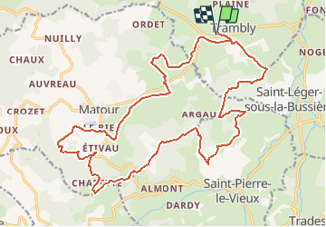
Trail Mountain bike of 25 km to be discovered at Bourgogne-Franche-Comté, Saône-et-Loire, Trambly. This trail is proposed by tracegps.
Description
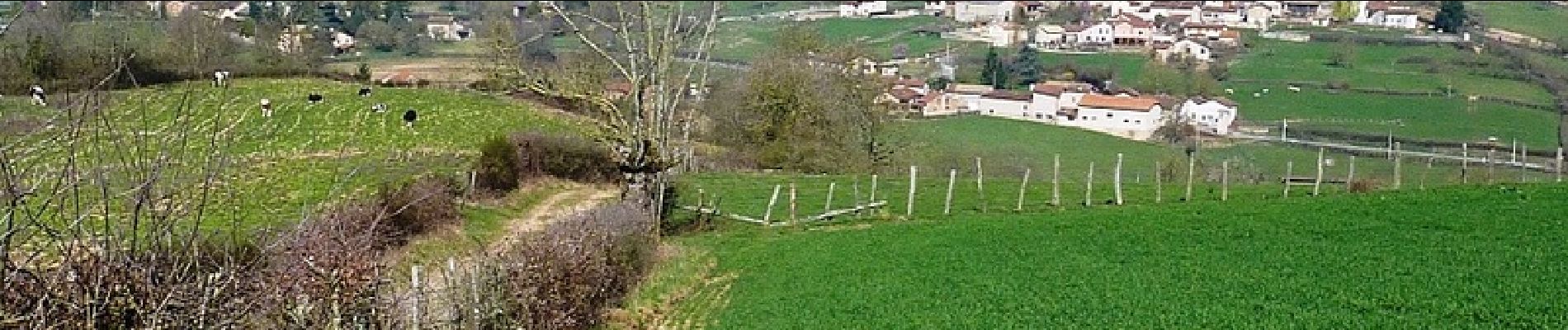
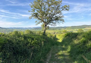
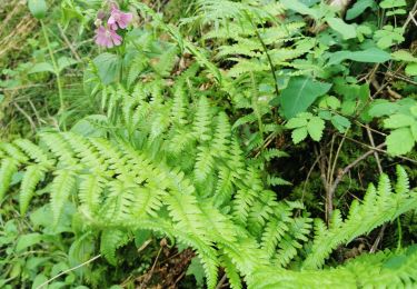
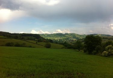
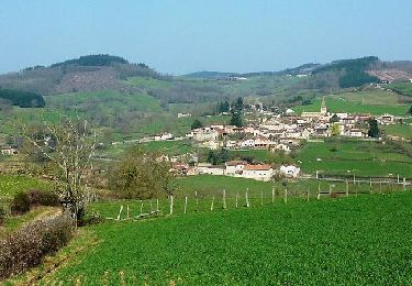
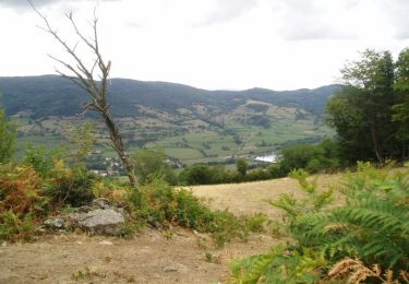
Parking et départ de la salle du Mille Club (Trambly ouest, sur la route de Matour-D987). Chaque année, le dernier dimanche de mars, le "Foyer Rural" de Trambly organise une randonnée pédestre et VTT appelée "Les Serpentines" et celle-ci s'est déroulée le dimanche 25 mars 2012. Les membres du Foyer Rural sont de véritables passionnés très sympathiques qui proposent ces parcours en toute convivialité et avec le souci de donner du bonheur aux randonneurs. Merci à Camille, ce passionné de sport nature, qui a tracé ce fabuleux parcours de rêve. Ce circuit sportif et vallonné est très agréable. Ce parcours emprunte de beaux sentiers et de belles pistes pas trop dégradés qui traversent le bocage verdoyant, les sous-bois paisibles et sur les sommets, découvrez de beaux panoramas (prendre l'appareil photo). Trambly est un petit village français peuplé d'environ 400 habitants, situé dans le département de Saône-et-Loire en région de la Bourgogne. Entouré par les communes de Saint-Léger-sous-la-Bussière, Montagny-sur-Grosne et Matour, Trambly est situé à 23 km au Nord-Ouest de Mâcon la plus grande ville à proximité. Situé à 334 mètres d'altitude, la rivière la "Grosne" et le ruisseau de la "Baize" sont les principaux cours d'eau qui bordent la commune de Trambly. Topoguide : Le Clunisois, guide : Pays Côté Chemin (19 circuits de randonnée) Les chemins du Clunisois - Balades et randonnées (carte qui recense tous les sentiers ouverts des 3 communautés de communes de Matour et sa région).
Positioning
Comments
Trails nearby
![Trail Walking Navour-sur-Grosne - Brandon 8,5 km - Photo](https://media.geolcdn.com/t/375/260/5600efb6-5b5a-44a5-94aa-e68fd686e94d.jpg&format=jpg&maxdim=2)
![Walking Walking](https://static1.geolcdn.com/sitytour/trail-icons/101.png)
Walking
![](/images/other/stat-length.png)
![](https://static1.geolcdn.com/siteimages/upload/files/16400158638029165_repeat_loop_refresh_sync_direction_icon.png)
![Trail Walking Saint-Pierre-le-Vieux - La Grotte de Saint Pierre le vieux - Photo](https://media.geolcdn.com/t/375/260/3e6056d2-ae64-4dbf-af43-09faab387029.jpg&format=jpg&maxdim=2)
![Walking Walking](https://static1.geolcdn.com/sitytour/trail-icons/101.png)
Walking
![](/images/other/stat-length.png)
![](https://static1.geolcdn.com/siteimages/upload/files/16400158638029165_repeat_loop_refresh_sync_direction_icon.png)
![Trail Walking Trambly - Trambly - Saint Leger sous la Bussière - Photo](https://media.geolcdn.com/t/375/260/ext.jpg?maxdim=2&url=https%3A%2F%2Fservices.sitytrail.com%2FGeolivesWS%2FDownloadMedia.ashx%3FTrailID%3D971497%26Media%3D20180521155547.jpg)
![Walking Walking](https://static1.geolcdn.com/sitytour/trail-icons/101.png)
Walking
![](/images/other/stat-length.png)
![](https://static1.geolcdn.com/siteimages/upload/files/16400158638029165_repeat_loop_refresh_sync_direction_icon.png)
![Trail Mountain bike Trambly - Les Serpentines (2012-VTT-35km) - Trambly - Photo](https://media.geolcdn.com/t/375/260/ext.jpg?maxdim=2&url=https%3A%2F%2Fservices.sitytrail.com%2FGeolivesWS%2FDownloadMedia.ashx%3FTrailID%3D129627%26Media%3D13144_6.jpg)
![Mountain bike Mountain bike](https://static1.geolcdn.com/sitytour/trail-icons/202.png)
Mountain bike
![](/images/other/stat-length.png)
![](https://static1.geolcdn.com/siteimages/upload/files/16400158638029165_repeat_loop_refresh_sync_direction_icon.png)
![Trail Walking Navour-sur-Grosne - Les Echeliers - Brandon - Photo](https://media.geolcdn.com/t/375/260/ext.jpg?maxdim=2&url=https%3A%2F%2Fservices.sitytrail.com%2FGeolivesWS%2FDownloadMedia.ashx%3FTrailID%3D111773%26Media%3D8271_3.jpg)
![Walking Walking](https://static1.geolcdn.com/sitytour/trail-icons/101.png)
Walking
![](/images/other/stat-length.png)
![](https://static1.geolcdn.com/siteimages/upload/files/16400158638029165_repeat_loop_refresh_sync_direction_icon.png)
![Trail On foot Matour - sejour-rcy-journee-5-les-cretes-du-haut-beaujolais-OORtbRat2t - Photo](https://media.geolcdn.com/t/375/260/ext.jpg?maxdim=2&url=https%3A%2F%2Fstatic1.geolcdn.com%2Fsiteimages%2Fupload%2Ffiles%2F1545311037marcheuse_200dpi.jpg)
![On foot On foot](https://static1.geolcdn.com/sitytour/trail-icons/100.png)
On foot
![](/images/other/stat-length.png)
![](https://static1.geolcdn.com/siteimages/upload/files/16400158638029165_repeat_loop_refresh_sync_direction_icon.png)
![Trail Walking Tramayes - Promenade Tramayes - Saint-Point - Mère Boîtier et retour - Photo](https://media.geolcdn.com/t/375/260/ext.jpg?maxdim=2&url=https%3A%2F%2Fstatic1.geolcdn.com%2Fsiteimages%2Fupload%2Ffiles%2F1553511878bg_sport_marche.png)
![Walking Walking](https://static1.geolcdn.com/sitytour/trail-icons/101.png)
Walking
![](/images/other/stat-length.png)
![](https://static1.geolcdn.com/siteimages/upload/files/16400158638029165_repeat_loop_refresh_sync_direction_icon.png)
![Trail Walking Matour - 2021-05-13_17h54m44_SityTrail - 2579960 - matour-clunyxet5 - Photo](https://media.geolcdn.com/t/375/260/ext.jpg?maxdim=2&url=https%3A%2F%2Fstatic1.geolcdn.com%2Fsiteimages%2Fupload%2Ffiles%2F1553511878bg_sport_marche.png)
![Walking Walking](https://static1.geolcdn.com/sitytour/trail-icons/101.png)
Walking
![](/images/other/stat-length.png)
![](https://static1.geolcdn.com/siteimages/upload/files/16400158638029165_repeat_loop_refresh_sync_direction_icon.png)
![Trail On foot Matour - Matour-Cluny.Et5 - Photo](https://media.geolcdn.com/t/375/260/ext.jpg?maxdim=2&url=https%3A%2F%2Fstatic1.geolcdn.com%2Fsiteimages%2Fupload%2Ffiles%2F1545311037marcheuse_200dpi.jpg)
![On foot On foot](https://static1.geolcdn.com/sitytour/trail-icons/100.png)
On foot
![](/images/other/stat-length.png)
![](https://static1.geolcdn.com/siteimages/upload/files/16400158638029165_repeat_loop_refresh_sync_direction_icon.png)