


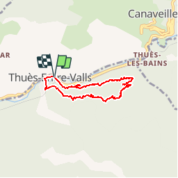


7.2 km | 15.3 km-effort


User


FREE GPS app for hiking
 SityTrail
IGN / Geographical institutes
SityTrail World
The world is yours!
Trail Mountain bike of 6.4 km to be discovered at Occitania, Pyrénées-Orientales, Thuès-Entre-Valls. This trail is proposed by fine66.
le chemin des baba avec milou et ian


Walking

Walking

Walking

Walking

Walking
Walking
Walking
Walking
Walking
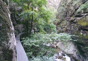
très joli, sauvage,un peu vertigineux par endroit. Heureusement j'étais à pied. Travail remarquable des anciens par endroit , quel boulot. Grâce à eux , super sentier.