Trail Walking Bourges - VEZ-07-Bourges-Charost - Photo

VEZ-07-Bourges-Charost

 SERUS
SERUS

User

© OpenStreetMap contributors
Length
Length
26 km
Max alt
Max alt
165 m
Uphill gradient
Uphill gradient
219 m
Km-Effort
Km-Effort  
29 km
Min alt
Min alt
115 m
Downhill gradient
Downhill gradient
221 m
Boucle
Boucle
No
Creation date :
2019-05-19 20:39:28.549
Updated on :
2019-05-19 20:50:21.596

(0 Reviews)

Walking
Walking
--
Difficulty : Easy

Scan this QR Code to open this trail in the SityTrail application

FREE GPS app for hiking

Logo SityTrail SityTrail

IGN / Geographical institutes

Download SityTrail from the App Store Download SityTrail from Google Play

Logo SityTrail SityTrail World

The world is yours!

Download SityTrail from the App Store Download SityTrail from Google Play Download SityTrail on Huawei AppGallery

About

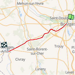
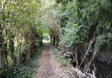
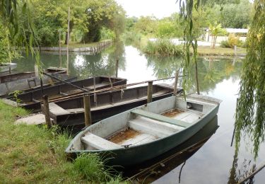
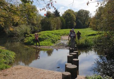
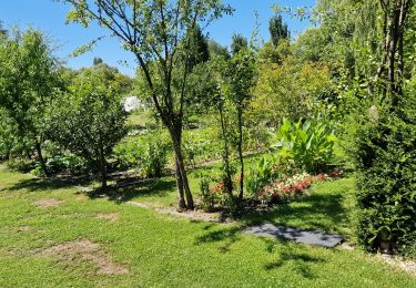
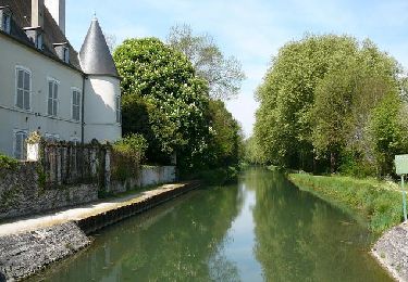
Trail Walking of 26 km to be discovered at Centre-Loire Valley, Cher, Bourges. This trail is proposed by SERUS.

Description

Chemin de Vézelay

Elevation profile

Positioning

Country:
France
Region :
Centre-Loire Valley
Department/Province :
Cher
Municipality :
Bourges
Location:
Unknown
Start:(UTM)
453980 ; 5214467 (31T) N.

Trails nearby

Trail Walking Bourges - 16-Bourges-marais-9.5km - Photo
Walking
SyMA

Walking

Easy
(1)
Bourges, Centre-Loire Valley, Cher, France
9.4 km | 10.1 km-effort
2h 36min
Yes
Trail Walking Bourges - Marais de Bourges 6km - Photo
Walking
GUIDE
thonyc

Walking

Easy
(1)
Bourges, Centre-Loire Valley, Cher, France
5.7 km | 6.1 km-effort
2h 0min
Yes
Trail Mountain bike Bourges - Bourges (18) - Breurey lès Faverney (70) - Etape 1/6 - De Bourges à Nevers - Photo
Mountain bike
tracegps

Mountain bike

Difficult
Bourges, Centre-Loire Valley, Cher, France
81 km | 90 km-effort
6h 30min
No
Trail Walking Bourges - PR BOURGES CAF  - Photo
Walking
91an80

Walking

Easy
Bourges, Centre-Loire Valley, Cher, France
23 km | 26 km-effort
8h 58min
No
Trail Walking Bourges - Bourges 18 la cathédrale  - Photo
Walking
picouleau220345

Walking

Easy
Bourges, Centre-Loire Valley, Cher, France
4.2 km | 4.9 km-effort
2h 33min
No
Trail Walking Bourges - Bourges 18 les marais  - Photo
Walking
picouleau220345

Walking

Easy
Bourges, Centre-Loire Valley, Cher, France
5.1 km | 5.4 km-effort
1h 53min
Yes
Trail Running Plaimpied-Givaudins - lac du val d'auron  - Photo
Running
levequejef

Running

Easy
Plaimpied-Givaudins, Centre-Loire Valley, Cher, France
15.7 km | 17.5 km-effort
2h 9min
Yes
Trail Mountain bike Bourges - Autour de Bourges - Photo
Mountain bike
tracegps

Mountain bike

Medium
Bourges, Centre-Loire Valley, Cher, France
31 km | 35 km-effort
2h 0min
No
Trail Walking Bourges - Autour de Bourges - Photo
Walking
tracegps

Walking

Medium
Bourges, Centre-Loire Valley, Cher, France
31 km | 35 km-effort
4h 0min
No


Close
My subscriptions