Trail Mountain bike Augignac - Circuit_Champniers1 - Photo

Circuit_Champniers1

© OpenStreetMap contributors
Length
Length
29 km
Max alt
Max alt
306 m
Uphill gradient
Uphill gradient
465 m
Km-Effort
Km-Effort  
35 km
Min alt
Min alt
204 m
Downhill gradient
Downhill gradient
460 m
Boucle
Boucle
Yes
Creation date :
2014-12-10 00:00:00.0
Updated on :
2014-12-10 00:00:00.0

(1 Reviews)

Mountain bike
Mountain bike
4h52
Difficulty : Medium

Scan this QR Code to open this trail in the SityTrail application

FREE GPS app for hiking

Logo SityTrail SityTrail

IGN / Geographical institutes

Download SityTrail from the App Store Download SityTrail from Google Play

Logo SityTrail SityTrail World

The world is yours!

Download SityTrail from the App Store Download SityTrail from Google Play Download SityTrail on Huawei AppGallery

About

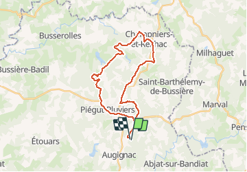
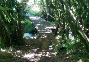
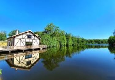
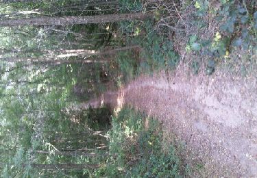
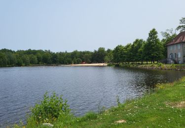
Trail Mountain bike of 29 km to be discovered at New Aquitaine, Dordogne, Augignac. This trail is proposed by JeremyBois.

Description

Ballade très sympa à travers le nord de la dordogne.

Elevation profile

Points of interest

Point of interest Champniers-et-Reilhac - Mini côte sympathique - Photo
JeremyBois
CHAMPNIERS-ET-REILHAC 

Positioning

Country:
France
Region :
New Aquitaine
Department/Province :
Dordogne
Municipality :
Augignac
Location:
Unknown
Start:(UTM)
321744 ; 5052414 (31T) N.

Comments

Please log in to post a review or rate the element


la laschanaud-Peysie


Trails nearby

Trail Walking Saint-Estèphe - Saint-Estephe par Piėgut - Photo
Walking
swp648

Walking

Very easy
Saint-Estèphe, New Aquitaine, Dordogne, France
15 km | 0 m-effort
4h 13min
No
Trail Walking Piégut-Pluviers - Piégut-Pluviers - Photo
Walking
Laigneville159-

Walking

Piégut-Pluviers, New Aquitaine, Dordogne, France
4.7 km | 5.8 km-effort
1h 27min
No
Trail Walking Saint-Estèphe - st estephe  piegut - Photo
Walking
thierry16

Walking

Very difficult
Saint-Estèphe, New Aquitaine, Dordogne, France
16.2 km | 20 km-effort
3h 15min
No
Trail Walking Augignac - les chaufauds - Photo
Walking
temmichel

Walking

Medium
Augignac, New Aquitaine, Dordogne, France
8.7 km | 10.4 km-effort
2h 14min
Yes
Trail Walking Saint-Estèphe - Boucle Saint-Estèphe - Piégut - Photo
Walking
CC.RIDER

Walking

Difficult
Saint-Estèphe, New Aquitaine, Dordogne, France
13.1 km | 16.1 km-effort
3h 39min
Yes
Trail Mountain bike Augignac - Circuit_StEstephe_Bourdeix - Photo
Mountain bike
JeremyBois

Mountain bike

Difficult
Augignac, New Aquitaine, Dordogne, France
27 km | 33 km-effort
2h 4min
Yes
Trail Walking Saint-Estèphe - Boucle par le Roc branlant - Photo
Walking
rigol05

Walking

Easy
Saint-Estèphe, New Aquitaine, Dordogne, France
4 km | 4.6 km-effort
1h 12min
Yes
Trail Walking Saint-Estèphe - St estephe - Photo
Walking
dededavid

Walking

Easy
Saint-Estèphe, New Aquitaine, Dordogne, France
3.1 km | 3.4 km-effort
1h 8min
Yes
Trail Walking Saint-Estèphe - De Saint-Estèphe à Piégut - Photo
Walking
neoroll44

Walking

Difficult
Saint-Estèphe, New Aquitaine, Dordogne, France
13.6 km | 16.6 km-effort
3h 46min
Yes


Close
My subscriptions