![](/images/other/stat-length.png)
![Trail Walking Carolles - Projet Champeaux Falaises et Arrière pays - Photo](https://media.geolcdn.com/t/1900/400/ext.pjpeg?maxdim=2&url=https%3A%2F%2Fstatic1.geolcdn.com%2Fsiteimages%2Fupload%2Ffiles%2F1553511878bg_sport_marche.png)
Projet Champeaux Falaises et Arrière pays
mousetik
User
![Length](/images/other/stat-length.png)
Length
14.1 km
![Max alt](https://static1.geolcdn.com/siteimages/upload/files/1508320355ic_sort_altitude_max_24dp.png)
Max alt
102 m
![Uphill gradient](https://static1.geolcdn.com/siteimages/upload/files/1508320355ic_sort_den_pos_24dp.png)
Uphill gradient
223 m
![Km-Effort](/images/other/stat-length.png)
Km-Effort
17.1 km
![Min alt](https://static1.geolcdn.com/siteimages/upload/files/1508320355ic_sort_altitude_min_24dp.png)
Min alt
11 m
![Downhill gradient](https://static1.geolcdn.com/siteimages/upload/files/1508320355ic_sort_den_neg_24dp.png)
Downhill gradient
217 m
![Boucle](https://static1.geolcdn.com/siteimages/upload/files/16400158638029165_repeat_loop_refresh_sync_direction_icon.png)
Boucle
Yes
Creation date :
2014-12-10 00:00:00.0
Updated on :
2014-12-10 00:00:00.0
![Walking](https://static1.geolcdn.com/sitytour/trail-icons/101.png)
--
Difficulty : Medium
![Scan this QR Code to open this trail in the SityTrail application](https://capi.geolives.com/qq0zvz2zws4bq2lad0pu/sitytour/trails/119706/qr.png?size=200)
FREE GPS app for hiking
About
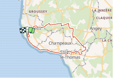
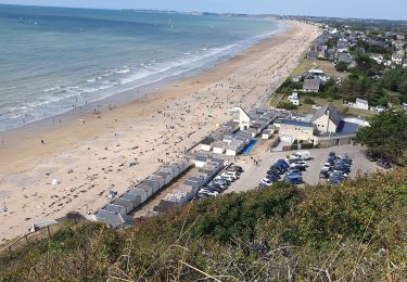
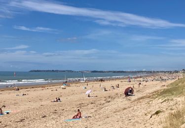
Trail Walking of 14.1 km to be discovered at Normandy, Manche, Carolles. This trail is proposed by mousetik.
Description
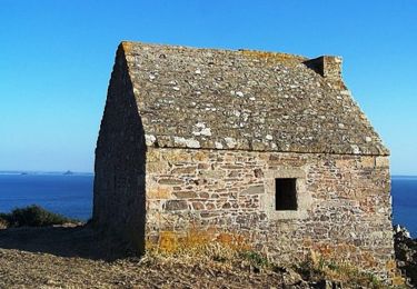
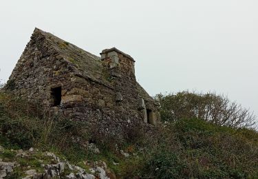
Départ Parking Cabane Vauban
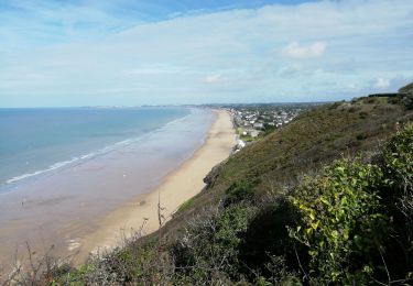
Chemin des douaniers jusqu'à Saint Jean Le Thomas
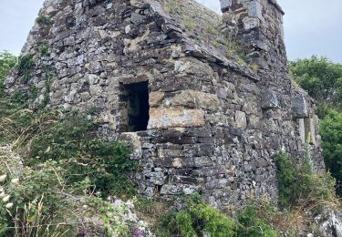
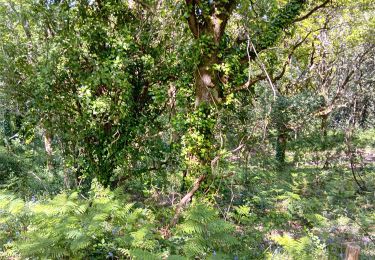
Remontée dans l'arrière pays de Champeaux et de Carolles
Retour au parking
Positioning
Country:
France
Region :
Normandy
Department/Province :
Manche
Municipality :
Carolles
Location:
Unknown
Start:(Dec)
Start:(UTM)
605419 ; 5399854 (30U) N.
Comments
Trails nearby
![Trail Walking Carolles - La Vallée du Lude - Carolles - Photo](https://media.geolcdn.com/t/375/260/ext.jpg?maxdim=2&url=https%3A%2F%2Fservices.sitytrail.com%2FGeolivesWS%2FDownloadMedia.ashx%3FTrailID%3D111207%26Media%3D6732_2.jpg)
![Walking Walking](https://static1.geolcdn.com/sitytour/trail-icons/101.png)
La Vallée du Lude - Carolles
Walking
Medium
(1)
Carolles,
Normandy,
Manche,
France
![](/images/other/stat-length.png)
6.7 km | 8.6 km-effort
2h 30min
![](https://static1.geolcdn.com/siteimages/upload/files/16400158638029165_repeat_loop_refresh_sync_direction_icon.png)
No
![Trail Walking Carolles - Falaises de Carolles - Photo](https://media.geolcdn.com/t/375/260/5d1fc960-65ea-42db-9e46-60d9d0864366.jpg&format=jpg&maxdim=2)
![Walking Walking](https://static1.geolcdn.com/sitytour/trail-icons/101.png)
Falaises de Carolles
Walking
Very easy
Carolles,
Normandy,
Manche,
France
![](/images/other/stat-length.png)
4.1 km | 5.4 km-effort
1h 6min
![](https://static1.geolcdn.com/siteimages/upload/files/16400158638029165_repeat_loop_refresh_sync_direction_icon.png)
Yes
![Trail Walking Champeaux - les falaises de Carolles - Champeaux - Photo](https://media.geolcdn.com/t/375/260/b4018617-2a83-4486-b109-eba5df37275a.jpg&format=jpg&maxdim=2)
![Walking Walking](https://static1.geolcdn.com/sitytour/trail-icons/101.png)
les falaises de Carolles - Champeaux
Walking
Medium
Champeaux,
Normandy,
Manche,
France
![](/images/other/stat-length.png)
8.6 km | 10.9 km-effort
2h 13min
![](https://static1.geolcdn.com/siteimages/upload/files/16400158638029165_repeat_loop_refresh_sync_direction_icon.png)
Yes
![Trail Walking Carolles - Carolle-plage--Cabane Vauban - Photo](https://media.geolcdn.com/t/375/260/a1294c86-a38d-47df-96a5-f6a609fcfeb5.jpg&format=jpg&maxdim=2)
![Walking Walking](https://static1.geolcdn.com/sitytour/trail-icons/101.png)
Carolle-plage--Cabane Vauban
Walking
Medium
Carolles,
Normandy,
Manche,
France
![](/images/other/stat-length.png)
5.9 km | 7.8 km-effort
3h 0min
![](https://static1.geolcdn.com/siteimages/upload/files/16400158638029165_repeat_loop_refresh_sync_direction_icon.png)
Yes
![Trail Walking Champeaux - La cabane Vauban et ses falaises - Photo](https://media.geolcdn.com/t/375/260/0537bf9f-7396-4153-894c-ff80f4b1c8c9.jpg&format=jpg&maxdim=2)
![Walking Walking](https://static1.geolcdn.com/sitytour/trail-icons/101.png)
La cabane Vauban et ses falaises
Walking
Medium
Champeaux,
Normandy,
Manche,
France
![](/images/other/stat-length.png)
7.9 km | 9.5 km-effort
2h 54min
![](https://static1.geolcdn.com/siteimages/upload/files/16400158638029165_repeat_loop_refresh_sync_direction_icon.png)
Yes
![Trail Walking Carolles - carolles 2 Françoise Chan - Photo](https://media.geolcdn.com/t/375/260/84d08c68-e3bb-40fc-8c58-d13ee2f789eb.jpg&format=jpg&maxdim=2)
![Walking Walking](https://static1.geolcdn.com/sitytour/trail-icons/101.png)
carolles 2 Françoise Chan
Walking
Medium
Carolles,
Normandy,
Manche,
France
![](/images/other/stat-length.png)
8.5 km | 10.6 km-effort
2h 50min
![](https://static1.geolcdn.com/siteimages/upload/files/16400158638029165_repeat_loop_refresh_sync_direction_icon.png)
Yes
![Trail Nordic walking Carolles - Carolles 7 km chantal Françoise - Photo](https://media.geolcdn.com/t/375/260/511e2612-50d0-4984-9fe7-21900970065f.jpg&format=jpg&maxdim=2)
![Nordic walking Nordic walking](https://static1.geolcdn.com/sitytour/trail-icons/102.png)
Carolles 7 km chantal Françoise
Nordic walking
Very easy
Carolles,
Normandy,
Manche,
France
![](/images/other/stat-length.png)
7 km | 9.3 km-effort
2h 33min
![](https://static1.geolcdn.com/siteimages/upload/files/16400158638029165_repeat_loop_refresh_sync_direction_icon.png)
Yes
![Trail Walking Jullouville - Jullouville - Carolles - Photo](https://media.geolcdn.com/t/375/260/7a08b560-2c53-4e14-8982-7e1346600440.jpg&format=jpg&maxdim=2)
![Walking Walking](https://static1.geolcdn.com/sitytour/trail-icons/101.png)
Jullouville - Carolles
Walking
Medium
Jullouville,
Normandy,
Manche,
France
![](/images/other/stat-length.png)
7.4 km | 8.6 km-effort
2h 4min
![](https://static1.geolcdn.com/siteimages/upload/files/16400158638029165_repeat_loop_refresh_sync_direction_icon.png)
No
![Trail Walking Dragey-Ronthon - Le Bec d’Andaine - Photo](https://media.geolcdn.com/t/375/260/9bab126b-7d02-49a6-a8e6-abf4befe4e3f.jpg&format=jpg&maxdim=2)
![Walking Walking](https://static1.geolcdn.com/sitytour/trail-icons/101.png)
Le Bec d’Andaine
Walking
Easy
Dragey-Ronthon,
Normandy,
Manche,
France
![](/images/other/stat-length.png)
10.2 km | 11.2 km-effort
3h 1min
![](https://static1.geolcdn.com/siteimages/upload/files/16400158638029165_repeat_loop_refresh_sync_direction_icon.png)
Yes