


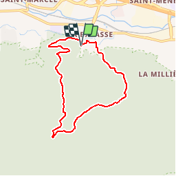


14.2 km | 24 km-effort


User


FREE GPS app for hiking
 SityTrail
IGN / Geographical institutes
SityTrail World
The world is yours!
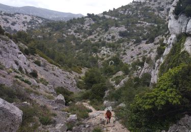
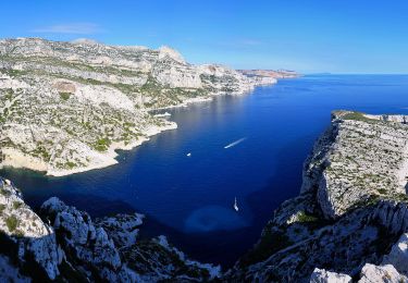
Trail Walking of 7.3 km to be discovered at Provence-Alpes-Côte d'Azur, Bouches-du-Rhône, Marseille. This trail is proposed by P2V789.
Boucle de 7,6 kmD�nivel� 300 mTemps de parcours 3h45

Walking

Walking

Running
Walking
On foot

Walking

Walking
Walking

Other activity