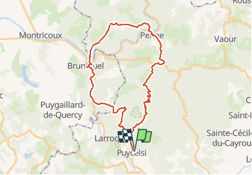
![](/images/other/stat-length.png)
![Trail Walking Puycelsi - Les bastides - Puycelsi - Photo](https://media.geolcdn.com/t/1900/400/ext.pjpeg?maxdim=2&url=https%3A%2F%2Fservices.sitytrail.com%2FGeolivesWS%2FDownloadMedia.ashx%3FTrailID%3D118840%26Media%3D13055_1.jpg)
Les bastides - Puycelsi
tracegps
User
![Length](/images/other/stat-length.png)
![Max alt](https://static1.geolcdn.com/siteimages/upload/files/1508320355ic_sort_altitude_max_24dp.png)
![Uphill gradient](https://static1.geolcdn.com/siteimages/upload/files/1508320355ic_sort_den_pos_24dp.png)
![Km-Effort](/images/other/stat-length.png)
![Min alt](https://static1.geolcdn.com/siteimages/upload/files/1508320355ic_sort_altitude_min_24dp.png)
![Downhill gradient](https://static1.geolcdn.com/siteimages/upload/files/1508320355ic_sort_den_neg_24dp.png)
![Boucle](https://static1.geolcdn.com/siteimages/upload/files/16400158638029165_repeat_loop_refresh_sync_direction_icon.png)
![Walking](https://static1.geolcdn.com/sitytour/trail-icons/101.png)
8h00
Difficulty : Difficult
![Scan this QR Code to open this trail in the SityTrail application](https://capi.geolives.com/qq0zvz2zws4bq2lad0pu/sitytour/trails/118840/qr.png?size=200)
FREE GPS app for hiking
About
Trail Walking of 35 km to be discovered at Occitania, Tarn, Puycelsi. This trail is proposed by tracegps.
Description
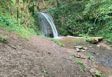
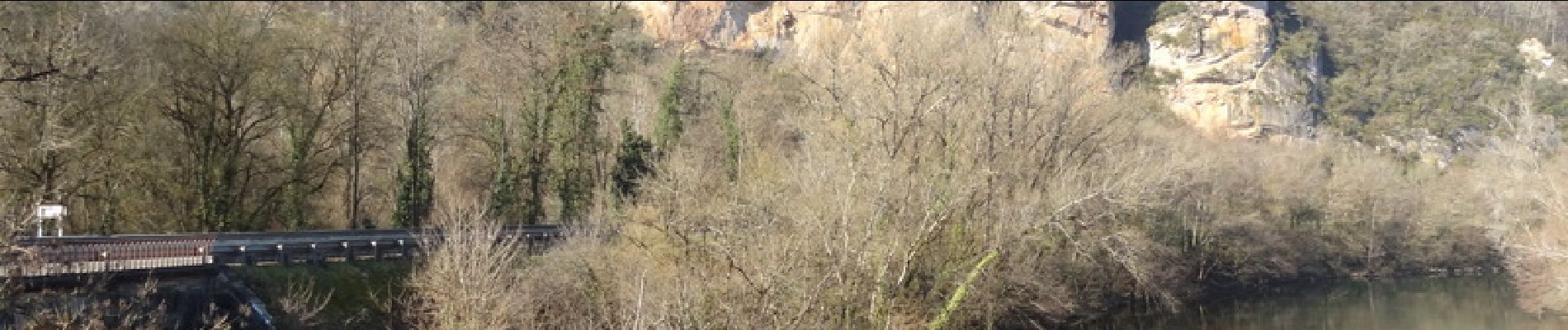
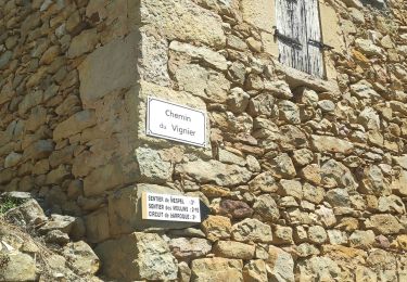
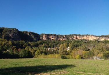
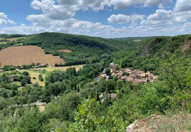
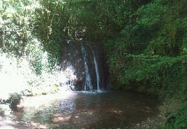
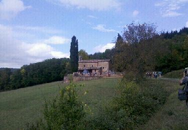
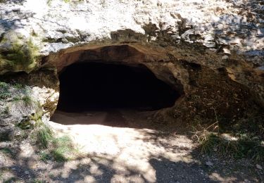
8h00 de marche pour découvrir trois des plus beaux sites du Tarn nord. Au départ de Puycelsi, cette randonnée vous fera parcourir les sublimes villages de Puycelsi, Bruniquel et Penne. Balade verte et très variée, vous pourrez profiter des villages en cours de chemin pour y trouver de quoi vous restaurer. Empruntant le GR46 et un GR de pays, le tracé est très bien balisé.
Positioning
Comments
Trails nearby
![Trail Walking Larroque - sentier des Mespel - Photo](https://media.geolcdn.com/t/375/260/d60bdd5b-bcc2-4a9b-bbb3-3c004c92bf11.jpg&format=jpg&maxdim=2)
![Walking Walking](https://static1.geolcdn.com/sitytour/trail-icons/101.png)
Walking
![](/images/other/stat-length.png)
![](https://static1.geolcdn.com/siteimages/upload/files/16400158638029165_repeat_loop_refresh_sync_direction_icon.png)
![Trail Walking Larroque - Larroque en boucle - Photo](https://media.geolcdn.com/t/375/260/f861a864-1452-42c4-a9ea-63332d57d455.jpg&format=jpg&maxdim=2)
![Walking Walking](https://static1.geolcdn.com/sitytour/trail-icons/101.png)
Walking
![](/images/other/stat-length.png)
![](https://static1.geolcdn.com/siteimages/upload/files/16400158638029165_repeat_loop_refresh_sync_direction_icon.png)
![Trail Walking Puycelsi - Puycelsi - Photo](https://media.geolcdn.com/t/375/260/40b8d916-ad63-4df9-9cd9-6b79cb90cba5.jpg&format=jpg&maxdim=2)
![Walking Walking](https://static1.geolcdn.com/sitytour/trail-icons/101.png)
![Trail Walking Puycelsi - PUYCELSI Sentier Patrimoine - Photo](https://media.geolcdn.com/t/375/260/ext.jpg?maxdim=2&url=https%3A%2F%2Fstatic1.geolcdn.com%2Fsiteimages%2Fupload%2Ffiles%2F1553511878bg_sport_marche.png)
![Walking Walking](https://static1.geolcdn.com/sitytour/trail-icons/101.png)
Walking
![](/images/other/stat-length.png)
![](https://static1.geolcdn.com/siteimages/upload/files/16400158638029165_repeat_loop_refresh_sync_direction_icon.png)
![Trail Walking Puycelsi - puycelsi - Photo](https://media.geolcdn.com/t/375/260/ext.jpg?maxdim=2&url=https%3A%2F%2Fservices.sitytrail.com%2FGeolivesWS%2FDownloadMedia.ashx%3FTrailID%3D189805%26Media%3D20130506133445.jpeg)
![Walking Walking](https://static1.geolcdn.com/sitytour/trail-icons/101.png)
![Trail Walking Puycelsi - Aveyron-121011 - Puycelci-FtGrésigne (txt,gps,foto) - Photo](https://media.geolcdn.com/t/375/260/ext.jpg?maxdim=2&url=https%3A%2F%2Fservices.sitytrail.com%2FGeolivesWS%2FDownloadMedia.ashx%3FTrailID%3D160220%26Media%3D20121011141537.jpeg)
![Walking Walking](https://static1.geolcdn.com/sitytour/trail-icons/101.png)
Walking
![](/images/other/stat-length.png)
![](https://static1.geolcdn.com/siteimages/upload/files/16400158638029165_repeat_loop_refresh_sync_direction_icon.png)
![Trail Walking Larroque - Mespel au départ de Notre Dame des Bois - Photo](https://media.geolcdn.com/t/375/260/e32c0608-7546-4ced-8c9f-12fac932a832.jpg&format=jpg&maxdim=2)
![Walking Walking](https://static1.geolcdn.com/sitytour/trail-icons/101.png)
Walking
![](/images/other/stat-length.png)
![](https://static1.geolcdn.com/siteimages/upload/files/16400158638029165_repeat_loop_refresh_sync_direction_icon.png)
![Trail Walking Larroque - st martin d'urbens - Photo](https://media.geolcdn.com/t/375/260/cfa7eb2a-1d44-4468-a1d3-61db0b746441.jpg&format=jpg&maxdim=2)
![Walking Walking](https://static1.geolcdn.com/sitytour/trail-icons/101.png)
Walking
![](/images/other/stat-length.png)
![](https://static1.geolcdn.com/siteimages/upload/files/16400158638029165_repeat_loop_refresh_sync_direction_icon.png)
![Trail sport Puycelsi - Puycelci - Photo](https://media.geolcdn.com/t/375/260/8a4caf13-d064-47ac-89e8-dc88b419559f.jpg&format=jpg&maxdim=2)