


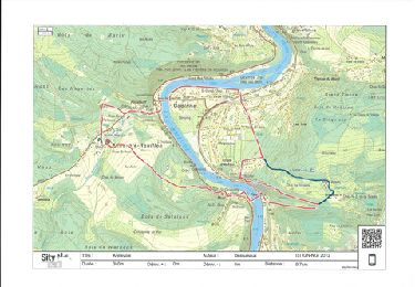
22 km | 30 km-effort


User


FREE GPS app for hiking
 SityTrail
IGN / Geographical institutes
SityTrail World
The world is yours!
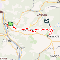
Trail Other activity of 8.5 km to be discovered at Wallonia, Namur, Yvoir. This trail is proposed by pjjrevrard.
Ce tracé suit entree la rue de Niersant (Evrehailles) et l'avenue de la Vallée à Purnode, un beau chemin forestier privé. Une autorisation de passage doit être demandée au garde privé.

Walking

Walking

Walking

Walking

Walking

Walking

Walking

Walking
Walking