

ROCHECORBON

LEMENIO
User

Length
11.7 km

Max alt
104 m

Uphill gradient
152 m

Km-Effort
13.7 km

Min alt
44 m

Downhill gradient
160 m
Boucle
Yes
Creation date :
2014-12-10 00:00:00.0
Updated on :
2014-12-10 00:00:00.0
2h41
Difficulty : Easy

FREE GPS app for hiking
About
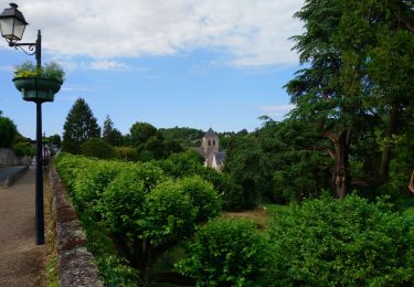
Trail Walking of 11.7 km to be discovered at Centre-Loire Valley, Indre-et-Loire, Rochecorbon. This trail is proposed by LEMENIO.
Description
Départ place de la mairie. En fin de ballade, au lieu-dit "LA PLANCHE" ne pas tenir compte du balisage et continuer le long de la petite rivière pour rejoindre ROCHECORBON.
Positioning
Country:
France
Region :
Centre-Loire Valley
Department/Province :
Indre-et-Loire
Municipality :
Rochecorbon
Location:
Unknown
Start:(Dec)
Start:(UTM)
330640 ; 5253625 (31T) N.
Comments
Trails nearby
Tours - Marmoutier GR3 GR655 Rochecorbon - 8.2km 105m 1h50 - 2021 10 09


Walking
Very easy
(1)
Tours,
Centre-Loire Valley,
Indre-et-Loire,
France

8.2 km | 9.6 km-effort
1h 50min
Yes
Rochecorbon - Zig zag autour de Rochecorbon - 17km 295m 3h50 - 2024 03 13


Walking
Medium
Rochecorbon,
Centre-Loire Valley,
Indre-et-Loire,
France

17.1 km | 21 km-effort
3h 50min
Yes
Saint-Pierre-des-Corps - PR Sentier du bord de Loire avec variantes - 13.6km ...


Walking
Easy
Saint-Pierre-des-Corps,
Centre-Loire Valley,
Indre-et-Loire,
France

13.6 km | 14.7 km-effort
2h 55min
Yes
Montlouis-sur-Loire - gare GR41 Veretz Azay-sur-Cher - 13km 85m 2h45 - 2023 1...


Walking
Easy
Montlouis-sur-Loire,
Centre-Loire Valley,
Indre-et-Loire,
France

13 km | 14.2 km-effort
2h 45min
Yes
Parcay-Meslay - lieu-dit le Houdeau de Monnaie - 21.3km 190m 4h50 (50mn) - 20...


Walking
Easy
Parçay-Meslay,
Centre-Loire Valley,
Indre-et-Loire,
France

21 km | 24 km-effort
4h 50min
Yes
Saint-Avertin - PR Sentier du vieux Cher, Cangé - 9.3km 95m 2h05 (20mn) - 202...


Walking
Easy
Saint-Avertin,
Centre-Loire Valley,
Indre-et-Loire,
France

9.3 km | 10.5 km-effort
2h 5min
Yes
Vouvray - PR balisé en bleu - 15.1km 125m 3h30 - 2023 06 28


Walking
Easy
Vouvray,
Centre-Loire Valley,
Indre-et-Loire,
France

15.1 km | 16.8 km-effort
3h 30min
Yes
De Montlouis sur Loire à Villandry


Bicycle tourism
Medium
Montlouis-sur-Loire,
Centre-Loire Valley,
Indre-et-Loire,
France

78 km | 85 km-effort
5h 18min
No
Rochecorbon - la Rabatterie Parçay-Meslay - 20.5km 350m 4h45 - 2022 06 12


Walking
Easy
Rochecorbon,
Centre-Loire Valley,
Indre-et-Loire,
France

21 km | 25 km-effort
4h 45min
Yes


 SityTrail


