Mont Gosford SityTrail > Trails > Outdoor > Canada > Quebec > Le Granit > Saint-Augustin-de-Woburn SityTrail > Trails > Outdoor > Canada > Quebec > Le Granit > Saint-Augustin-de-Woburn Mont Gosford lscheven User 3D © OpenStreetMap contributors Length 8.5 km Max alt 1179 m Uphill gradient 572 m Km-Effort 16.1 km Min alt 625 m Downhill gradient 572 m Boucle Yes Creation date : 2014-12-11 00:00:00.0 Updated on : 2014-12-11 00:00:00.0 (0 Reviews) Walking -- Difficulty : Medium FREE GPS app for hiking SityTrail IGN / Geographical institutes SityTrail World The world is yours! About 
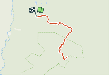
Trail Walking of 8.5 km to be discovered at Quebec, Le Granit, Saint-Augustin-de-Woburn. This trail is proposed by lscheven. Legends | More details (PDF) Elevation profile Legends > 15% 15% - 10% 10% - 5% flat 5% - 10% 10% - 15% 15% - 30% > 30% Points of interest lscheven Accueil SAINT-AUGUSTIN-DE-WOBURN lscheven Intersection 1 SAINT-AUGUSTIN-DE-WOBURN lscheven Intersection 2 SAINT-AUGUSTIN-DE-WOBURN lscheven Sommet - Mont Gosford SAINT-AUGUSTIN-DE-WOBURN lscheven Stationnement SAINT-AUGUSTIN-DE-WOBURN Positioning Country: Canada Region : Quebec Department/Province : Le Granit Municipality : Saint-Augustin-de-Woburn Location: Unknown Start:(Dec) 45.317774 / -70.884289 Start:(UTM) 352313 ; 5019979 (19T) N. Comments Please log in to post a review or rate the element Trails nearby GUIDE Alizée.pee 2015-04-19 15:00:20 Walking Medium Saint-Augustin-de-Woburn, Quebec, Le Granit, Canada 13.4 km | 22 km-effort 4h 31min Yes