LE CHEMIN DE LARRAZET SityTrail > Trails > Outdoor > France > Occitania > Gers > Masseube SityTrail > Trails > Outdoor > France > Occitania > Gers > Masseube LE CHEMIN DE LARRAZET Marco44 User 3D © OpenStreetMap contributors Length 19.5 km Max alt 301 m Uphill gradient 318 m Km-Effort 24 km Min alt 190 m Downhill gradient 320 m Boucle Yes Creation date : 2019-05-07 00:19:23.311 Updated on : 2019-05-07 00:19:23.311 (0 Reviews) Other activity -- Difficulty : Unknown FREE GPS app for hiking SityTrail IGN / Geographical institutes SityTrail World The world is yours! About 
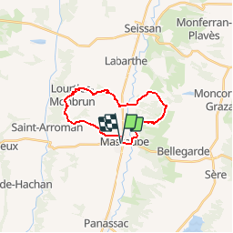
Trail Other activity of 19.5 km to be discovered at Occitania, Gers, Masseube. This trail is proposed by Marco44. Description Une randonnée longue distance au départ de Masseube. Legends | More details (PDF) Elevation profile Legends > 15% 15% - 10% 10% - 5% flat 5% - 10% 10% - 15% 15% - 30% > 30% Points of interest Marco44 Départ MASSEUBE Marco44 PR03 MASSEUBE Marco44 Vers le bois POUY-LOUBRIN Marco44 Lamothe POUY-LOUBRIN Marco44 Vers le Gers MASSEUBE Marco44 Rejoindre le PR01 MASSEUBE Marco44 Lourties-Monbrun LOURTIES-MONBRUN Marco44 Vers Masseube LOURTIES-MONBRUN Positioning Country: France Region : Occitania Department/Province : Gers Municipality : Masseube Location: Unknown Start:(Dec) 43.42988 / 0.57714 Start:(UTM) 303896 ; 4811405 (31T) N. Comments Please log in to post a review or rate the element Trails nearby marcel.F Masseube - boucle PR3 Walking Difficult Masseube, Occitania, Gers, France 21 km | 25 km-effort 6h 11min Yes