![](/images/other/stat-length.png)
![Trail Walking Melve - Le circuit des fermes - Melve - Photo](https://media.geolcdn.com/t/1900/400/ext.pjpeg?maxdim=2&url=https%3A%2F%2Fservices.sitytrail.com%2FGeolivesWS%2FDownloadMedia.ashx%3FTrailID%3D112806%26Media%3D12469_5.jpg)
Le circuit des fermes - Melve
tracegps
User
![Length](/images/other/stat-length.png)
![Max alt](https://static1.geolcdn.com/siteimages/upload/files/1508320355ic_sort_altitude_max_24dp.png)
![Uphill gradient](https://static1.geolcdn.com/siteimages/upload/files/1508320355ic_sort_den_pos_24dp.png)
![Km-Effort](/images/other/stat-length.png)
![Min alt](https://static1.geolcdn.com/siteimages/upload/files/1508320355ic_sort_altitude_min_24dp.png)
![Downhill gradient](https://static1.geolcdn.com/siteimages/upload/files/1508320355ic_sort_den_neg_24dp.png)
![Boucle](https://static1.geolcdn.com/siteimages/upload/files/16400158638029165_repeat_loop_refresh_sync_direction_icon.png)
![Walking](https://static1.geolcdn.com/sitytour/trail-icons/101.png)
5h00
Difficulty : Very difficult
![Scan this QR Code to open this trail in the SityTrail application](https://capi.geolives.com/qq0zvz2zws4bq2lad0pu/sitytour/trails/112806/qr.png?size=200)
FREE GPS app for hiking
About
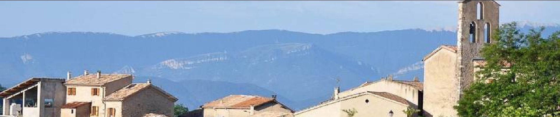
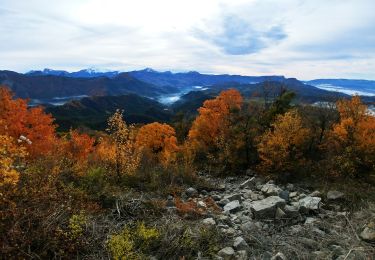
Trail Walking of 17.8 km to be discovered at Provence-Alpes-Côte d'Azur, Alpes-de-Haute-Provence, Melve. This trail is proposed by tracegps.
Description
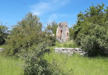
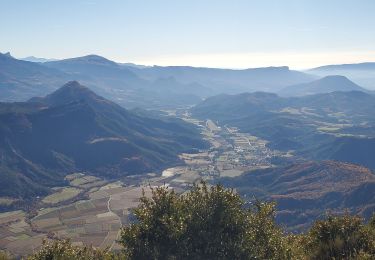
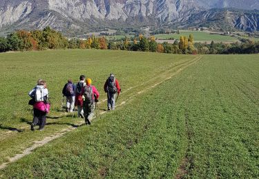
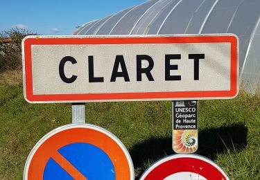
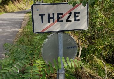
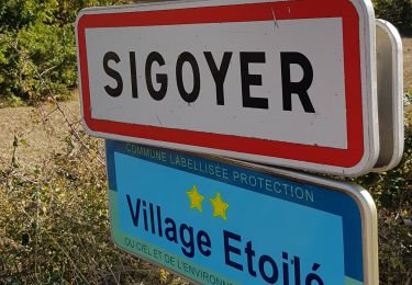
Ce circuit vous est proposé par les Hautes Terres de Provence. Trois points de départ pour cette randonnée à la journée, tout d’abord de Sigoyer, ensuite de Melve et enfin au départ du hameau des Baudes. De celui-ci que vous traversez en longeant ses gîtes ruraux, poursuivez sur une belle piste jusqu’à la ferme de Villarnaud. Descendre sur cette route d’accès goudronnée durant 200m puis s’engager à droite pour rejoindre « les Masses » et le torrent de Syriez. Remonter cette piste pour rattraper la D304 qui vous conduira à Sigoyer. De là, descendre la piste en direction du Pita, puis en étant bien attentif, prendre à droite le sentier dans la pinède qui vous guidera jusqu’au hameau de Fouquetis. Après votre passage sur de belles pistes reliant différentes fermes entre elles, dont la dernière, « Prédannau », remonter par un sentier puis des « drailles » jusqu’à votre point de départ des Baudes. Retrouvez le circuit sur le site des Hautes Terres de Provence.
Positioning
Comments
Trails nearby
![Trail Walking Sigoyer - SIGOYER Boucle Croix de la Biousse o l m s - Photo](https://media.geolcdn.com/t/375/260/cc06d09a-5ff2-41a1-9edb-f8368db9ba2d.jpg&format=jpg&maxdim=2)
![Walking Walking](https://static1.geolcdn.com/sitytour/trail-icons/101.png)
Walking
![](/images/other/stat-length.png)
![](https://static1.geolcdn.com/siteimages/upload/files/16400158638029165_repeat_loop_refresh_sync_direction_icon.png)
![Trail Walking La Motte-du-Caire - LA MOTTE DU CAIRE .Le tour de la Blachere o - Photo](https://media.geolcdn.com/t/375/260/181c511a-92a7-4933-9888-9e2bc6024806.jpg&format=jpg&maxdim=2)
![Walking Walking](https://static1.geolcdn.com/sitytour/trail-icons/101.png)
Walking
![](/images/other/stat-length.png)
![](https://static1.geolcdn.com/siteimages/upload/files/16400158638029165_repeat_loop_refresh_sync_direction_icon.png)
![Trail Walking Melve - Melve Les Chanderettes 1014m 16kms - Photo](https://media.geolcdn.com/t/375/260/ccabf33a-e431-4ec0-8bfa-bcf63e55d70b.jpg&format=jpg&maxdim=2)
![Walking Walking](https://static1.geolcdn.com/sitytour/trail-icons/101.png)
Walking
![](/images/other/stat-length.png)
![](https://static1.geolcdn.com/siteimages/upload/files/16400158638029165_repeat_loop_refresh_sync_direction_icon.png)
![Trail Walking Sigoyer - Sigoyer Les Baudes - Photo](https://media.geolcdn.com/t/375/260/a01c5cb6-bdb8-480b-87fa-564c7d11bb21.jpg&format=jpg&maxdim=2)
![Walking Walking](https://static1.geolcdn.com/sitytour/trail-icons/101.png)
Walking
![](/images/other/stat-length.png)
![](https://static1.geolcdn.com/siteimages/upload/files/16400158638029165_repeat_loop_refresh_sync_direction_icon.png)
![Trail Walking Claret - Tete de Boursier depart Claret - Photo](https://media.geolcdn.com/t/375/260/c93a942b-9518-4b3c-80a9-c6f6ef8e8c48.jpg&format=jpg&maxdim=2)
![Walking Walking](https://static1.geolcdn.com/sitytour/trail-icons/101.png)
Walking
![](/images/other/stat-length.png)
![](https://static1.geolcdn.com/siteimages/upload/files/16400158638029165_repeat_loop_refresh_sync_direction_icon.png)
![Trail Walking Thèze - Boucle Theze Sigoyer depart Theze - Photo](https://media.geolcdn.com/t/375/260/91670e8d-b25b-43eb-b3a3-a9631c3bd51e.jpg&format=jpg&maxdim=2)
![Walking Walking](https://static1.geolcdn.com/sitytour/trail-icons/101.png)
Walking
![](/images/other/stat-length.png)
![](https://static1.geolcdn.com/siteimages/upload/files/16400158638029165_repeat_loop_refresh_sync_direction_icon.png)
![Trail Walking Sigoyer - Boucle Croix de la Biousse - Photo](https://media.geolcdn.com/t/375/260/9bf7cebd-6a47-4b2b-a790-11caea904f86.jpg&format=jpg&maxdim=2)
![Walking Walking](https://static1.geolcdn.com/sitytour/trail-icons/101.png)
Walking
![](/images/other/stat-length.png)
![](https://static1.geolcdn.com/siteimages/upload/files/16400158638029165_repeat_loop_refresh_sync_direction_icon.png)
![Trail Walking Melve - 20191126_Melve Tête de Boursier - Photo](https://media.geolcdn.com/t/375/260/1d6a6e93-136f-4ae8-96da-7f5812d2bd56.jpg&format=jpg&maxdim=2)
![Walking Walking](https://static1.geolcdn.com/sitytour/trail-icons/101.png)
Walking
![](/images/other/stat-length.png)
![](https://static1.geolcdn.com/siteimages/upload/files/16400158638029165_repeat_loop_refresh_sync_direction_icon.png)
![Trail Walking Melve - Melve Rando Pivoines, avec la RSPG : https://www.rspg05.org/ - Photo](https://media.geolcdn.com/t/375/260/d79f0681-8663-4e9d-b91d-6ba336eb6feb.jpg&format=jpg&maxdim=2)
![Walking Walking](https://static1.geolcdn.com/sitytour/trail-icons/101.png)
Walking
![](/images/other/stat-length.png)
![](https://static1.geolcdn.com/siteimages/upload/files/16400158638029165_repeat_loop_refresh_sync_direction_icon.png)