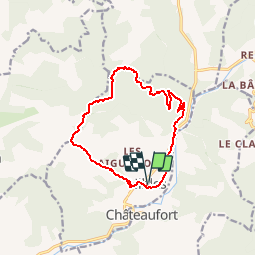
![](/images/other/stat-length.png)
![Trail Walking Nibles - La boucle de Saint Jacques - Nibles - Photo](https://media.geolcdn.com/t/1900/400/ext.pjpeg?maxdim=2&url=https%3A%2F%2Fservices.sitytrail.com%2FGeolivesWS%2FDownloadMedia.ashx%3FTrailID%3D112804%26Media%3D12464_5.jpg)
La boucle de Saint Jacques - Nibles
tracegps
User
![Length](/images/other/stat-length.png)
![Max alt](https://static1.geolcdn.com/siteimages/upload/files/1508320355ic_sort_altitude_max_24dp.png)
![Uphill gradient](https://static1.geolcdn.com/siteimages/upload/files/1508320355ic_sort_den_pos_24dp.png)
![Km-Effort](/images/other/stat-length.png)
![Min alt](https://static1.geolcdn.com/siteimages/upload/files/1508320355ic_sort_altitude_min_24dp.png)
![Downhill gradient](https://static1.geolcdn.com/siteimages/upload/files/1508320355ic_sort_den_neg_24dp.png)
![Boucle](https://static1.geolcdn.com/siteimages/upload/files/16400158638029165_repeat_loop_refresh_sync_direction_icon.png)
![Walking](https://static1.geolcdn.com/sitytour/trail-icons/101.png)
3h30
Difficulty : Difficult
![Scan this QR Code to open this trail in the SityTrail application](https://capi.geolives.com/qq0zvz2zws4bq2lad0pu/sitytour/trails/112804/qr.png?size=200)
FREE GPS app for hiking
About
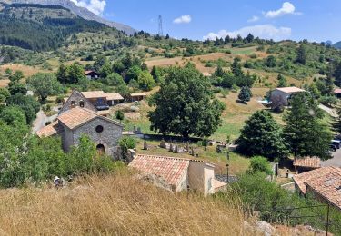
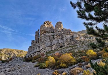
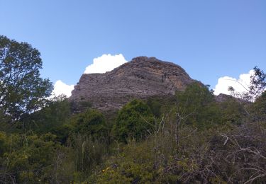
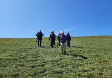
Trail Walking of 13.1 km to be discovered at Provence-Alpes-Côte d'Azur, Alpes-de-Haute-Provence, Nibles. This trail is proposed by tracegps.
Description
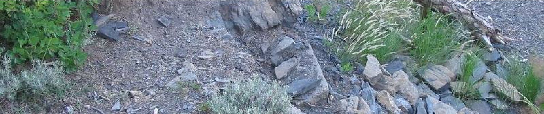
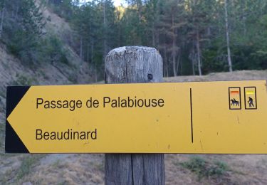
Après vous être garé dans Nibles, rejoindre la D 951 que vous empruntez sur 200m environ en direction de Sisteron. Depuis Nibles, le balisage rouge et blanc du GR 653D va vous guider durant la moitié de ce circuit. Quitter la départementale à droite par un petit sentier jusqu’aux fermes de Clans et Borelly. De là, prendre plein Nord une piste qui va vous guider jusqu’au passage de l’homme mort. Laisser sur votre gauche le balisage du circuit de St Jacques puis poursuivre sur cette piste et son balisage jaune durant un peu plus d’une heure. Soyez attentif à un croisement de pistes au sentier qui plonge sur votre droite en direction de la vallée de la Sasse. Vous atteignez enfin la D 951 que vous traversez avec attention. Il ne vous reste plus qu’à rejoindre Nibles par la rive gauche de son canal d’arrosage. Retrouvez le circuit sur le site des Hautes Terres de Provence.
Positioning
Comments
Trails nearby
![Trail Walking Clamensane - Clamensane - Col de la Croix - Chapelle St-Amand - Photo](https://media.geolcdn.com/t/375/260/03bf31a1-ae5a-4bc8-81f0-352f4f7d4b3d.jpg&format=jpg&maxdim=2)
![Walking Walking](https://static1.geolcdn.com/sitytour/trail-icons/101.png)
Walking
![](/images/other/stat-length.png)
![](https://static1.geolcdn.com/siteimages/upload/files/16400158638029165_repeat_loop_refresh_sync_direction_icon.png)
![Trail Walking Saint-Geniez - Le Trainon - Photo](https://media.geolcdn.com/t/375/260/6384f902-eeea-4c31-bc21-4fe490321a44.jpg&format=jpg&maxdim=2)
![Walking Walking](https://static1.geolcdn.com/sitytour/trail-icons/101.png)
Walking
![](/images/other/stat-length.png)
![](https://static1.geolcdn.com/siteimages/upload/files/16400158638029165_repeat_loop_refresh_sync_direction_icon.png)
![Trail Walking Valavoire - Sommet de Jouère - Photo](https://media.geolcdn.com/t/375/260/d8443deb-7a4b-44b3-ac6b-fcb5789c326f.jpg&format=jpg&maxdim=2)
![Walking Walking](https://static1.geolcdn.com/sitytour/trail-icons/101.png)
Walking
![](/images/other/stat-length.png)
![](https://static1.geolcdn.com/siteimages/upload/files/16400158638029165_repeat_loop_refresh_sync_direction_icon.png)
![Trail Walking Clamensane - VALAVOIRE Pas de Palabiouse , bergerie de Premarche o l s - Photo](https://media.geolcdn.com/t/375/260/0c200d5e-0f59-43cc-96e6-d7b8947343f2.jpg&format=jpg&maxdim=2)
![Walking Walking](https://static1.geolcdn.com/sitytour/trail-icons/101.png)
Walking
![](/images/other/stat-length.png)
![](https://static1.geolcdn.com/siteimages/upload/files/16400158638029165_repeat_loop_refresh_sync_direction_icon.png)
![Trail Walking Sigoyer - SIGOYER Boucle Croix de la Biousse o l m s - Photo](https://media.geolcdn.com/t/375/260/cc06d09a-5ff2-41a1-9edb-f8368db9ba2d.jpg&format=jpg&maxdim=2)
![Walking Walking](https://static1.geolcdn.com/sitytour/trail-icons/101.png)
Walking
![](/images/other/stat-length.png)
![](https://static1.geolcdn.com/siteimages/upload/files/16400158638029165_repeat_loop_refresh_sync_direction_icon.png)
![Trail Walking Clamensane - VALAVOIRE. Pas de Palabrouse. Fontaine de Pouille o l s - Photo](https://media.geolcdn.com/t/375/260/d94e99f0-0c27-4f39-bd9c-c7d2b68f013f.jpg&format=jpg&maxdim=2)
![Walking Walking](https://static1.geolcdn.com/sitytour/trail-icons/101.png)
Walking
![](/images/other/stat-length.png)
![](https://static1.geolcdn.com/siteimages/upload/files/16400158638029165_repeat_loop_refresh_sync_direction_icon.png)
![Trail Walking Valavoire - Château de la mole - Col de la Sapie - Photo](https://media.geolcdn.com/t/375/260/4daf6a52-01d9-480a-9c8c-120e5682afb7.jpg&format=jpg&maxdim=2)
![Walking Walking](https://static1.geolcdn.com/sitytour/trail-icons/101.png)
Walking
![](/images/other/stat-length.png)
![](https://static1.geolcdn.com/siteimages/upload/files/16400158638029165_repeat_loop_refresh_sync_direction_icon.png)
![Trail Walking Saint-Geniez - petite balade vers saint Génies - Photo](https://media.geolcdn.com/t/375/260/d2c5e168-823d-4cc4-a9db-db592606d4c2.jpg&format=jpg&maxdim=2)
![Walking Walking](https://static1.geolcdn.com/sitytour/trail-icons/101.png)
Walking
![](/images/other/stat-length.png)
![](https://static1.geolcdn.com/siteimages/upload/files/16400158638029165_repeat_loop_refresh_sync_direction_icon.png)
![Trail Walking Saint-Geniez - St Geniez boucle 320 + - Photo](https://media.geolcdn.com/t/375/260/2d1ba8ff-72b7-4442-a63e-36b2f4662557.jpg&format=jpg&maxdim=2)
![Walking Walking](https://static1.geolcdn.com/sitytour/trail-icons/101.png)
Walking
![](/images/other/stat-length.png)
![](https://static1.geolcdn.com/siteimages/upload/files/16400158638029165_repeat_loop_refresh_sync_direction_icon.png)