![](/images/other/stat-length.png)
![Trail Cycle Rigny-le-Ferron - Circuit de Rigny le Ferron - Photo](https://media.geolcdn.com/t/1900/400/ext.pjpeg?maxdim=2&url=https%3A%2F%2Fservices.sitytrail.com%2FGeolivesWS%2FDownloadMedia.ashx%3FTrailID%3D112795%26Media%3D12420_5.jpg)
Circuit de Rigny le Ferron
tracegps
User
![Length](/images/other/stat-length.png)
Length
28 km
![Max alt](https://static1.geolcdn.com/siteimages/upload/files/1508320355ic_sort_altitude_max_24dp.png)
Max alt
240 m
![Uphill gradient](https://static1.geolcdn.com/siteimages/upload/files/1508320355ic_sort_den_pos_24dp.png)
Uphill gradient
396 m
![Km-Effort](/images/other/stat-length.png)
Km-Effort
33 km
![Min alt](https://static1.geolcdn.com/siteimages/upload/files/1508320355ic_sort_altitude_min_24dp.png)
Min alt
123 m
![Downhill gradient](https://static1.geolcdn.com/siteimages/upload/files/1508320355ic_sort_den_neg_24dp.png)
Downhill gradient
396 m
![Boucle](https://static1.geolcdn.com/siteimages/upload/files/16400158638029165_repeat_loop_refresh_sync_direction_icon.png)
Boucle
Yes
Creation date :
2014-12-10 00:00:00.0
Updated on :
2014-12-10 00:00:00.0
![Cycle](https://static1.geolcdn.com/sitytour/trail-icons/200.png)
1h30
Difficulty : Easy
![Scan this QR Code to open this trail in the SityTrail application](https://capi.geolives.com/qq0zvz2zws4bq2lad0pu/sitytour/trails/112795/qr.png?size=200)
FREE GPS app for hiking
About
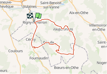
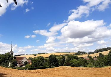
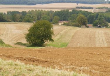
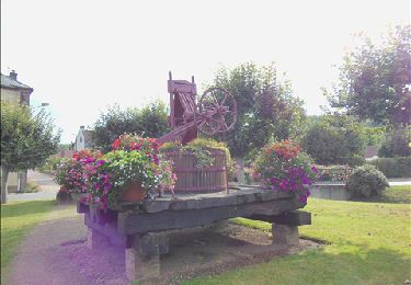
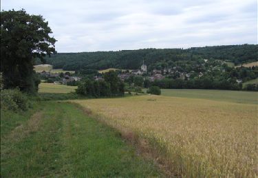
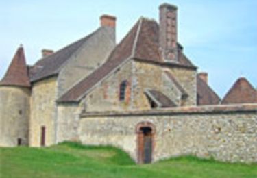
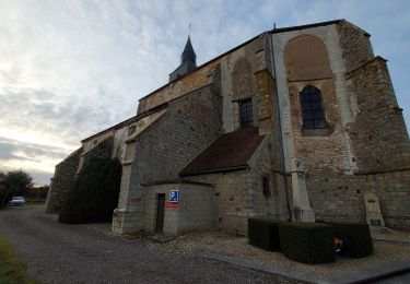
Trail Cycle of 28 km to be discovered at Grand Est, Aube, Rigny-le-Ferron. This trail is proposed by tracegps.
Description
Circuit proposé par l'office de Tourisme du Pays d'Othe, vallée de la Vanne et le Cyclo Club Othéen. Départ de la place de la mairie de Rigny-le-Ferron. Retrouvez le circuit a télécharger sur le site de l'office de tourisme du Pays d'Othe, vallée de la Vanne.
Positioning
Country:
France
Region :
Grand Est
Department/Province :
Aube
Municipality :
Rigny-le-Ferron
Location:
Unknown
Start:(Dec)
Start:(UTM)
546842 ; 5339674 (31U) N.
Comments
Trails nearby
![Trail Walking Bérulle - Sentier du Fer - Bérulle - Photo](https://media.geolcdn.com/t/375/260/ext.jpg?maxdim=2&url=https%3A%2F%2Fservices.sitytrail.com%2FGeolivesWS%2FDownloadMedia.ashx%3FTrailID%3D111397%26Media%3D7114_4.jpg)
![Walking Walking](https://static1.geolcdn.com/sitytour/trail-icons/101.png)
Sentier du Fer - Bérulle
Walking
Easy
(1)
Bérulle,
Grand Est,
Aube,
France
![](/images/other/stat-length.png)
5.8 km | 7.9 km-effort
1h 30min
![](https://static1.geolcdn.com/siteimages/upload/files/16400158638029165_repeat_loop_refresh_sync_direction_icon.png)
Yes
![Trail Electric bike Rigny-le-Ferron - Randonnée Rigny le Ferron-Cérilly-Bois le roi - Photo](https://media.geolcdn.com/t/375/260/ext.jpg?maxdim=2&url=https%3A%2F%2Fmedia.geolcdn.com%2Ff%2F4ea76414-e4be-42a2-ad41-7a84e4914579.jpg)
![Electric bike Electric bike](https://static1.geolcdn.com/sitytour/trail-icons/205.png)
Randonnée Rigny le Ferron-Cérilly-Bois le roi
Electric bike
Difficult
Rigny-le-Ferron,
Grand Est,
Aube,
France
![](/images/other/stat-length.png)
24 km | 31 km-effort
3h 39min
![](https://static1.geolcdn.com/siteimages/upload/files/16400158638029165_repeat_loop_refresh_sync_direction_icon.png)
Yes
![Trail Walking Bérulle - bérulle - Photo](https://media.geolcdn.com/t/375/260/ext.jpg?maxdim=2&url=https%3A%2F%2Fmedia.geolcdn.com%2Ff%2Fe8c41450-29be-4479-814c-c124a8438ec7.jpg)
![Walking Walking](https://static1.geolcdn.com/sitytour/trail-icons/101.png)
![Trail Walking Flacy - Autour de Flacy - Photo](https://media.geolcdn.com/t/375/260/ext.jpg?maxdim=2&url=https%3A%2F%2Fservices.sitytrail.com%2FGeolivesWS%2FDownloadMedia.ashx%3FTrailID%3D172803%26Media%3D14233_6.jpg)
![Walking Walking](https://static1.geolcdn.com/sitytour/trail-icons/101.png)
Autour de Flacy
Walking
Medium
Flacy,
Bourgogne-Franche-Comté,
Yonne,
France
![](/images/other/stat-length.png)
11.5 km | 13.4 km-effort
3h 0min
![](https://static1.geolcdn.com/siteimages/upload/files/16400158638029165_repeat_loop_refresh_sync_direction_icon.png)
Yes
![Trail Walking Bérulle - Bérulle Bérulle : Circuit de la Chapelle Sainte-Reine: Circuit de la Chapelle Sainte-Reine - Photo](https://media.geolcdn.com/t/375/260/ext.jpg?maxdim=2&url=https%3A%2F%2Fservices.sitytrail.com%2FGeolivesWS%2FDownloadMedia.ashx%3FTrailID%3D155976%26Media%3D6d104592-9a15-40d5-b2fe-77d39b9154de.JPG)
![Walking Walking](https://static1.geolcdn.com/sitytour/trail-icons/101.png)
Bérulle Bérulle : Circuit de la Chapelle Sainte-Reine: Circuit de la Chapelle...
Walking
Medium
Bérulle,
Grand Est,
Aube,
France
![](/images/other/stat-length.png)
13.2 km | 16.4 km-effort
4h 0min
![](https://static1.geolcdn.com/siteimages/upload/files/16400158638029165_repeat_loop_refresh_sync_direction_icon.png)
Yes
![Trail Walking Paisy-Cosdon - Vaujurennes - Bérulle (Boucle) 2011 - Photo](https://media.geolcdn.com/t/375/260/ext.jpg?maxdim=2&url=https%3A%2F%2Fservices.sitytrail.com%2FGeolivesWS%2FDownloadMedia.ashx%3FTrailID%3D152737%26Media%3D61315afe-d38a-4173-bfb9-c391c7bdfadb.JPG)
![Walking Walking](https://static1.geolcdn.com/sitytour/trail-icons/101.png)
Vaujurennes - Bérulle (Boucle) 2011
Walking
Easy
Paisy-Cosdon,
Grand Est,
Aube,
France
![](/images/other/stat-length.png)
12.9 km | 15.2 km-effort
4h 0min
![](https://static1.geolcdn.com/siteimages/upload/files/16400158638029165_repeat_loop_refresh_sync_direction_icon.png)
Yes
![Trail Walking Rigny-le-Ferron - Promenade des Sources - Rigny le Ferron - Photo](https://media.geolcdn.com/t/375/260/ext.jpg?maxdim=2&url=https%3A%2F%2Fservices.sitytrail.com%2FGeolivesWS%2FDownloadMedia.ashx%3FTrailID%3D111315%26Media%3D6988_5.jpg)
![Walking Walking](https://static1.geolcdn.com/sitytour/trail-icons/101.png)
Promenade des Sources - Rigny le Ferron
Walking
Difficult
Rigny-le-Ferron,
Grand Est,
Aube,
France
![](/images/other/stat-length.png)
14.8 km | 19 km-effort
3h 45min
![](https://static1.geolcdn.com/siteimages/upload/files/16400158638029165_repeat_loop_refresh_sync_direction_icon.png)
Yes
![Trail Walking Bérulle - Circuit de la chapelle Sainte-Reine - Bérulle - Photo](https://media.geolcdn.com/t/375/260/ext.jpg?maxdim=2&url=https%3A%2F%2Fservices.sitytrail.com%2FGeolivesWS%2FDownloadMedia.ashx%3FTrailID%3D111241%26Media%3D6794_3.jpg)
![Walking Walking](https://static1.geolcdn.com/sitytour/trail-icons/101.png)
Circuit de la chapelle Sainte-Reine - Bérulle
Walking
Medium
(1)
Bérulle,
Grand Est,
Aube,
France
![](/images/other/stat-length.png)
11 km | 14 km-effort
2h 45min
![](https://static1.geolcdn.com/siteimages/upload/files/16400158638029165_repeat_loop_refresh_sync_direction_icon.png)
Yes
![Trail Walking Coulours - Couleurs rando jc - Photo](https://media.geolcdn.com/t/375/260/ext.jpg?maxdim=2&url=https%3A%2F%2Fmedia.geolcdn.com%2Ff%2F1f806a94-2583-4bd9-b7b1-2d1cde138c1e.jpg)
![Walking Walking](https://static1.geolcdn.com/sitytour/trail-icons/101.png)
Couleurs rando jc
Walking
Very difficult
Coulours,
Bourgogne-Franche-Comté,
Yonne,
France
![](/images/other/stat-length.png)
15.8 km | 19.1 km-effort
7h 51min
![](https://static1.geolcdn.com/siteimages/upload/files/16400158638029165_repeat_loop_refresh_sync_direction_icon.png)
No