![](/images/other/stat-length.png)
![Trail Cycle Bercenay-en-Othe - Circuit de Bercenay-en-Othe - Photo](https://media.geolcdn.com/t/1900/400/ext.pjpeg?maxdim=2&url=https%3A%2F%2Fservices.sitytrail.com%2FGeolivesWS%2FDownloadMedia.ashx%3FTrailID%3D112793%26Media%3D12413_5.jpg)
Circuit de Bercenay-en-Othe
tracegps
User
![Length](/images/other/stat-length.png)
Length
27 km
![Max alt](https://static1.geolcdn.com/siteimages/upload/files/1508320355ic_sort_altitude_max_24dp.png)
Max alt
306 m
![Uphill gradient](https://static1.geolcdn.com/siteimages/upload/files/1508320355ic_sort_den_pos_24dp.png)
Uphill gradient
369 m
![Km-Effort](/images/other/stat-length.png)
Km-Effort
32 km
![Min alt](https://static1.geolcdn.com/siteimages/upload/files/1508320355ic_sort_altitude_min_24dp.png)
Min alt
168 m
![Downhill gradient](https://static1.geolcdn.com/siteimages/upload/files/1508320355ic_sort_den_neg_24dp.png)
Downhill gradient
371 m
![Boucle](https://static1.geolcdn.com/siteimages/upload/files/16400158638029165_repeat_loop_refresh_sync_direction_icon.png)
Boucle
Yes
Creation date :
2014-12-10 00:00:00.0
Updated on :
2014-12-10 00:00:00.0
![Cycle](https://static1.geolcdn.com/sitytour/trail-icons/200.png)
1h30
Difficulty : Easy
![Scan this QR Code to open this trail in the SityTrail application](https://capi.geolives.com/qq0zvz2zws4bq2lad0pu/sitytour/trails/112793/qr.png?size=200)
FREE GPS app for hiking
About
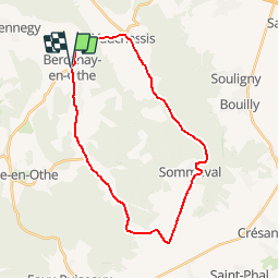
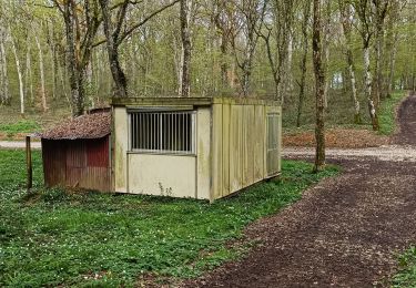
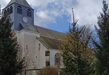
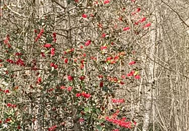
Trail Cycle of 27 km to be discovered at Grand Est, Aube, Bercenay-en-Othe. This trail is proposed by tracegps.
Description
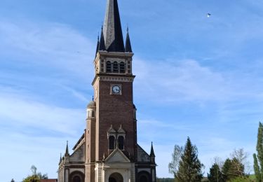
Circuit proposé par l'office de Tourisme du Pays d'Othe, vallée de la Vanne et le Cyclo Club Othéen. Départ de l'église de Bercenay-en-Othe. Retrouvez le circuit a télécharger sur le site de l'office de tourisme du Pays d'Othe, vallée de la Vanne.
Positioning
Country:
France
Region :
Grand Est
Department/Province :
Aube
Municipality :
Bercenay-en-Othe
Location:
Unknown
Start:(Dec)
Start:(UTM)
566209 ; 5339834 (31U) N.
Comments
Trails nearby
![Trail Walking Prugny - Montbernange - Photo](https://media.geolcdn.com/t/375/260/4b4d4fb7-91b5-4cd4-a11d-924324bd5236.jpg&format=jpg&maxdim=2)
![Walking Walking](https://static1.geolcdn.com/sitytour/trail-icons/101.png)
![Trail Walking Chennegy - Le chemin du patrimoine du Valdreux - Photo](https://media.geolcdn.com/t/375/260/ext.jpg?maxdim=2&url=https%3A%2F%2Fservices.sitytrail.com%2FGeolivesWS%2FDownloadMedia.ashx%3FTrailID%3D487691%26Media%3Dfix__20151031115944.jpg)
![Walking Walking](https://static1.geolcdn.com/sitytour/trail-icons/101.png)
Le chemin du patrimoine du Valdreux
Walking
Very easy
(1)
Chennegy,
Grand Est,
Aube,
France
![](/images/other/stat-length.png)
8.6 km | 10.5 km-effort
1h 57min
![](https://static1.geolcdn.com/siteimages/upload/files/16400158638029165_repeat_loop_refresh_sync_direction_icon.png)
Yes
![Trail Walking Vauchassis - Vauchassis Bercenay - Photo](https://media.geolcdn.com/t/375/260/3bc01075-f320-46fc-861d-82d815a161ca.jpg&format=jpg&maxdim=2)
![Walking Walking](https://static1.geolcdn.com/sitytour/trail-icons/101.png)
Vauchassis Bercenay
Walking
Difficult
Vauchassis,
Grand Est,
Aube,
France
![](/images/other/stat-length.png)
9.6 km | 12.3 km-effort
2h 44min
![](https://static1.geolcdn.com/siteimages/upload/files/16400158638029165_repeat_loop_refresh_sync_direction_icon.png)
Yes
![Trail Electric bike Vauchassis - Vauchassis Eaux Puiseaux Auxon Joigny Javernant Vauchassis - Photo](https://media.geolcdn.com/t/375/260/775eca5a-aa79-4179-b0a6-3e839dc590fd.jpg&format=jpg&maxdim=2)
![Electric bike Electric bike](https://static1.geolcdn.com/sitytour/trail-icons/205.png)
Vauchassis Eaux Puiseaux Auxon Joigny Javernant Vauchassis
Electric bike
Easy
Vauchassis,
Grand Est,
Aube,
France
![](/images/other/stat-length.png)
49 km | 57 km-effort
4h 26min
![](https://static1.geolcdn.com/siteimages/upload/files/16400158638029165_repeat_loop_refresh_sync_direction_icon.png)
Yes
![Trail Walking Vauchassis - Randonnée Bucey 23 04 2024 - Photo](https://media.geolcdn.com/t/375/260/68155dde-7682-460a-a2d4-c9db32b7927e.jpg&format=jpg&maxdim=2)
![Walking Walking](https://static1.geolcdn.com/sitytour/trail-icons/101.png)
Randonnée Bucey 23 04 2024
Walking
Difficult
Vauchassis,
Grand Est,
Aube,
France
![](/images/other/stat-length.png)
10.5 km | 13.4 km-effort
3h 5min
![](https://static1.geolcdn.com/siteimages/upload/files/16400158638029165_repeat_loop_refresh_sync_direction_icon.png)
Yes
![Trail Electric bike Vauchassis - Balade VAE Pays d Othe - Photo](https://media.geolcdn.com/t/375/260/9599c955-63b9-4d47-9a4c-acac74eb533f.jpg&format=jpg&maxdim=2)
![Electric bike Electric bike](https://static1.geolcdn.com/sitytour/trail-icons/205.png)
Balade VAE Pays d Othe
Electric bike
Very easy
Vauchassis,
Grand Est,
Aube,
France
![](/images/other/stat-length.png)
56 km | 66 km-effort
5h 15min
![](https://static1.geolcdn.com/siteimages/upload/files/16400158638029165_repeat_loop_refresh_sync_direction_icon.png)
Yes
![Trail Walking Vauchassis - Balade Forêt communale de Vauchassis - Photo](https://media.geolcdn.com/t/375/260/60154d9b-5182-45e8-96d5-ba2683475c3b.jpg&format=jpg&maxdim=2)
![Walking Walking](https://static1.geolcdn.com/sitytour/trail-icons/101.png)
Balade Forêt communale de Vauchassis
Walking
Medium
Vauchassis,
Grand Est,
Aube,
France
![](/images/other/stat-length.png)
7.5 km | 9.1 km-effort
2h 26min
![](https://static1.geolcdn.com/siteimages/upload/files/16400158638029165_repeat_loop_refresh_sync_direction_icon.png)
Yes
![Trail Walking Vauchassis - Vauchassis Bercenay Vauchassis - Photo](https://media.geolcdn.com/t/375/260/47a3c001-c9e0-442d-bf86-fe83ec300e69.jpg&format=jpg&maxdim=2)
![Walking Walking](https://static1.geolcdn.com/sitytour/trail-icons/101.png)
Vauchassis Bercenay Vauchassis
Walking
Difficult
Vauchassis,
Grand Est,
Aube,
France
![](/images/other/stat-length.png)
10.3 km | 13 km-effort
3h 2min
![](https://static1.geolcdn.com/siteimages/upload/files/16400158638029165_repeat_loop_refresh_sync_direction_icon.png)
Yes
![Trail Walking Vauchassis - Randonnée Grands Bois Vauchassis - Photo](https://media.geolcdn.com/t/375/260/9d027c1e-e535-409f-87d7-d0acadfbd13f.jpg&format=jpg&maxdim=2)
![Walking Walking](https://static1.geolcdn.com/sitytour/trail-icons/101.png)
Randonnée Grands Bois Vauchassis
Walking
Medium
Vauchassis,
Grand Est,
Aube,
France
![](/images/other/stat-length.png)
9.7 km | 12 km-effort
2h 51min
![](https://static1.geolcdn.com/siteimages/upload/files/16400158638029165_repeat_loop_refresh_sync_direction_icon.png)
Yes