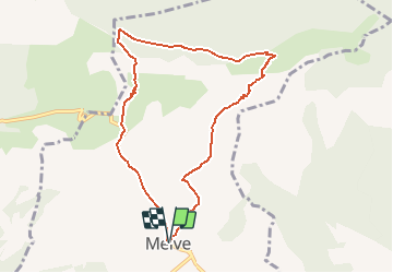
![](/images/other/stat-length.png)
![Trail Walking Melve - Les croix par la Tour - Melve - Photo](https://media.geolcdn.com/t/1900/400/ext.pjpeg?maxdim=2&url=https%3A%2F%2Fservices.sitytrail.com%2FGeolivesWS%2FDownloadMedia.ashx%3FTrailID%3D112791%26Media%3D12402_3.jpg)
Les croix par la Tour - Melve
tracegps
User
![Length](/images/other/stat-length.png)
![Max alt](https://static1.geolcdn.com/siteimages/upload/files/1508320355ic_sort_altitude_max_24dp.png)
![Uphill gradient](https://static1.geolcdn.com/siteimages/upload/files/1508320355ic_sort_den_pos_24dp.png)
![Km-Effort](/images/other/stat-length.png)
![Min alt](https://static1.geolcdn.com/siteimages/upload/files/1508320355ic_sort_altitude_min_24dp.png)
![Downhill gradient](https://static1.geolcdn.com/siteimages/upload/files/1508320355ic_sort_den_neg_24dp.png)
![Boucle](https://static1.geolcdn.com/siteimages/upload/files/16400158638029165_repeat_loop_refresh_sync_direction_icon.png)
![Walking](https://static1.geolcdn.com/sitytour/trail-icons/101.png)
3h30
Difficulty : Difficult
![Scan this QR Code to open this trail in the SityTrail application](https://capi.geolives.com/qq0zvz2zws4bq2lad0pu/sitytour/trails/112791/qr.png?size=200)
FREE GPS app for hiking
About
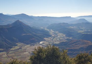
Trail Walking of 8.6 km to be discovered at Provence-Alpes-Côte d'Azur, Alpes-de-Haute-Provence, Melve. This trail is proposed by tracegps.
Description
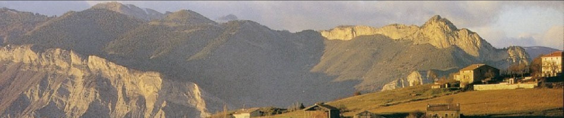
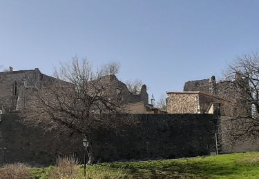
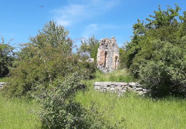
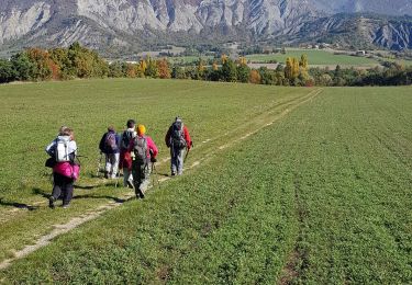
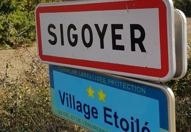
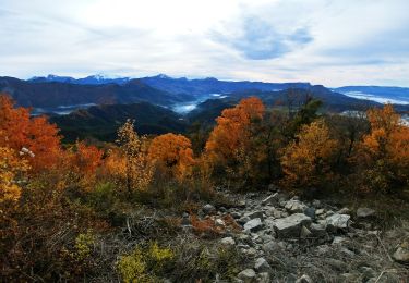
Départ du village de Melve. Après s’être garé sur la place du village avec sa fontaine, se diriger plein nord sur une belle piste puis sentier jusqu’à la tour carrée qui domine le village. Peu avant celle-ci, le sentier bifurque à droite à travers pâturage puis petite pinède. Peu de temps après, la traversée d’une zone marneuse à franchir sur sa crête peut s’avérer impressionnante pour toute personne sujette au vertige. Prudence de rigueur. Le sentier poursuit son chemin après être passé sur les hauteurs de la Motte du Caire et son vallon depuis la ferme du Saignon jusqu’à la crête de « la montagne ». Prendre sur sa gauche pour atteindre en peu de temps le sommet des Croix. Poursuivre sur cette arête jusqu’aux abords de la tête de Boursier et la liaison avec le circuit N° 13. La descente plein sud vers la D104 et Melve se fera sans difficulté particulière. Retrouvez le circuit sur le site des Hautes Terres de Provence.
Positioning
Comments
Trails nearby
![Trail Walking Sigoyer - SIGOYER Boucle Croix de la Biousse o l m s - Photo](https://media.geolcdn.com/t/375/260/cc06d09a-5ff2-41a1-9edb-f8368db9ba2d.jpg&format=jpg&maxdim=2)
![Walking Walking](https://static1.geolcdn.com/sitytour/trail-icons/101.png)
Walking
![](/images/other/stat-length.png)
![](https://static1.geolcdn.com/siteimages/upload/files/16400158638029165_repeat_loop_refresh_sync_direction_icon.png)
![Trail Walking La Motte-du-Caire - LA MOTTE DU CAIRE .Le tour de la Blachere o - Photo](https://media.geolcdn.com/t/375/260/181c511a-92a7-4933-9888-9e2bc6024806.jpg&format=jpg&maxdim=2)
![Walking Walking](https://static1.geolcdn.com/sitytour/trail-icons/101.png)
Walking
![](/images/other/stat-length.png)
![](https://static1.geolcdn.com/siteimages/upload/files/16400158638029165_repeat_loop_refresh_sync_direction_icon.png)
![Trail Walking Melve - Melve Les Chanderettes 1014m 16kms - Photo](https://media.geolcdn.com/t/375/260/ccabf33a-e431-4ec0-8bfa-bcf63e55d70b.jpg&format=jpg&maxdim=2)
![Walking Walking](https://static1.geolcdn.com/sitytour/trail-icons/101.png)
Walking
![](/images/other/stat-length.png)
![](https://static1.geolcdn.com/siteimages/upload/files/16400158638029165_repeat_loop_refresh_sync_direction_icon.png)
![Trail Walking Sigoyer - Sigoyer Les Baudes - Photo](https://media.geolcdn.com/t/375/260/a01c5cb6-bdb8-480b-87fa-564c7d11bb21.jpg&format=jpg&maxdim=2)
![Walking Walking](https://static1.geolcdn.com/sitytour/trail-icons/101.png)
Walking
![](/images/other/stat-length.png)
![](https://static1.geolcdn.com/siteimages/upload/files/16400158638029165_repeat_loop_refresh_sync_direction_icon.png)
![Trail Walking Claret - Tete de Boursier depart Claret - Photo](https://media.geolcdn.com/t/375/260/c93a942b-9518-4b3c-80a9-c6f6ef8e8c48.jpg&format=jpg&maxdim=2)
![Walking Walking](https://static1.geolcdn.com/sitytour/trail-icons/101.png)
Walking
![](/images/other/stat-length.png)
![](https://static1.geolcdn.com/siteimages/upload/files/16400158638029165_repeat_loop_refresh_sync_direction_icon.png)
![Trail Walking Thèze - Boucle Theze Sigoyer depart Theze - Photo](https://media.geolcdn.com/t/375/260/91670e8d-b25b-43eb-b3a3-a9631c3bd51e.jpg&format=jpg&maxdim=2)
![Walking Walking](https://static1.geolcdn.com/sitytour/trail-icons/101.png)
Walking
![](/images/other/stat-length.png)
![](https://static1.geolcdn.com/siteimages/upload/files/16400158638029165_repeat_loop_refresh_sync_direction_icon.png)
![Trail Walking Sigoyer - Boucle Croix de la Biousse - Photo](https://media.geolcdn.com/t/375/260/9bf7cebd-6a47-4b2b-a790-11caea904f86.jpg&format=jpg&maxdim=2)
![Walking Walking](https://static1.geolcdn.com/sitytour/trail-icons/101.png)
Walking
![](/images/other/stat-length.png)
![](https://static1.geolcdn.com/siteimages/upload/files/16400158638029165_repeat_loop_refresh_sync_direction_icon.png)
![Trail Walking Melve - 20191126_Melve Tête de Boursier - Photo](https://media.geolcdn.com/t/375/260/1d6a6e93-136f-4ae8-96da-7f5812d2bd56.jpg&format=jpg&maxdim=2)
![Walking Walking](https://static1.geolcdn.com/sitytour/trail-icons/101.png)
Walking
![](/images/other/stat-length.png)
![](https://static1.geolcdn.com/siteimages/upload/files/16400158638029165_repeat_loop_refresh_sync_direction_icon.png)
![Trail Walking Melve - Melve Rando Pivoines, avec la RSPG : https://www.rspg05.org/ - Photo](https://media.geolcdn.com/t/375/260/d79f0681-8663-4e9d-b91d-6ba336eb6feb.jpg&format=jpg&maxdim=2)
![Walking Walking](https://static1.geolcdn.com/sitytour/trail-icons/101.png)
Walking
![](/images/other/stat-length.png)
![](https://static1.geolcdn.com/siteimages/upload/files/16400158638029165_repeat_loop_refresh_sync_direction_icon.png)