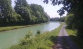
Trail Walking Châlons-en-Champagne - La Via Francigena - Châlons en Champagne- Vitry le François - Photo

La Via Francigena - Châlons en Champagne- Vitry le François

 tracegps
tracegps

User

© OpenStreetMap contributors
Length
Length
45 km
Max alt
Max alt
200 m
Uphill gradient
Uphill gradient
337 m
Km-Effort
Km-Effort  
49 km
Min alt
Min alt
78 m
Downhill gradient
Downhill gradient
323 m
Boucle
Boucle
No
Creation date :
2014-12-10 00:00:00.0
Updated on :
2014-12-10 00:00:00.0

(0 Reviews)

Walking
Walking
10h00
Difficulty : Medium

Scan this QR Code to open this trail in the SityTrail application

FREE GPS app for hiking

Logo SityTrail SityTrail

IGN / Geographical institutes

Download SityTrail from the App Store Download SityTrail from Google Play

Logo SityTrail SityTrail World

The world is yours!

Download SityTrail from the App Store Download SityTrail from Google Play Download SityTrail on Huawei AppGallery

About

Trail Walking of 45 km to be discovered at Grand Est, Marne, Châlons-en-Champagne. This trail is proposed by tracegps.

Description

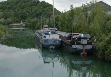
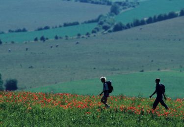
La Via Francigena - Châlons en Champagne- Vitry le François. En 990, l’archevêque de Canterbury Sigéric se rend à Rome pour y recevoir son pallium (large bande de tissu, symbole de son investiture) des mains du pape Jean XV. Sur le chemin du retour, il rédige un journal de voyage qui recense les 80 étapes qui lui furent nécessaire pour effectuer ce périple de plus de 2000 km. Ce précieux manuscrit permet d’avoir une idée précise du tracé de l’une des Vie Francigene, il correspond également au plus ancien itinéraire décrit par un pèlerin. L’itinéraire actuel diffère légèrement par endroit de celui décrit par le manuscrit de Sigéric afin de permettre au randonneur de trouver facilement le « gîte et le couvert » tout au long du parcours. Parcours agréable et sans dénivelé le long de la Marne jusqu’à La Chaussée sur Marne puis le long de la rivière Le Fion jusqu’à St Amand sur Fion. Un peu de relief pour monter au Mont de la Fourche avant de retrouver la vallée de la Marne à Vitry le François. Pour trouver toute l’information nécessaire à la planification de votre itinéraire vous pouvez consulter le site touristique de la région Champagne-Ardenne: En vue de limiter le nombre de fichiers, les étapes ont été regroupées. Il appartiendra au randonneur de choisir ses étapes en fonction de ses capacités. Source autres photos Immacolata Coraggio.

Elevation profile

Photos

Positioning

Country:
France
Region :
Grand Est
Department/Province :
Marne
Municipality :
Châlons-en-Champagne
Location:
Unknown
Start:(UTM)
599277 ; 5422579 (31U) N.

Trails nearby

Trail Mountain bike Châlons-en-Champagne - Vallée et Champagne crayeuse - Photo
Mountain bike
tracegps

Mountain bike

Medium
(1)
Châlons-en-Champagne, Grand Est, Marne, France
35 km | 38 km-effort
2h 30min
Yes
Trail Electric bike Châlons-en-Champagne - Chalons en Champagne Vitry le François  - Photo
Electric bike
FPortier

Electric bike

Very easy
Châlons-en-Champagne, Grand Est, Marne, France
32 km | 34 km-effort
3h 25min
No
Trail Walking Châlons-en-Champagne - Chemin de Compostelle, Voie de Vézelay GR654® De Châlons en Champagne à La Chaussée sur Marne - Photo
Walking
tracegps

Walking

Difficult
Châlons-en-Champagne, Grand Est, Marne, France
24 km | 26 km-effort
4h 49min
No
Trail Walking Châlons-en-Champagne - Via Columbani 10 du 14.06.2024 - Photo
Walking
bene_dictus77

Walking

Easy
Châlons-en-Champagne, Grand Est, Marne, France
25 km | 26 km-effort
7h 17min
No
Trail Nordic walking Châlons-en-Champagne - Châlons en Champagnbe 10 620m +54m - Photo
Nordic walking
DanielROLLET

Nordic walking

Easy
Châlons-en-Champagne, Grand Est, Marne, France
10.6 km | 11.3 km-effort
2h 20min
Yes
Trail Bicycle tourism Châlons-en-Champagne - Chalons - Sainte-Marie du Lac 62 km - Photo
Bicycle tourism
GUIDE
jeanmarcMasson

Bicycle tourism

Very difficult
Châlons-en-Champagne, Grand Est, Marne, France
62 km | 66 km-effort
4h 31min
No
Trail Cycle Châlons-en-Champagne - 20070610Arcis - Photo
Cycle
gpstracks

Cycle

Very easy
Châlons-en-Champagne, Grand Est, Marne, France
62 km | 68 km-effort
Unknown
No
Trail Walking Châlons-en-Champagne - Le Chemin des Pélerins - Photo
Walking
DanielROLLET

Walking

Very difficult
Châlons-en-Champagne, Grand Est, Marne, France
30 km | 32 km-effort
7h 17min
Yes
Trail Walking Châlons-en-Champagne - L'Epine 19 500m +130m - Photo
Walking
DanielROLLET

Walking

Very difficult
Châlons-en-Champagne, Grand Est, Marne, France
19.5 km | 21 km-effort
4h 41min
Yes


Close
My subscriptions