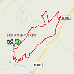
![](/images/other/stat-length.png)
![Trail Walking Queige - Le sentier de la mémoire - Les Pointières - Photo](https://media.geolcdn.com/t/1900/400/ext.pjpeg?maxdim=2&url=https%3A%2F%2Fservices.sitytrail.com%2FGeolivesWS%2FDownloadMedia.ashx%3FTrailID%3D112686%26Media%3D11530_5.jpg)
Le sentier de la mémoire - Les Pointières
tracegps
User
![Length](/images/other/stat-length.png)
![Max alt](https://static1.geolcdn.com/siteimages/upload/files/1508320355ic_sort_altitude_max_24dp.png)
![Uphill gradient](https://static1.geolcdn.com/siteimages/upload/files/1508320355ic_sort_den_pos_24dp.png)
![Km-Effort](/images/other/stat-length.png)
![Min alt](https://static1.geolcdn.com/siteimages/upload/files/1508320355ic_sort_altitude_min_24dp.png)
![Downhill gradient](https://static1.geolcdn.com/siteimages/upload/files/1508320355ic_sort_den_neg_24dp.png)
![Boucle](https://static1.geolcdn.com/siteimages/upload/files/16400158638029165_repeat_loop_refresh_sync_direction_icon.png)
![Walking](https://static1.geolcdn.com/sitytour/trail-icons/101.png)
3h00
Difficulty : Medium
![Scan this QR Code to open this trail in the SityTrail application](https://capi.geolives.com/qq0zvz2zws4bq2lad0pu/sitytour/trails/112686/qr.png?size=200)
FREE GPS app for hiking
About
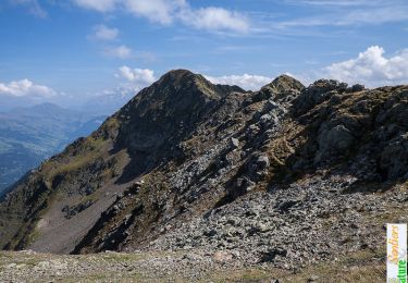
Trail Walking of 5.1 km to be discovered at Auvergne-Rhône-Alpes, Savoy, Queige. This trail is proposed by tracegps.
Description
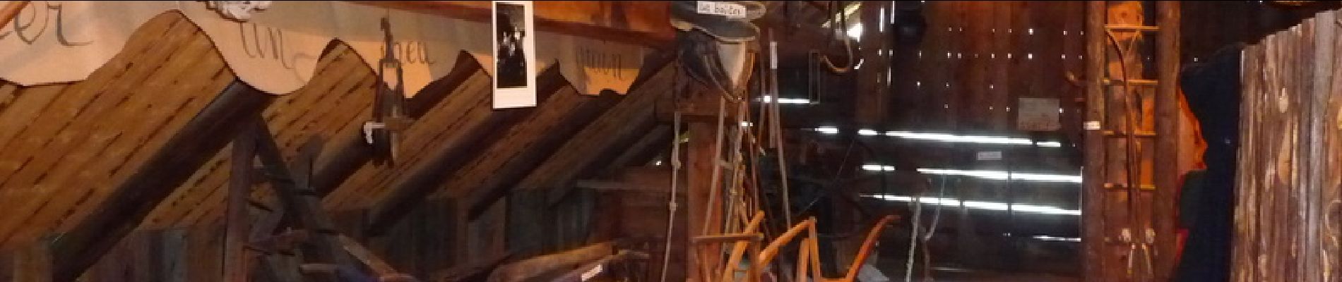
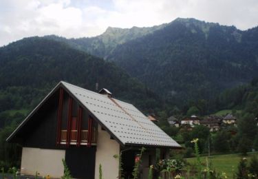
Ce hameau est situé dans le massif du Beaufortain, sur la commune de Queige, à quelques kilomètres d’Albertville. En suivant ce sentier des Pointières, vous entreprenez un véritable voyage dans le temps… Jusqu'en 1950, le hameau des Pointières comptait de nombreux habitants, une école, un moulin ou encore un four à pain. L'exode rural amorcé au milieu du XXe siècle a eu raison de ce hameau aujourd'hui réhabilité par une poignée de passionnés qui vous invitent à découvrir leur hameau et son histoire! Découvrir en marchant l'évolution et la mémoire du hameau des Pointières. Une balade facile qui respire la nature et l'histoire sur ce sentier balcon qui domine Albertville. Une boucle sculptée dans le flanc de la montagne par des artisans du temps qui passe. Sur le sentier vous y rencontrerez : Le four à pain des Cruets, une famille vivait ici toute l'année. Le four à pain en est un témoignage. La prairie des Barnards, les épicéas ont remplacé 10 hectares de prairie artificielle. La grange à la Pauline, après avoir travaillé de longues années à paris, Pauline achète cette propriété avec ses économies. Pour le voisinage, c'est la grange à Pauline. Le jardin des Veuillettes, le secteur était travaillé comme un jardin, cinq familles vivaient une partie de l'année au milieu d'une vingtaine d'hectares Le chaume à la Baëque, une grange où l'on explique le chaume. Le musée du Roselais, les anciens propriétaires y vivaient une partie de l'année, pratiquant les "remues" comme beaucoup d'autres familles beaufortaines : on se déplaçait en altitude avec toutes les bêtes pour bénéficier de bons pâturages. Départ : hameau des Pointières à Queige. (Chapelle des Pointières)
Positioning
Comments
Trails nearby
![Trail Walking Queige - suuntoapp-Hiking-2024-09-06T06-04-43Z - Photo](https://media.geolcdn.com/t/375/260/f3e89b8c-3c97-4299-aeda-1fcf18be7990.jpg&format=jpg&maxdim=2)
![Walking Walking](https://static1.geolcdn.com/sitytour/trail-icons/101.png)
Walking
![](/images/other/stat-length.png)
![](https://static1.geolcdn.com/siteimages/upload/files/16400158638029165_repeat_loop_refresh_sync_direction_icon.png)
![Trail Walking Marthod - Santier botanique - Photo](https://media.geolcdn.com/t/375/260/c3ed3ef9-14f9-4ca9-a64b-14164707e877.jpg&format=jpg&maxdim=2)
![Walking Walking](https://static1.geolcdn.com/sitytour/trail-icons/101.png)
Walking
![](/images/other/stat-length.png)
![](https://static1.geolcdn.com/siteimages/upload/files/16400158638029165_repeat_loop_refresh_sync_direction_icon.png)
![Trail Cycle Albertville - Hardy L'Arly - Photo](https://media.geolcdn.com/t/375/260/ext.jpg?maxdim=2&url=https%3A%2F%2Fservices.sitytrail.com%2FGeolivesWS%2FDownloadMedia.ashx%3FTrailID%3D134775%26Media%3D59e07ac4-0a90-4777-a7cc-621c74e43c59.jpg)
![Cycle Cycle](https://static1.geolcdn.com/sitytour/trail-icons/200.png)
Cycle
![](/images/other/stat-length.png)
![](https://static1.geolcdn.com/siteimages/upload/files/16400158638029165_repeat_loop_refresh_sync_direction_icon.png)
![Trail Snowshoes Queige - Le Haut du Pré depuis le parking des Croix - Photo](https://media.geolcdn.com/t/375/260/40db71ab-b2eb-4294-a255-1a7ab8f8b4e8.jpg&format=jpg&maxdim=2)
![Snowshoes Snowshoes](https://static1.geolcdn.com/sitytour/trail-icons/504.png)
Snowshoes
![](/images/other/stat-length.png)
![](https://static1.geolcdn.com/siteimages/upload/files/16400158638029165_repeat_loop_refresh_sync_direction_icon.png)
![Trail Walking Albertville - alberville - Photo](https://media.geolcdn.com/t/375/260/d0d2962d-135f-4879-8d0e-d5009494617f.jpg&format=jpg&maxdim=2)
![Walking Walking](https://static1.geolcdn.com/sitytour/trail-icons/101.png)
Walking
![](/images/other/stat-length.png)
![](https://static1.geolcdn.com/siteimages/upload/files/16400158638029165_repeat_loop_refresh_sync_direction_icon.png)
![Trail Walking Queige - La Roche Pourrie depuis les Chappes - Photo](https://media.geolcdn.com/t/375/260/ext.jpg?maxdim=2&url=https%3A%2F%2Fservices.sitytrail.com%2FGeolivesWS%2FDownloadMedia.ashx%3FTrailID%3D172914%26Media%3D14376_1.jpg)
![Walking Walking](https://static1.geolcdn.com/sitytour/trail-icons/101.png)
Walking
![](/images/other/stat-length.png)
![](https://static1.geolcdn.com/siteimages/upload/files/16400158638029165_repeat_loop_refresh_sync_direction_icon.png)
![Trail Walking Venthon - Traversée de la Roche Pourrie, Mont Mirantin, 2460m - Photo](https://media.geolcdn.com/t/375/260/ext.jpg?maxdim=2&url=https%3A%2F%2Fservices.sitytrail.com%2FGeolivesWS%2FDownloadMedia.ashx%3FTrailID%3D172720%26Media%3D14106_1.jpg)
![Walking Walking](https://static1.geolcdn.com/sitytour/trail-icons/101.png)
Walking
![](/images/other/stat-length.png)
![](https://static1.geolcdn.com/siteimages/upload/files/16400158638029165_repeat_loop_refresh_sync_direction_icon.png)
![Trail Walking Albertville - D'Albertville à Thônes 1/4 - Autour de la Belle Etoile - Photo](https://media.geolcdn.com/t/375/260/ext.jpg?maxdim=2&url=https%3A%2F%2Fservices.sitytrail.com%2FGeolivesWS%2FDownloadMedia.ashx%3FTrailID%3D109630%26Media%3D4271_1.jpg)
![Walking Walking](https://static1.geolcdn.com/sitytour/trail-icons/101.png)
Walking
![](/images/other/stat-length.png)
![](https://static1.geolcdn.com/siteimages/upload/files/16400158638029165_repeat_loop_refresh_sync_direction_icon.png)
![Trail Walking Queige - Le sentier de la mémoire - Les Pointières - Photo](https://media.geolcdn.com/t/375/260/ext.jpg?maxdim=2&url=https%3A%2F%2Fstatic1.geolcdn.com%2Fsiteimages%2Fupload%2Ffiles%2F1553511878bg_sport_marche.png)
![Walking Walking](https://static1.geolcdn.com/sitytour/trail-icons/101.png)
Walking
![](/images/other/stat-length.png)
![](https://static1.geolcdn.com/siteimages/upload/files/16400158638029165_repeat_loop_refresh_sync_direction_icon.png)