![](/images/other/stat-length.png)
![Trail Walking Commana - Le circuit des Korrigans - Commana - Photo](https://media.geolcdn.com/t/1900/400/ext.pjpeg?maxdim=2&url=https%3A%2F%2Fservices.sitytrail.com%2FGeolivesWS%2FDownloadMedia.ashx%3FTrailID%3D112680%26Media%3D11472_5.jpg)
Le circuit des Korrigans - Commana
tracegps
User
![Length](/images/other/stat-length.png)
![Max alt](https://static1.geolcdn.com/siteimages/upload/files/1508320355ic_sort_altitude_max_24dp.png)
![Uphill gradient](https://static1.geolcdn.com/siteimages/upload/files/1508320355ic_sort_den_pos_24dp.png)
![Km-Effort](/images/other/stat-length.png)
![Min alt](https://static1.geolcdn.com/siteimages/upload/files/1508320355ic_sort_altitude_min_24dp.png)
![Downhill gradient](https://static1.geolcdn.com/siteimages/upload/files/1508320355ic_sort_den_neg_24dp.png)
![Boucle](https://static1.geolcdn.com/siteimages/upload/files/16400158638029165_repeat_loop_refresh_sync_direction_icon.png)
![Walking](https://static1.geolcdn.com/sitytour/trail-icons/101.png)
30m
Difficulty : Easy
![Scan this QR Code to open this trail in the SityTrail application](https://capi.geolives.com/qq0zvz2zws4bq2lad0pu/sitytour/trails/112680/qr.png?size=200)
FREE GPS app for hiking
About
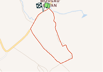
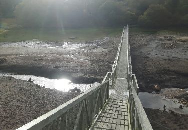
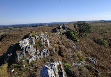
Trail Walking of 1.7 km to be discovered at Brittany, Finistère, Commana. This trail is proposed by tracegps.
Description
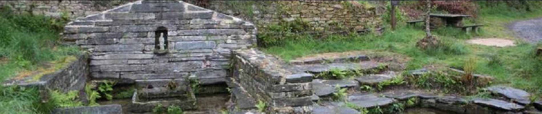
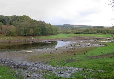
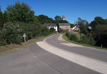
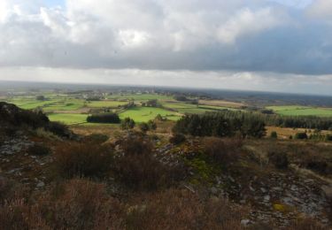
Une trentaine de communes portent le label "Communes du Patrimoine Rural de Bretagne" et mettent en commun leur volonté de sauvegarde, de mise en valeur et d'animation de leur patrimoine architectural et paysager. Des circuits de randonnées pour les uns, des balades champêtres pour les autres vous feront découvrir les bourgs et les villages de caractère de nos communes. Au départ de l’impressionnante allée couverte du Mougau, cette promenade permet de découvrir l’écologie et l’histoire de la tourbière du Mougau à travers un circuit de lecture agrémenté de nombreuses pauses pédagogiques. Retrouvez la fiche du circuit sur le site des Communes du Patrimoine Rural de Bretagne.
Positioning
Comments
Trails nearby
![Trail On foot Commana - Tour du Lac du Drennec - Photo](https://media.geolcdn.com/t/375/260/217e9b5b-dfd1-47dd-bef6-7dae7db515fe.jpeg&format=jpg&maxdim=2)
![On foot On foot](https://static1.geolcdn.com/sitytour/trail-icons/100.png)
On foot
![](/images/other/stat-length.png)
![](https://static1.geolcdn.com/siteimages/upload/files/16400158638029165_repeat_loop_refresh_sync_direction_icon.png)
![Trail On foot Botmeur - Brasparts Circuit des landes et tourbières - Photo](https://media.geolcdn.com/t/375/260/98159458-f3c1-4612-bed6-39d858fe0671.jpeg&format=jpg&maxdim=2)
![On foot On foot](https://static1.geolcdn.com/sitytour/trail-icons/100.png)
On foot
![](/images/other/stat-length.png)
![](https://static1.geolcdn.com/siteimages/upload/files/16400158638029165_repeat_loop_refresh_sync_direction_icon.png)
![Trail Walking Sizun - Tour du lac du Drennec - Photo](https://media.geolcdn.com/t/375/260/ext.jpg?maxdim=2&url=https%3A%2F%2Fservices.sitytrail.com%2FGeolivesWS%2FDownloadMedia.ashx%3FTrailID%3D656775%26Media%3Dfix__20161106144537.jpg)
![Walking Walking](https://static1.geolcdn.com/sitytour/trail-icons/101.png)
Walking
![](/images/other/stat-length.png)
![](https://static1.geolcdn.com/siteimages/upload/files/16400158638029165_repeat_loop_refresh_sync_direction_icon.png)
![Trail Walking Botmeur - Roc'h Bichourel - Botmeur - Photo](https://media.geolcdn.com/t/375/260/ext.jpg?maxdim=2&url=https%3A%2F%2Fservices.sitytrail.com%2FGeolivesWS%2FDownloadMedia.ashx%3FTrailID%3D191436%26Media%3D15024_3.jpg)
![Walking Walking](https://static1.geolcdn.com/sitytour/trail-icons/101.png)
Walking
![](/images/other/stat-length.png)
![](https://static1.geolcdn.com/siteimages/upload/files/16400158638029165_repeat_loop_refresh_sync_direction_icon.png)
![Trail Walking Commana - Circuit de la pierre bleue - Commana - Photo](https://media.geolcdn.com/t/375/260/ext.jpg?maxdim=2&url=https%3A%2F%2Fservices.sitytrail.com%2FGeolivesWS%2FDownloadMedia.ashx%3FTrailID%3D191397%26Media%3D14972_2.jpg)
![Walking Walking](https://static1.geolcdn.com/sitytour/trail-icons/101.png)
Walking
![](/images/other/stat-length.png)
![](https://static1.geolcdn.com/siteimages/upload/files/16400158638029165_repeat_loop_refresh_sync_direction_icon.png)
![Trail Walking Sizun - St Cadou et le Lac du Drennec - Sizun - Photo](https://media.geolcdn.com/t/375/260/ext.jpg?maxdim=2&url=https%3A%2F%2Fservices.sitytrail.com%2FGeolivesWS%2FDownloadMedia.ashx%3FTrailID%3D173020%26Media%3D14524_5.jpg)
![Walking Walking](https://static1.geolcdn.com/sitytour/trail-icons/101.png)
Walking
![](/images/other/stat-length.png)
![](https://static1.geolcdn.com/siteimages/upload/files/16400158638029165_repeat_loop_refresh_sync_direction_icon.png)
![Trail Walking La Feuillée - 2023-10-08 Roc'h trévezel - Roc'h ruz - Photo](https://media.geolcdn.com/t/375/260/d8895edc-d4c1-401b-9e6a-1edf2c8902a5.jpg&format=jpg&maxdim=2)
![Walking Walking](https://static1.geolcdn.com/sitytour/trail-icons/101.png)
Walking
![](/images/other/stat-length.png)
![](https://static1.geolcdn.com/siteimages/upload/files/16400158638029165_repeat_loop_refresh_sync_direction_icon.png)
![Trail Walking Sizun - SAINT CADOU - Photo](https://media.geolcdn.com/t/375/260/fef4f49b-990f-4a0a-b8a9-f239bc0349c0.jpg&format=jpg&maxdim=2)
![Walking Walking](https://static1.geolcdn.com/sitytour/trail-icons/101.png)
![Trail Walking Commana - Maugau Bihan - Photo](https://media.geolcdn.com/t/375/260/0a2488ec-2659-438a-9aad-c108d3c772f9.jpg&format=jpg&maxdim=2)
![Walking Walking](https://static1.geolcdn.com/sitytour/trail-icons/101.png)
Walking
![](/images/other/stat-length.png)
![](https://static1.geolcdn.com/siteimages/upload/files/16400158638029165_repeat_loop_refresh_sync_direction_icon.png)