![](/images/other/stat-length.png)
![Trail Cycle Estissac - Circuit en Forêt d'Othe - Estissac - Photo](https://media.geolcdn.com/t/1900/400/ext.pjpeg?maxdim=2&url=https%3A%2F%2Fservices.sitytrail.com%2FGeolivesWS%2FDownloadMedia.ashx%3FTrailID%3D112625%26Media%3D11208_2.jpg)
Circuit en Forêt d'Othe - Estissac
tracegps
User
![Length](/images/other/stat-length.png)
![Max alt](https://static1.geolcdn.com/siteimages/upload/files/1508320355ic_sort_altitude_max_24dp.png)
![Uphill gradient](https://static1.geolcdn.com/siteimages/upload/files/1508320355ic_sort_den_pos_24dp.png)
![Km-Effort](/images/other/stat-length.png)
![Min alt](https://static1.geolcdn.com/siteimages/upload/files/1508320355ic_sort_altitude_min_24dp.png)
![Downhill gradient](https://static1.geolcdn.com/siteimages/upload/files/1508320355ic_sort_den_neg_24dp.png)
![Boucle](https://static1.geolcdn.com/siteimages/upload/files/16400158638029165_repeat_loop_refresh_sync_direction_icon.png)
![Cycle](https://static1.geolcdn.com/sitytour/trail-icons/200.png)
3h00
Difficulty : Medium
![Scan this QR Code to open this trail in the SityTrail application](https://capi.geolives.com/qq0zvz2zws4bq2lad0pu/sitytour/trails/112625/qr.png?size=200)
FREE GPS app for hiking
About
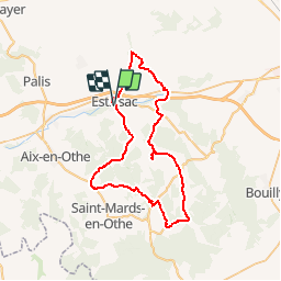
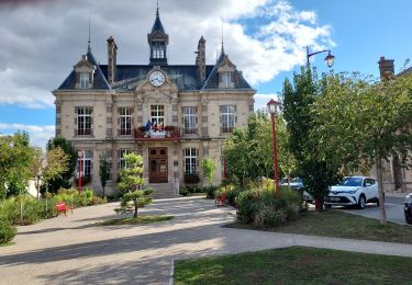
Trail Cycle of 53 km to be discovered at Grand Est, Aube, Estissac. This trail is proposed by tracegps.
Description
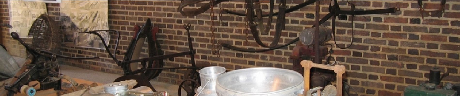
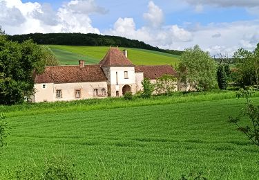
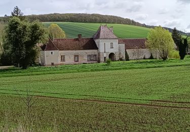
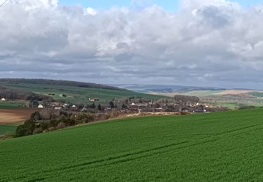
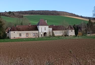
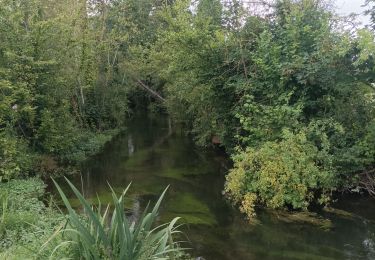
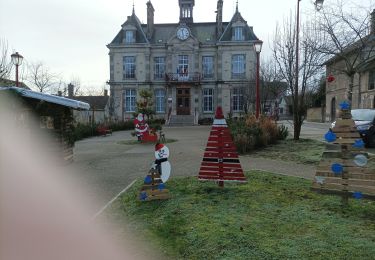
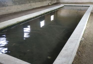
Proposé par le Comité Départemental du Tourisme de l'Aube, un circuit créé et validé par la Fédération Départementale du Cyclotourisme de l’Aube. Circuit en Forêt d’Othe – 55 km - Église d’Estissac - Lavoirs d’Estissac, Fontvannes, Chennegy, Surençon et Villemoiron-en-Othe - Ferme de Champcharme (musée du cidre) - Musée de l’Histoire paysanne à Aix en Othe (Thuisy) - Centre de télécommunications spatiales de Bercenay-en-Othe.
Positioning
Comments
Trails nearby
![Trail Walking Bucey-en-Othe - Au dessus de BUCEY EN OTHE - Photo](https://media.geolcdn.com/t/375/260/35008645-73de-4efb-a96c-d0d684570ae0.jpg&format=jpg&maxdim=2)
![Walking Walking](https://static1.geolcdn.com/sitytour/trail-icons/101.png)
Walking
![](/images/other/stat-length.png)
![](https://static1.geolcdn.com/siteimages/upload/files/16400158638029165_repeat_loop_refresh_sync_direction_icon.png)
![Trail Walking Bucey-en-Othe - Bucey en Othe - Photo](https://media.geolcdn.com/t/375/260/5c3adecb-99f2-402f-8840-28b9ce614624.jpg&format=jpg&maxdim=2)
![Walking Walking](https://static1.geolcdn.com/sitytour/trail-icons/101.png)
Walking
![](/images/other/stat-length.png)
![](https://static1.geolcdn.com/siteimages/upload/files/16400158638029165_repeat_loop_refresh_sync_direction_icon.png)
![Trail Walking Chennegy - Randonnée à Chennegy - Photo](https://media.geolcdn.com/t/375/260/666caa5e-9668-4e17-9e4d-980944e36ad5.jpg&format=jpg&maxdim=2)
![Walking Walking](https://static1.geolcdn.com/sitytour/trail-icons/101.png)
Walking
![](/images/other/stat-length.png)
![](https://static1.geolcdn.com/siteimages/upload/files/16400158638029165_repeat_loop_refresh_sync_direction_icon.png)
![Trail Walking Bucey-en-Othe - Balade autour de Bicey - Photo](https://media.geolcdn.com/t/375/260/98615ad1-cbf1-4979-baef-35b7e1343f2e.jpg&format=jpg&maxdim=2)
![Walking Walking](https://static1.geolcdn.com/sitytour/trail-icons/101.png)
Walking
![](/images/other/stat-length.png)
![](https://static1.geolcdn.com/siteimages/upload/files/16400158638029165_repeat_loop_refresh_sync_direction_icon.png)
![Trail Walking Bucey-en-Othe - Bucey en Othe - Photo](https://media.geolcdn.com/t/375/260/3a00c592-7942-4888-b55e-9a28bdf9eb19.jpg&format=jpg&maxdim=2)
![Walking Walking](https://static1.geolcdn.com/sitytour/trail-icons/101.png)
Walking
![](/images/other/stat-length.png)
![](https://static1.geolcdn.com/siteimages/upload/files/16400158638029165_repeat_loop_refresh_sync_direction_icon.png)
![Trail Walking Estissac - Randonnée Bucey 01 août, 2023 - Photo](https://media.geolcdn.com/t/375/260/73372dab-7bdc-4eae-ba52-6410be568c17.jpg&format=jpg&maxdim=2)
![Walking Walking](https://static1.geolcdn.com/sitytour/trail-icons/101.png)
Walking
![](/images/other/stat-length.png)
![](https://static1.geolcdn.com/siteimages/upload/files/16400158638029165_repeat_loop_refresh_sync_direction_icon.png)
![Trail Walking Estissac - Randonnée Club - Photo](https://media.geolcdn.com/t/375/260/3f183a86-fb71-4e1c-bc68-3aefbf52e304.jpg&format=jpg&maxdim=2)
![Walking Walking](https://static1.geolcdn.com/sitytour/trail-icons/101.png)
![Trail Road bike Estissac - EXT125 Estissac-01 - Photo](https://media.geolcdn.com/t/375/260/ac8a0968-d794-4f70-8e18-1fd419623ff1.jpg&format=jpg&maxdim=2)
![Road bike Road bike](https://static1.geolcdn.com/sitytour/trail-icons/201.png)
Road bike
![](/images/other/stat-length.png)
![](https://static1.geolcdn.com/siteimages/upload/files/16400158638029165_repeat_loop_refresh_sync_direction_icon.png)
![Trail Walking Bucey-en-Othe - Au dessus de Bucey et Messon - Photo](https://media.geolcdn.com/t/375/260/60700a73-91d2-41e6-ac18-57bc0b49cc95.jpg&format=jpg&maxdim=2)
![Walking Walking](https://static1.geolcdn.com/sitytour/trail-icons/101.png)
Walking
![](/images/other/stat-length.png)
![](https://static1.geolcdn.com/siteimages/upload/files/16400158638029165_repeat_loop_refresh_sync_direction_icon.png)