![](/images/other/stat-length.png)
![Trail Cycle Nogent-sur-Seine - De menhirs en château - Nogent sur Seine - Photo](https://media.geolcdn.com/t/1900/400/ext.pjpeg?maxdim=2&url=https%3A%2F%2Fservices.sitytrail.com%2FGeolivesWS%2FDownloadMedia.ashx%3FTrailID%3D112581%26Media%3D11028_1.jpg)
De menhirs en château - Nogent sur Seine
tracegps
User
![Length](/images/other/stat-length.png)
![Max alt](https://static1.geolcdn.com/siteimages/upload/files/1508320355ic_sort_altitude_max_24dp.png)
![Uphill gradient](https://static1.geolcdn.com/siteimages/upload/files/1508320355ic_sort_den_pos_24dp.png)
![Km-Effort](/images/other/stat-length.png)
![Min alt](https://static1.geolcdn.com/siteimages/upload/files/1508320355ic_sort_altitude_min_24dp.png)
![Downhill gradient](https://static1.geolcdn.com/siteimages/upload/files/1508320355ic_sort_den_neg_24dp.png)
![Boucle](https://static1.geolcdn.com/siteimages/upload/files/16400158638029165_repeat_loop_refresh_sync_direction_icon.png)
![Cycle](https://static1.geolcdn.com/sitytour/trail-icons/200.png)
3h30
Difficulty : Medium
![Scan this QR Code to open this trail in the SityTrail application](https://capi.geolives.com/qq0zvz2zws4bq2lad0pu/sitytour/trails/112581/qr.png?size=200)
FREE GPS app for hiking
About
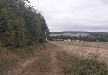
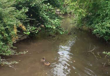
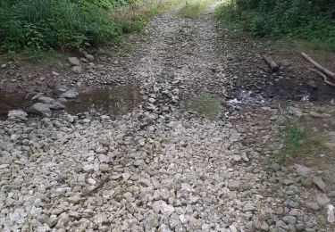
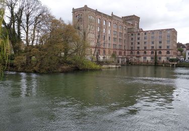
Trail Cycle of 70 km to be discovered at Grand Est, Aube, Nogent-sur-Seine. This trail is proposed by tracegps.
Description
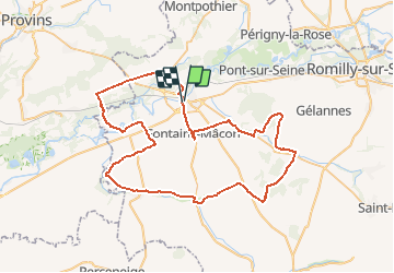
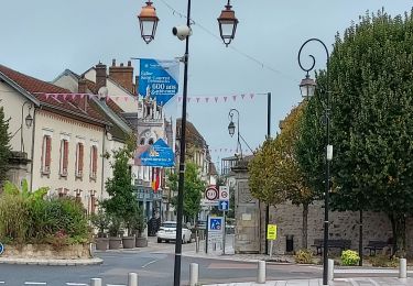
Proposé par le Comité Départemental du Tourisme de l'Aube, un circuit créé et validé par la Fédération Départementale du Cyclotourisme de l’Aube. De menhirs en château – 68 km – niveau facile A voir lors de votre circuit : - Château de la Motte-Tilly XVIIIème - Ville de Nogent-sur-Seine et musée Dubois-Boucher - Domaine de la Pierre au Coq à Avant les Marcilly - Ancienne abbaye du Paraclet - Eglise de Nogent sur Seine A proximité : jardins botaniques de Marnay-sur-Seine ; Polissoir de Tremblay
Positioning
Comments
Trails nearby
![Trail Road bike Nogent-sur-Seine - EXT65 Nogent sur Seine-02 - Photo](https://media.geolcdn.com/t/375/260/ca417b70-cfc7-449d-acaf-f03a858412c8.jpg&format=jpg&maxdim=2)
![Road bike Road bike](https://static1.geolcdn.com/sitytour/trail-icons/201.png)
Road bike
![](/images/other/stat-length.png)
![](https://static1.geolcdn.com/siteimages/upload/files/16400158638029165_repeat_loop_refresh_sync_direction_icon.png)
![Trail Road bike Nogent-sur-Seine - EXT65 Nogent sur Seine-01 - Photo](https://media.geolcdn.com/t/375/260/f12c7822-7616-49c7-aa13-046d75c5f2da.jpg&format=jpg&maxdim=2)
![Road bike Road bike](https://static1.geolcdn.com/sitytour/trail-icons/201.png)
Road bike
![](/images/other/stat-length.png)
![](https://static1.geolcdn.com/siteimages/upload/files/16400158638029165_repeat_loop_refresh_sync_direction_icon.png)
![Trail Walking Saint-Aubin - Saint Aubin et la vallée de l'Ardusson - Photo](https://media.geolcdn.com/t/375/260/f350ed10-944d-4a3f-a8a0-a8fbb2c48c0b.jpg&format=jpg&maxdim=2)
![Walking Walking](https://static1.geolcdn.com/sitytour/trail-icons/101.png)
Walking
![](/images/other/stat-length.png)
![](https://static1.geolcdn.com/siteimages/upload/files/16400158638029165_repeat_loop_refresh_sync_direction_icon.png)
![Trail Walking Saint-Aubin - St Aubin - Fontaine Mâcon - St Aubin - Photo](https://media.geolcdn.com/t/375/260/e257991e-7cb7-4143-9b1a-d9a805529f6d.jpg&format=jpg&maxdim=2)
![Walking Walking](https://static1.geolcdn.com/sitytour/trail-icons/101.png)
Walking
![](/images/other/stat-length.png)
![](https://static1.geolcdn.com/siteimages/upload/files/16400158638029165_repeat_loop_refresh_sync_direction_icon.png)
![Trail Walking Saint-Aubin - St Aubin - Fontaine Mâcon - Abbaye du Paraclet - St Aubin - Photo](https://media.geolcdn.com/t/375/260/91520258-9572-40f5-aac3-ae8eb59945ec.jpg&format=jpg&maxdim=2)
![Walking Walking](https://static1.geolcdn.com/sitytour/trail-icons/101.png)
Walking
![](/images/other/stat-length.png)
![](https://static1.geolcdn.com/siteimages/upload/files/16400158638029165_repeat_loop_refresh_sync_direction_icon.png)
![Trail Hybrid bike Marnay-sur-Seine - Marnay bis - Photo](https://media.geolcdn.com/t/375/260/d3dd4a92-ca0b-442d-80fb-f340a7687fae.jpg&format=jpg&maxdim=2)
![Hybrid bike Hybrid bike](https://static1.geolcdn.com/sitytour/trail-icons/203.png)
Hybrid bike
![](/images/other/stat-length.png)
![](https://static1.geolcdn.com/siteimages/upload/files/16400158638029165_repeat_loop_refresh_sync_direction_icon.png)
![Trail Walking Nogent-sur-Seine - Nogent sur Seine 230330 - Photo](https://media.geolcdn.com/t/375/260/d5eae0c2-429b-436a-8eb9-e4b49cb4c570.jpg&format=jpg&maxdim=2)
![Walking Walking](https://static1.geolcdn.com/sitytour/trail-icons/101.png)
Walking
![](/images/other/stat-length.png)
![](https://static1.geolcdn.com/siteimages/upload/files/16400158638029165_repeat_loop_refresh_sync_direction_icon.png)
![Trail Walking Nogent-sur-Seine - 221016 Nogent sur Seine - Photo](https://media.geolcdn.com/t/375/260/f36b1d3f-ad34-4eca-906f-9809ed42b371.jpg&format=jpg&maxdim=2)
![Walking Walking](https://static1.geolcdn.com/sitytour/trail-icons/101.png)
Walking
![](/images/other/stat-length.png)
![](https://static1.geolcdn.com/siteimages/upload/files/16400158638029165_repeat_loop_refresh_sync_direction_icon.png)
![Trail Walking Nogent-sur-Seine - SityTrail - bord de la Seine - Photo](https://media.geolcdn.com/t/375/260/ext.jpg?maxdim=2&url=https%3A%2F%2Fstatic1.geolcdn.com%2Fsiteimages%2Fupload%2Ffiles%2F1553511878bg_sport_marche.png)
![Walking Walking](https://static1.geolcdn.com/sitytour/trail-icons/101.png)
Walking
![](/images/other/stat-length.png)
![](https://static1.geolcdn.com/siteimages/upload/files/16400158638029165_repeat_loop_refresh_sync_direction_icon.png)