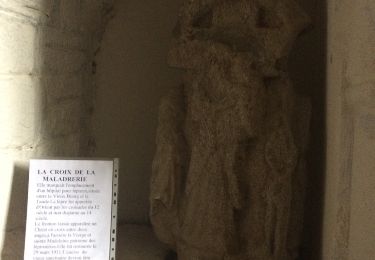
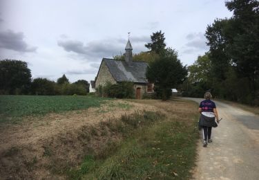
Trail Walking Ploërmel - Le tour du lac au Duc - Ploërmel - Photo

Le tour du lac au Duc - Ploërmel

 tracegps
tracegps

User

© OpenStreetMap contributors
Length
Length
13.7 km
Max alt
Max alt
51 m
Uphill gradient
Uphill gradient
116 m
Km-Effort
Km-Effort  
15.2 km
Min alt
Min alt
22 m
Downhill gradient
Downhill gradient
117 m
Boucle
Boucle
Yes
Creation date :
2014-12-10 00:00:00.0
Updated on :
2014-12-10 00:00:00.0

(0 Reviews)

Walking
Walking
4h00
Difficulty : Medium

Scan this QR Code to open this trail in the SityTrail application

FREE GPS app for hiking

Logo SityTrail SityTrail

IGN / Geographical institutes

Download SityTrail from the App Store Download SityTrail from Google Play

Logo SityTrail SityTrail World

The world is yours!

Download SityTrail from the App Store Download SityTrail from Google Play Download SityTrail on Huawei AppGallery

About

Trail Walking of 13.7 km to be discovered at Brittany, Morbihan, Ploërmel. This trail is proposed by tracegps.

Description

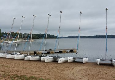
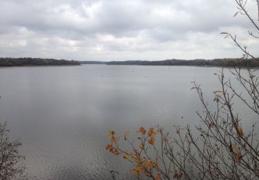
Point de départ : parking de l’hôtel du Roi Arthur (Ploërmel) - Coordonnées GPS : 02°24’42’’O / 47°56’31’’N - Distance : 16 km - 4 h 00 A voir en chemin: 1. Le Lac au Duc : d’abord étang naturel jusqu’au XIIème siècle, il appartient aux moines bénédictins de St Gildas de Rhuys qui font construire des moulins ainsi qu’une digue. En avril 1257, le Duc de Bretagne résidant à Ploërmel rachète aux moines l’étang et les grands moulins. L’étang devient alors « l’étang aux ducs ». Les grands moulins garderont leur importance jusqu’au XIXème siècle avant d’être détruits. 2. Le circuit des hortensias : unique en Bretagne, le circuit des hortensias invite à la flânerie mais aussi à la découverte botanique. Agréé par le Conservatoire des Collections Végétales Spécialisées, le circuit rassemble plus de 5300 hydrangeas roses, bleues, mauves, bicolores… 3. Le manoir de Lézonnet (Privé) : en bordure de Voie Verte, le manoir de Lézonnet évoque un passé prestigieux. Ancien ensemble féodal dont subsiste seulement une tour de guet, il devient ensuite un rendez vous de chasse rebâti au XIXème siècle. 4. Loyat : Loyat passe pour le pays des sorciers. La fontaine aux sorciers, située sur la lande de Tréguier, était à l’origine de la disparition de certains jeunes gens qui allaient danser et s’amuser la nuit avec de belles ensorceleuses sur le haut des Grées… Contact: Office de tourisme de Ploërmel «Terres de légendes». Tel : 02 97 74 02 70 - Email : accueil (at) tourisme-ploermel.com

Elevation profile

Positioning

Country:
France
Region :
Brittany
Department/Province :
Morbihan
Municipality :
Ploërmel
Location:
Ploërmel
Start:(UTM)
543908 ; 5310024 (30T) N.

Trails nearby

Trail Walking Taupont - GR_37_CG_41_Taupont_Josselin_20221015 - Photo
Walking
patrickdanilo

Walking

Very difficult
Taupont, Brittany, Morbihan, France
21 km | 25 km-effort
5h 18min
No
Trail Walking Ploërmel - LAC AU DUC (56) - Photo
Walking
0010Jacem.1957

Walking

Very easy
Ploërmel, Brittany, Morbihan, France
14.6 km | 16.1 km-effort
2h 42min
Yes
Trail Mountain bike Ploërmel - 56-ploermel_vtt_josselin_46kmD450m - Photo
Mountain bike
SyMA

Mountain bike

Medium
Ploërmel, Brittany, Morbihan, France
47 km | 53 km-effort
4h 1min
Yes
Trail Walking Ploërmel - la ville bouquet - Photo
Walking
motardfou.dgs

Walking

Easy
Ploërmel, Brittany, Morbihan, France
10.1 km | 11.8 km-effort
2h 27min
No
Trail Other activity Taupont - taupins - Photo
Other activity
bourdet

Other activity

Very easy
Taupont, Brittany, Morbihan, France
21 km | 24 km-effort
5h 59min
No
Trail Walking Saint-Servant - castel 2 - Photo
Walking
bourdet

Walking

Easy
Saint-Servant, Brittany, Morbihan, France
422 m | 462 m-effort
33min
Yes
Trail Walking Guillac - Guillac  - Photo
Walking
motardfou.dgs

Walking

Very easy
Guillac, Brittany, Morbihan, France
8.8 km | 10.3 km-effort
2h 0min
Yes
Trail Nordic walking Loyat - 2018-10-25 TOUR DU LAC AU DUC - Photo
Nordic walking
rousseau.mich

Nordic walking

Very easy
Loyat, Brittany, Morbihan, France
16.9 km | 18.3 km-effort
3h 48min
Yes
Trail Nordic walking Taupont - 2018-09-30 TAUPONT CHEMIN DES CHAPELLES - Photo
Nordic walking
rousseau.mich

Nordic walking

Very easy
Taupont, Brittany, Morbihan, France
11.5 km | 13 km-effort
2h 36min
Yes


Close
My subscriptions