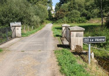
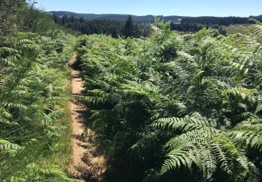
Trail Mountain bike Saint-Merd-les-Oussines - Du site des Cars à la tourbière du Longeyroux - Saint Merd les Oussines - Pays de Haute Corrèze - Photo

Du site des Cars à la tourbière du Longeyroux - Saint Merd les Oussines - Pays de Haute Corrèze

 tracegps
tracegps

User

© OpenStreetMap contributors
Length
Length
16.1 km
Max alt
Max alt
912 m
Uphill gradient
Uphill gradient
402 m
Km-Effort
Km-Effort  
21 km
Min alt
Min alt
808 m
Downhill gradient
Downhill gradient
402 m
Boucle
Boucle
Yes
Creation date :
2014-12-10 00:00:00.0
Updated on :
2014-12-10 00:00:00.0

(0 Reviews)

Mountain bike
Mountain bike
1h15
Difficulty : Medium

Scan this QR Code to open this trail in the SityTrail application

FREE GPS app for hiking

Logo SityTrail SityTrail

IGN / Geographical institutes

Download SityTrail from the App Store Download SityTrail from Google Play

Logo SityTrail SityTrail World

The world is yours!

Download SityTrail from the App Store Download SityTrail from Google Play Download SityTrail on Huawei AppGallery

About

Trail Mountain bike of 16.1 km to be discovered at New Aquitaine, Corrèze, Saint-Merd-les-Oussines. This trail is proposed by tracegps.

Description

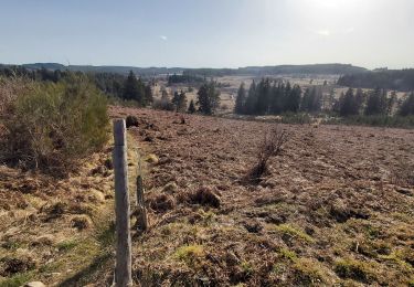
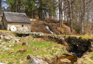
Du site des Cars à la tourbière du Longeyroux - Saint Merd les Oussines - Pays de Haute Corrèze. Au programme de la balade, seux sites emblématiques du Plateau de Millevaches ; les vestiges des Cars, éléments d’un vaste domaine agricole gallo-romain, et la Tourbière du Longeyroux. Un sentier d’interprétation au départ du parking vous permettra d’en faire le tour. Autre élément de patrimoine, le moulin sectionnal des Maisons a été restauré de manière remarquable par la commune. Téléchargez la fiche du circuit sur le site du Conseil Général de la Corrèze. Renseignements : Office de Tourisme de Burgeat 05.55.95.18.68

Elevation profile

Photos

Positioning

Country:
France
Region :
New Aquitaine
Department/Province :
Corrèze
Municipality :
Saint-Merd-les-Oussines
Location:
Unknown
Start:(UTM)
425165 ; 5053692 (31T) N.

Trails nearby

Trail Walking Saint-Merd-les-Oussines - Du site des Cars à la tourbière du Longeyroux - Saint Merd les Oussines - Pays de Haute Corrèze - Photo
Walking
tracegps

Walking

Medium
(1)
Saint-Merd-les-Oussines, New Aquitaine, Corrèze, France
16.1 km | 21 km-effort
4h 30min
Yes
Trail Walking Saint-Merd-les-Oussines - Le sentier des bruyères - Photo
Walking
Indi34

Walking

Medium
(1)
Saint-Merd-les-Oussines, New Aquitaine, Corrèze, France
8 km | 9.6 km-effort
2h 0min
Yes
Trail Walking Saint-Merd-les-Oussines - Autour de la Tourbière - Photo
Walking
Jethro Gene

Walking

Easy
(2)
Saint-Merd-les-Oussines, New Aquitaine, Corrèze, France
7.7 km | 9.4 km-effort
1h 38min
Yes
Trail Walking Pérols-sur-Vézère - Varieras_Razel - Photo
Walking
viam19

Walking

Very easy
Pérols-sur-Vézère, New Aquitaine, Corrèze, France
13.8 km | 17.9 km-effort
4h 58min
Yes
Trail sport Saint-Merd-les-Oussines - F 2024?Longeyroux Lac Oussines - Photo
sport
hl44lv

sport

Very easy
Saint-Merd-les-Oussines, New Aquitaine, Corrèze, France
19.1 km | 24 km-effort
Unknown
Yes
Trail sport Saint-Merd-les-Oussines - Longeyroux Les Oussines - Photo
sport
hl44lv

sport

Very easy
Saint-Merd-les-Oussines, New Aquitaine, Corrèze, France
19.3 km | 24 km-effort
Unknown
Yes
Trail Walking Chavanac - chavanac_les Oussines - Photo
Walking
viam19

Walking

Easy
Chavanac, New Aquitaine, Corrèze, France
11 km | 14.1 km-effort
3h 56min
No
Trail On foot Millevaches - Sentier du puy des Pouges - Photo
On foot
GUIDE+

On foot

Easy
Millevaches, New Aquitaine, Corrèze, France
5 km | 6.1 km-effort
1h 23min
No
Trail Walking Saint-Merd-les-Oussines - Correze Mille Vache Longeyroux - Photo
Walking
hl44lv

Walking

Very easy
(1)
Saint-Merd-les-Oussines, New Aquitaine, Corrèze, France
8 km | 9.9 km-effort
2h 36min
Yes


Close
My subscriptions