![](/images/other/stat-length.png)
![Trail Cycle Vendôme - La plaine de Marcilly en Beauce - Vendôme - Photo](https://media.geolcdn.com/t/1900/400/ext.pjpeg?maxdim=2&url=https%3A%2F%2Fservices.sitytrail.com%2FGeolivesWS%2FDownloadMedia.ashx%3FTrailID%3D112171%26Media%3D9998_6.jpg)
La plaine de Marcilly en Beauce - Vendôme
tracegps
User
![Length](/images/other/stat-length.png)
Length
24 km
![Max alt](https://static1.geolcdn.com/siteimages/upload/files/1508320355ic_sort_altitude_max_24dp.png)
Max alt
140 m
![Uphill gradient](https://static1.geolcdn.com/siteimages/upload/files/1508320355ic_sort_den_pos_24dp.png)
Uphill gradient
242 m
![Km-Effort](/images/other/stat-length.png)
Km-Effort
27 km
![Min alt](https://static1.geolcdn.com/siteimages/upload/files/1508320355ic_sort_altitude_min_24dp.png)
Min alt
75 m
![Downhill gradient](https://static1.geolcdn.com/siteimages/upload/files/1508320355ic_sort_den_neg_24dp.png)
Downhill gradient
242 m
![Boucle](https://static1.geolcdn.com/siteimages/upload/files/16400158638029165_repeat_loop_refresh_sync_direction_icon.png)
Boucle
Yes
Creation date :
2014-12-10 00:00:00.0
Updated on :
2014-12-10 00:00:00.0
![Cycle](https://static1.geolcdn.com/sitytour/trail-icons/200.png)
1h15
Difficulty : Easy
![Scan this QR Code to open this trail in the SityTrail application](https://capi.geolives.com/qq0zvz2zws4bq2lad0pu/sitytour/trails/112171/qr.png?size=200)
FREE GPS app for hiking
About
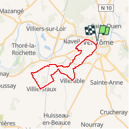
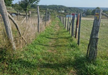
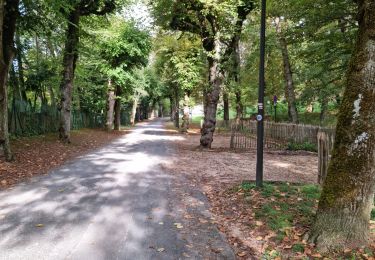
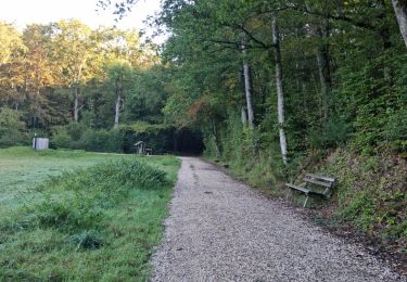
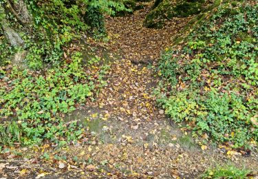
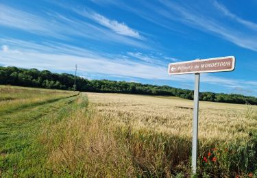
Trail Cycle of 24 km to be discovered at Centre-Loire Valley, Loir-et-Cher, Vendôme. This trail is proposed by tracegps.
Description
Circuit proposé par la Communauté du Pays de Vendôme. Départ de l’Office de Tourisme de Vendôme , 47 Rue Poterie. Retrouvez le descriptif et le plan du circuit sur le site de la Communauté du Pays de Vendôme.
Positioning
Country:
France
Region :
Centre-Loire Valley
Department/Province :
Loir-et-Cher
Municipality :
Vendôme
Location:
Unknown
Start:(Dec)
Start:(UTM)
355069 ; 5295218 (31T) N.
Comments
Trails nearby
![Trail Walking Vendôme - Voie de Tours - Poiriers - Vendôme - Prunay Cassereau - Photo](https://media.geolcdn.com/t/375/260/e1f85ff8-5dc9-4860-aac3-2c0f20ccd4d1.jpg&format=jpg&maxdim=2)
![Walking Walking](https://static1.geolcdn.com/sitytour/trail-icons/101.png)
Voie de Tours - Poiriers - Vendôme - Prunay Cassereau
Walking
Easy
Vendôme,
Centre-Loire Valley,
Loir-et-Cher,
France
![](/images/other/stat-length.png)
25 km | 28 km-effort
4h 30min
![](https://static1.geolcdn.com/siteimages/upload/files/16400158638029165_repeat_loop_refresh_sync_direction_icon.png)
No
![Trail Walking Sainte-Anne - Sainte-Anne - Photo](https://media.geolcdn.com/t/375/260/24b1063f-e6f0-46cc-a8b8-437f2017162e.jpg&format=jpg&maxdim=2)
![Walking Walking](https://static1.geolcdn.com/sitytour/trail-icons/101.png)
Sainte-Anne
Walking
Medium
Sainte-Anne,
Centre-Loire Valley,
Loir-et-Cher,
France
![](/images/other/stat-length.png)
7.4 km | 8.3 km-effort
1h 52min
![](https://static1.geolcdn.com/siteimages/upload/files/16400158638029165_repeat_loop_refresh_sync_direction_icon.png)
Yes
![Trail Walking Marcilly-en-Beauce - Varennes - Photo](https://media.geolcdn.com/t/375/260/e5fe1065-d10c-4b43-96c8-69a926a5b2c1.jpg&format=jpg&maxdim=2)
![Walking Walking](https://static1.geolcdn.com/sitytour/trail-icons/101.png)
Varennes
Walking
Easy
Marcilly-en-Beauce,
Centre-Loire Valley,
Loir-et-Cher,
France
![](/images/other/stat-length.png)
7.9 km | 9.1 km-effort
2h 3min
![](https://static1.geolcdn.com/siteimages/upload/files/16400158638029165_repeat_loop_refresh_sync_direction_icon.png)
Yes
![Trail Walking Naveil - Naveil - Photo](https://media.geolcdn.com/t/375/260/37d67a4f-f628-4e03-8093-029fa7b56966.jpg&format=jpg&maxdim=2)
![Walking Walking](https://static1.geolcdn.com/sitytour/trail-icons/101.png)
Naveil
Walking
Easy
Naveil,
Centre-Loire Valley,
Loir-et-Cher,
France
![](/images/other/stat-length.png)
9.8 km | 11.3 km-effort
2h 33min
![](https://static1.geolcdn.com/siteimages/upload/files/16400158638029165_repeat_loop_refresh_sync_direction_icon.png)
Yes
![Trail Walking Vendôme - Vendôme - Villiers-sur-Loir - Photo](https://media.geolcdn.com/t/375/260/e66027b3-088b-4b5f-b5f5-ac0b8671fb02.jpg&format=jpg&maxdim=2)
![Walking Walking](https://static1.geolcdn.com/sitytour/trail-icons/101.png)
Vendôme - Villiers-sur-Loir
Walking
Medium
Vendôme,
Centre-Loire Valley,
Loir-et-Cher,
France
![](/images/other/stat-length.png)
13.2 km | 15.6 km-effort
3h 32min
![](https://static1.geolcdn.com/siteimages/upload/files/16400158638029165_repeat_loop_refresh_sync_direction_icon.png)
Yes
![Trail Walking Vendôme - Vendôme Sud - Photo](https://media.geolcdn.com/t/375/260/824e66f3-05ad-4135-a662-4e0a98e9afaa.jpg&format=jpg&maxdim=2)
![Walking Walking](https://static1.geolcdn.com/sitytour/trail-icons/101.png)
Vendôme Sud
Walking
Easy
Vendôme,
Centre-Loire Valley,
Loir-et-Cher,
France
![](/images/other/stat-length.png)
5.1 km | 6 km-effort
1h 21min
![](https://static1.geolcdn.com/siteimages/upload/files/16400158638029165_repeat_loop_refresh_sync_direction_icon.png)
Yes
![Trail Walking Vendôme - Vendôme Nord - Photo](https://media.geolcdn.com/t/375/260/8467046a-0d6b-4c3c-968e-b82cf7fdf11f.jpg&format=jpg&maxdim=2)
![Walking Walking](https://static1.geolcdn.com/sitytour/trail-icons/101.png)
Vendôme Nord
Walking
Medium
Vendôme,
Centre-Loire Valley,
Loir-et-Cher,
France
![](/images/other/stat-length.png)
9.6 km | 11.5 km-effort
2h 37min
![](https://static1.geolcdn.com/siteimages/upload/files/16400158638029165_repeat_loop_refresh_sync_direction_icon.png)
Yes
![Trail Walking Vendôme - Petit parcours dans la partie Sud-est du Bois de l'Oratoire - Photo](https://media.geolcdn.com/t/375/260/d2231777-d069-4086-bb9e-9c65df795eb8.jpg&format=jpg&maxdim=2)
![Walking Walking](https://static1.geolcdn.com/sitytour/trail-icons/101.png)
Petit parcours dans la partie Sud-est du Bois de l'Oratoire
Walking
Easy
Vendôme,
Centre-Loire Valley,
Loir-et-Cher,
France
![](/images/other/stat-length.png)
4.2 km | 5 km-effort
1h 13min
![](https://static1.geolcdn.com/siteimages/upload/files/16400158638029165_repeat_loop_refresh_sync_direction_icon.png)
Yes
![Trail Walking Naveil - Circuit au lieu-dit Bordebeure Marcilly-en-Beauce - Photo](https://media.geolcdn.com/t/375/260/6cc52240-c522-4ad6-a3c9-9972a995f3df.jpg&format=jpg&maxdim=2)
![Walking Walking](https://static1.geolcdn.com/sitytour/trail-icons/101.png)
Circuit au lieu-dit Bordebeure Marcilly-en-Beauce
Walking
Medium
Naveil,
Centre-Loire Valley,
Loir-et-Cher,
France
![](/images/other/stat-length.png)
5.3 km | 6.5 km-effort
1h 30min
![](https://static1.geolcdn.com/siteimages/upload/files/16400158638029165_repeat_loop_refresh_sync_direction_icon.png)
Yes