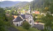
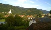
Trail Walking Oderen - Flânerie à Oderen - Photo

Flânerie à Oderen

 tracegps
tracegps

User

© OpenStreetMap contributors
Length
Length
8.9 km
Max alt
Max alt
632 m
Uphill gradient
Uphill gradient
274 m
Km-Effort
Km-Effort  
12.6 km
Min alt
Min alt
452 m
Downhill gradient
Downhill gradient
276 m
Boucle
Boucle
Yes
Creation date :
2014-12-10 00:00:00.0
Updated on :
2014-12-10 00:00:00.0

(0 Reviews)

Walking
Walking
2h30
Difficulty : Medium

Scan this QR Code to open this trail in the SityTrail application

FREE GPS app for hiking

Logo SityTrail SityTrail
IGN / Geographical institutes

Download SityTrail from the App Store Download SityTrail from Google Play

Logo SityTrail SityTrail World

The world is yours!

Download SityTrail from the App Store Download SityTrail from Google Play Download SityTrail on Huawei AppGallery

About

Trail Walking of 8.9 km to be discovered at Grand Est, Haut-Rhin, Oderen. This trail is proposed by tracegps.

Description

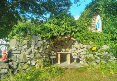
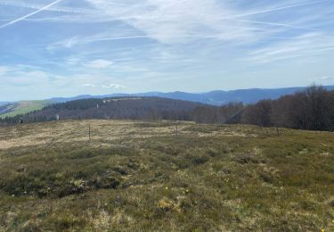
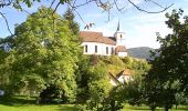
La commune d’Oderen est située au cœur du Parc Naturel Régional des Ballons des Vosges, dans un environnement naturel et paysager remarquable. L’altitude de la commune passe ainsi de 445 m à son point le plus bas à 1280 m à son point culminant, le "Breitfirst", situé non loin et en contre-haut de la route des crêtes. Ancien centre administratif de la vallée supérieure de la Thur, Oderen est une commune de moyenne montagne qui allie nature et modernité, avec près de 2000 hectares de ban communal dont la moitié de forêt, longtemps «richesse» de la Commune. L’église, dédiée à Saint-Nicolas, domine le village sur un îlot rocheux. Incendiée en 1376, elle a été plusieurs fois détruite et reconstruite. La tour renferme des restes d’une custode gothique. A l’entrée du village, une chapelle dédiée à Notre Dame du Bon Secours et dont l’origine remonte au XVII° siècle, est taillée dans le roc du « Maerelberg ». Cette chapelle dite « Maria Hilf » est très renommée pour ses pèlerinages. Avec Fellering, Oderen se partage l’un des sites les plus prisés d’Europe pour la pratique du vol libre. Le Markstein, station «été – hiver», offre aux touristes la possibilité de pratiquer la randonnée, le VTT, le cheval, le ski nordique et alpin, la luge et la raquette de neige ainsi que le Kite surf. Au Markstein, vous aurez également la possibilité de découvrir la fleur d’arnica. Oderen a aussi la chance d’avoir encore une dizaine d’agriculteurs de montagne. Leurs travaux d’entretien permettent le maintien des espaces ouverts dans le cadre des aménagements paysagers. La partie du ban communal située sur les crêtes vosgiennes permet également de profiter de fermes-auberges. Départ : Mairie d’Oderen (parking rue de Durrenbach).

Elevation profile

Photos

Points of interest

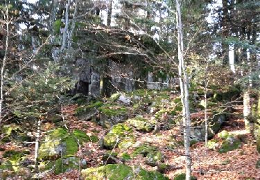
Point of interest Oderen - -Banc - Photo
tracegps
ODEREN 
Point of interest Oderen - Banc - Photo
tracegps
ODEREN 
Point of interest Oderen - Banc- - Photo
tracegps
ODEREN 
Point of interest Oderen - Banc-- - Photo
tracegps
ODEREN 
Point of interest Oderen - Banc. - Photo
tracegps
ODEREN 
Point of interest Oderen - Banc... - Photo
tracegps
ODEREN 
Point of interest Oderen - Banc.... - Photo
tracegps
ODEREN 
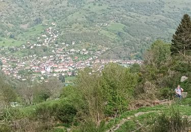
Point of interest Oderen - calvaire - Point de vue - Photo
tracegps
Point of interest Oderen - Chapelle - Photo
tracegps
ODEREN 
Point of interest Oderen - Départ - Arrivée - Photo
tracegps

Positioning

Country:
France
Region :
Grand Est
Department/Province :
Haut-Rhin
Municipality :
Oderen
Location:
Unknown
Start:(UTM)
348732 ; 5308316 (32T) N.

Trails nearby

Trail Walking Fellering - Felsach _chapelle ST Nicolas_frenz - Photo
Walking
Le grand Claude

Walking

Difficult
(3)
Fellering, Grand Est, Haut-Rhin, France
9.6 km | 16.5 km-effort
3h 45min
Yes
Trail Walking Oderen - 6146369-Chapelle St Nicolas 2 - Photo
Walking

Walking

Medium
(1)
Oderen, Grand Est, Haut-Rhin, France
10.9 km | 17.9 km-effort
3h 41min
Yes
Trail Walking Kruth - barrage de Wildenstein et Grand Ventron - Photo
Walking
egodard

Walking

Medium
(1)
Kruth, Grand Est, Haut-Rhin, France
13.7 km | 24 km-effort
4h 40min
Yes
Trail Mountain bike Metzeral - Breitfirst - Petit Ballon - Col de Firstplan - Wintzenheim - Photo
Mountain bike
sit68000

Mountain bike

Medium
(1)
Metzeral, Grand Est, Haut-Rhin, France
38 km | 52 km-effort
3h 11min
No
Trail Walking Oderen - TREK ALSACIEN (boucle, la meute) - Photo
Walking
Godasses et Grosses Pattes

Walking

Difficult
Oderen, Grand Est, Haut-Rhin, France
14.3 km | 23 km-effort
4h 30min
Yes
Trail Walking Oderen - Oderen Bergenbach Langenbach - Photo
Walking
geishouse

Walking

Medium
Oderen, Grand Est, Haut-Rhin, France
7.1 km | 11.6 km-effort
3h 40min
No
Trail Walking Oderen - TREK ALSACIEN (1ère étape) - Photo
Walking
Godasses et Grosses Pattes

Walking

Medium
Oderen, Grand Est, Haut-Rhin, France
9.2 km | 18.1 km-effort
4h 0min
No
Trail Walking Metzeral - 24 04 14 autour d’Uffrain - Photo
Walking
jmbilger

Walking

Metzeral, Grand Est, Haut-Rhin, France
70 km | 83 km-effort
3h 45min
No
Trail Walking Ventron - Rando des Marcheurs..22/02/2024... - Photo
Walking
boubou68

Walking

Very difficult
Ventron, Grand Est, Vosges, France
19.5 km | 31 km-effort
5h 4min
Yes


Close
My subscriptions