Trail Walking Unknown - Mauritanie jour 4 - Photo

Mauritanie jour 4

 chrisgps
chrisgps

User

© OpenStreetMap contributors
Length
Length
18.5 km
Max alt
Max alt
707 m
Uphill gradient
Uphill gradient
117 m
Km-Effort
Km-Effort  
21 km
Min alt
Min alt
386 m
Downhill gradient
Downhill gradient
359 m
Boucle
Boucle
No
Creation date :
2019-05-08 15:15:59.71
Updated on :
2019-05-08 15:15:59.819

(0 Reviews)

Walking
Walking
9h04
Difficulty : Medium

Scan this QR Code to open this trail in the SityTrail application

FREE GPS app for hiking

Logo SityTrail SityTrail

IGN / Geographical institutes

Download SityTrail from the App Store Download SityTrail from Google Play

Logo SityTrail SityTrail World

The world is yours!

Download SityTrail from the App Store Download SityTrail from Google Play Download SityTrail on Huawei AppGallery

About

Trail Walking of 18.5 km to be discovered at Adrar. This trail is proposed by chrisgps.

Description

DKHALI-LEMEIZIN - OASIS DE FARES

Elevation profile

Positioning

Country:
Mauritania
Region :
Adrar
Department/Province :
Unknown
Municipality :
Unknown
Location:
Unknown
Start:(UTM)
731070 ; 2251259 (28Q) N.

Trails nearby

Trail Walking  - Mauritanie jour 3 - Photo
Walking
chrisgps

Walking

Medium
, Adrar, , Mauritania
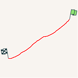
17.5 km | 23 km-effort
9h 41min
No
Trail Walking  - Mauritanie jour 5 - Photo
Walking
chrisgps

Walking

Medium
, Adrar, , Mauritania
15.2 km | 17.4 km-effort
10h 36min
No


Close
My subscriptions