![](/images/other/stat-length.png)
![Trail Walking Belforêt-en-Perche - Chêne séculaire - Bellême - Photo](https://media.geolcdn.com/t/1900/400/ext.pjpeg?maxdim=2&url=https%3A%2F%2Fservices.sitytrail.com%2FGeolivesWS%2FDownloadMedia.ashx%3FTrailID%3D111658%26Media%3D7896_2.jpg)
Chêne séculaire - Bellême
tracegps
User
![Length](/images/other/stat-length.png)
Length
9.3 km
![Max alt](https://static1.geolcdn.com/siteimages/upload/files/1508320355ic_sort_altitude_max_24dp.png)
Max alt
256 m
![Uphill gradient](https://static1.geolcdn.com/siteimages/upload/files/1508320355ic_sort_den_pos_24dp.png)
Uphill gradient
183 m
![Km-Effort](/images/other/stat-length.png)
Km-Effort
11.8 km
![Min alt](https://static1.geolcdn.com/siteimages/upload/files/1508320355ic_sort_altitude_min_24dp.png)
Min alt
164 m
![Downhill gradient](https://static1.geolcdn.com/siteimages/upload/files/1508320355ic_sort_den_neg_24dp.png)
Downhill gradient
196 m
![Boucle](https://static1.geolcdn.com/siteimages/upload/files/16400158638029165_repeat_loop_refresh_sync_direction_icon.png)
Boucle
Yes
Creation date :
2014-12-10 00:00:00.0
Updated on :
2014-12-10 00:00:00.0
![Walking](https://static1.geolcdn.com/sitytour/trail-icons/101.png)
3h30
Difficulty : Medium
![Scan this QR Code to open this trail in the SityTrail application](https://capi.geolives.com/qq0zvz2zws4bq2lad0pu/sitytour/trails/111658/qr.png?size=200)
FREE GPS app for hiking
About
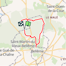
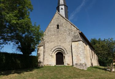
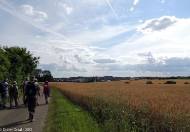
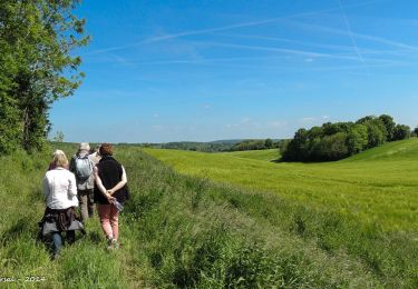
Trail Walking of 9.3 km to be discovered at Normandy, Orne, Belforêt-en-Perche. This trail is proposed by tracegps.
Description
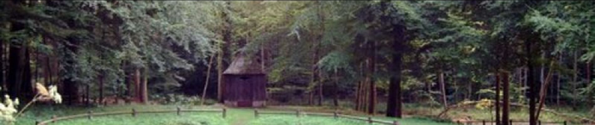
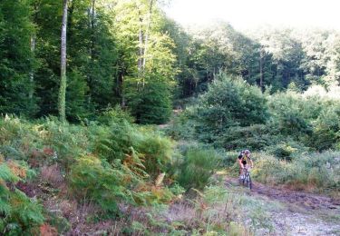
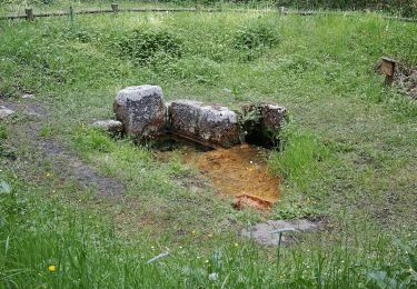
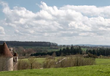
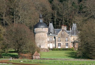
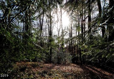
Chêne séculaire – Bellême Découvrez un pittoresque parcours forestier, agrémenté par l'étang de la Herse et sa fontaine miraculeuse. Retrouvez les Coup de Cœur Randonnée dans l’Orne en Normandie.
Positioning
Country:
France
Region :
Normandy
Department/Province :
Orne
Municipality :
Belforêt-en-Perche
Location:
Eperrais
Start:(Dec)
Start:(UTM)
318331 ; 5363052 (31U) N.
Comments
Trails nearby
![Trail Mountain bike Bellême - La Bell'Rando 2005 - Photo](https://media.geolcdn.com/t/375/260/ext.jpg?maxdim=2&url=https%3A%2F%2Fservices.sitytrail.com%2FGeolivesWS%2FDownloadMedia.ashx%3FTrailID%3D101083%26Media%3D573_2.jpg)
![Mountain bike Mountain bike](https://static1.geolcdn.com/sitytour/trail-icons/202.png)
La Bell'Rando 2005
Mountain bike
Very difficult
(1)
Bellême,
Normandy,
Orne,
France
![](/images/other/stat-length.png)
50 km | 64 km-effort
3h 15min
![](https://static1.geolcdn.com/siteimages/upload/files/16400158638029165_repeat_loop_refresh_sync_direction_icon.png)
Yes
![Trail Walking Bellême - de belleme a l'etang de la herse - Photo](https://media.geolcdn.com/t/375/260/cf5fb921-4c5a-49a3-9ce7-3714cc541daf.jpg&format=jpg&maxdim=2)
![Walking Walking](https://static1.geolcdn.com/sitytour/trail-icons/101.png)
de belleme a l'etang de la herse
Walking
Easy
Bellême,
Normandy,
Orne,
France
![](/images/other/stat-length.png)
11 km | 13.9 km-effort
3h 10min
![](https://static1.geolcdn.com/siteimages/upload/files/16400158638029165_repeat_loop_refresh_sync_direction_icon.png)
Yes
![Trail On foot Saint-Martin-du-Vieux-Bellême - Chêne séculaire - Photo](https://media.geolcdn.com/t/375/260/1e7dc81d-cfa6-49bd-86cc-f4a86c5edf07.jpeg&format=jpg&maxdim=2)
![On foot On foot](https://static1.geolcdn.com/sitytour/trail-icons/100.png)
Chêne séculaire
On foot
Easy
Saint-Martin-du-Vieux-Bellême,
Normandy,
Orne,
France
![](/images/other/stat-length.png)
9.2 km | 11.8 km-effort
2h 40min
![](https://static1.geolcdn.com/siteimages/upload/files/16400158638029165_repeat_loop_refresh_sync_direction_icon.png)
No
![Trail Electric bike Bellême - circuit des vallées bellemoises - Photo](https://media.geolcdn.com/t/375/260/8942d37a-44b6-4034-87b6-86b0b9a49d8c.jpg&format=jpg&maxdim=2)
![Electric bike Electric bike](https://static1.geolcdn.com/sitytour/trail-icons/205.png)
circuit des vallées bellemoises
Electric bike
Easy
Bellême,
Normandy,
Orne,
France
![](/images/other/stat-length.png)
44 km | 52 km-effort
4h 48min
![](https://static1.geolcdn.com/siteimages/upload/files/16400158638029165_repeat_loop_refresh_sync_direction_icon.png)
Yes
![Trail Walking Bellême - Bellême - Mortagne-au-Perche 23 km - Photo](https://media.geolcdn.com/t/375/260/648b0c04-c9f6-4954-a7eb-873b2f717454.jpg&format=jpg&maxdim=2)
![Walking Walking](https://static1.geolcdn.com/sitytour/trail-icons/101.png)
Bellême - Mortagne-au-Perche 23 km
Walking
Very difficult
Bellême,
Normandy,
Orne,
France
![](/images/other/stat-length.png)
23 km | 27 km-effort
6h 17min
![](https://static1.geolcdn.com/siteimages/upload/files/16400158638029165_repeat_loop_refresh_sync_direction_icon.png)
No
![Trail Walking Bellême - Bellême - Nocé/Courboyer 17 km - Photo](https://media.geolcdn.com/t/375/260/0a669ee2-665f-435c-8b9c-5b0346d2e0a4.jpg&format=jpg&maxdim=2)
![Walking Walking](https://static1.geolcdn.com/sitytour/trail-icons/101.png)
Bellême - Nocé/Courboyer 17 km
Walking
Easy
Bellême,
Normandy,
Orne,
France
![](/images/other/stat-length.png)
16.6 km | 20 km-effort
3h 24min
![](https://static1.geolcdn.com/siteimages/upload/files/16400158638029165_repeat_loop_refresh_sync_direction_icon.png)
No
![Trail Walking Bellême - Traversées Percheronnes Bellême - Gémages 15,4 Km - Photo](https://media.geolcdn.com/t/375/260/23f7282d-ffa3-4b2e-a94a-5dc4af001232.jpg&format=jpg&maxdim=2)
![Walking Walking](https://static1.geolcdn.com/sitytour/trail-icons/101.png)
Traversées Percheronnes Bellême - Gémages 15,4 Km
Walking
Medium
Bellême,
Normandy,
Orne,
France
![](/images/other/stat-length.png)
15.4 km | 17.6 km-effort
4h 2min
![](https://static1.geolcdn.com/siteimages/upload/files/16400158638029165_repeat_loop_refresh_sync_direction_icon.png)
No
![Trail Walking Bellême - Bellême - La Perrière 12 km - Photo](https://media.geolcdn.com/t/375/260/b423f935-0a19-479d-aaad-bc5a9bf55dc8.jpg&format=jpg&maxdim=2)
![Walking Walking](https://static1.geolcdn.com/sitytour/trail-icons/101.png)
Bellême - La Perrière 12 km
Walking
Medium
Bellême,
Normandy,
Orne,
France
![](/images/other/stat-length.png)
12.1 km | 15.4 km-effort
3h 20min
![](https://static1.geolcdn.com/siteimages/upload/files/16400158638029165_repeat_loop_refresh_sync_direction_icon.png)
No
![Trail Walking Bellême - Bellême - Mauves-sur-Huisne 14 km - Photo](https://media.geolcdn.com/t/375/260/bd52a7c3-ac84-428f-b134-e425824892a0.jpg&format=jpg&maxdim=2)
![Walking Walking](https://static1.geolcdn.com/sitytour/trail-icons/101.png)
Bellême - Mauves-sur-Huisne 14 km
Walking
Easy
Bellême,
Normandy,
Orne,
France
![](/images/other/stat-length.png)
13.8 km | 16.5 km-effort
5h 40min
![](https://static1.geolcdn.com/siteimages/upload/files/16400158638029165_repeat_loop_refresh_sync_direction_icon.png)
No
une balade bien sympathique
Ballade assez sympathique avec un étang très joli et de beaux passages en forêt.