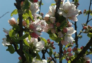
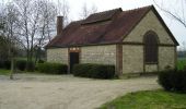
Trail Walking Davrey - Circuit de Davrey - Photo

Circuit de Davrey

 tracegps
tracegps

User

© OpenStreetMap contributors
Length
Length
16.4 km
Max alt
Max alt
167 m
Uphill gradient
Uphill gradient
105 m
Km-Effort
Km-Effort  
17.8 km
Min alt
Min alt
116 m
Downhill gradient
Downhill gradient
105 m
Boucle
Boucle
Yes
Creation date :
2014-12-10 00:00:00.0
Updated on :
2014-12-10 00:00:00.0

(0 Reviews)

Walking
Walking
4h10
Difficulty : Very difficult

Scan this QR Code to open this trail in the SityTrail application

FREE GPS app for hiking

Logo SityTrail SityTrail

IGN / Geographical institutes

Download SityTrail from the App Store Download SityTrail from Google Play

Logo SityTrail SityTrail World

The world is yours!

Download SityTrail from the App Store Download SityTrail from Google Play Download SityTrail on Huawei AppGallery

About

Trail Walking of 16.4 km to be discovered at Grand Est, Aube, Davrey. This trail is proposed by tracegps.

Description

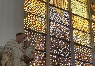
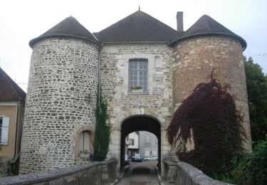
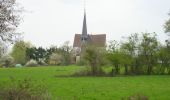
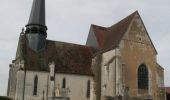
Circuit proposé par l’Office du Tourisme du Chaourçois en Pays d’Armance. Départ de la place de Davrey Le village de Davrey est située à 2km d’Evry-le-Châtel et s’étend avec ses trois hameaux entre une couronne de bois et deux rivières de plaine : l’Armance et le Landion, bordés de peupliers. L’église de l’Assomption des 12e, 16e, et 19e siècles présente de magnifiques vitraux du 16e, une statue de la Vierge à l’enfant et une belle croix de procession. Les deux lavoirs de Davrey, nommés lavoir de Davrey et lavoir de la Vacherie, restaurés à l’ancienne, furent bâtis en 1913. Ils disposent d’un plancher mobile pour s’adapter au niveau des crues et sont reliés par le chemin de la prairie, qui longe le Landion. Retrouvez ce circuit sur le site de l’Office du Tourisme.

Elevation profile

Photos

Positioning

Country:
France
Region :
Grand Est
Department/Province :
Aube
Municipality :
Davrey
Location:
Unknown
Start:(UTM)
570718 ; 5322408 (31U) N.

Trails nearby

Trail Walking Ervy-le-Châtel - ERVY LE CHATEL, au départ de la halle - Photo
Walking
jeannine grandjean

Walking

Medium
(1)
Ervy-le-Châtel, Grand Est, Aube, France
10.1 km | 11.4 km-effort
2h 35min
Yes
Trail Walking Saint-Phal - Pont aux Verriers 12.2km réel - Photo
Walking
rando-nico

Walking

Easy
(1)
Saint-Phal, Grand Est, Aube, France
12 km | 14.1 km-effort
3h 8min
Yes
Trail Walking Ervy-le-Châtel - Circuit des Chaumes Blanches - Ervy-le-Chatel - Photo
Walking
tracegps

Walking

Easy
Ervy-le-Châtel, Grand Est, Aube, France
6.3 km | 7.3 km-effort
1h 34min
Yes
Trail Walking Ervy-le-Châtel - Circuit du bois du Parc - Ervy-le-Chatel - Photo
Walking
tracegps

Walking

Medium
Ervy-le-Châtel, Grand Est, Aube, France
10.1 km | 11.5 km-effort
2h 30min
Yes
Trail Walking Ervy-le-Châtel - Circuit de l'Armance - Ervy-le-Chatel - Photo
Walking
tracegps

Walking

Easy
Ervy-le-Châtel, Grand Est, Aube, France
4.8 km | 5.7 km-effort
1h 15min
Yes
Trail Cycle Ervy-le-Châtel - Pays d'Armance : à la découverte d'un village perché  - Ervy le Châtel - Photo
Cycle
tracegps

Cycle

Difficult
Ervy-le-Châtel, Grand Est, Aube, France
75 km | 86 km-effort
4h 0min
Yes
Trail Walking Davrey - davrey - Photo
Walking
bougnaou

Walking

Medium
Davrey, Grand Est, Aube, France
17.3 km | 18.8 km-effort
6h 0min
Yes
Trail Walking Davrey - Davrey balisage 22 juillet 24 - Photo
Walking
bougnaou

Walking

Medium
Davrey, Grand Est, Aube, France
17.1 km | 18.5 km-effort
7h 13min
Yes
Trail Walking Ervy-le-Châtel - ervy nocturne 23 - Photo
Walking
bougnaou

Walking

Easy
Ervy-le-Châtel, Grand Est, Aube, France
11.5 km | 12.9 km-effort
2h 45min
Yes


Close
My subscriptions