Trail Walking Beaucens - Hautacam - Soum de Maucasau  - Photo

Hautacam - Soum de Maucasau

 tracegps
tracegps

User

© OpenStreetMap contributors
Length
Length
13.3 km
Max alt
Max alt
1739 m
Uphill gradient
Uphill gradient
558 m
Km-Effort
Km-Effort  
21 km
Min alt
Min alt
1512 m
Downhill gradient
Downhill gradient
557 m
Boucle
Boucle
Yes
Creation date :
2014-12-10 00:00:00.0
Updated on :
2014-12-10 00:00:00.0

(1 Reviews)

Walking
Walking
4h00
Difficulty : Medium

Scan this QR Code to open this trail in the SityTrail application

FREE GPS app for hiking

Logo SityTrail SityTrail

IGN / Geographical institutes

Download SityTrail from the App Store Download SityTrail from Google Play

Logo SityTrail SityTrail World

The world is yours!

Download SityTrail from the App Store Download SityTrail from Google Play Download SityTrail on Huawei AppGallery

About

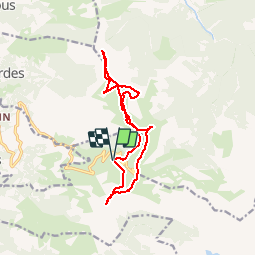
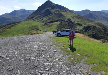
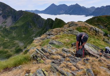
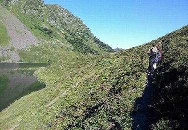
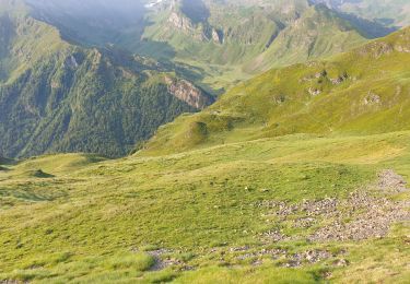
Trail Walking of 13.3 km to be discovered at Occitania, Hautespyrenees, Beaucens. This trail is proposed by tracegps.

Description

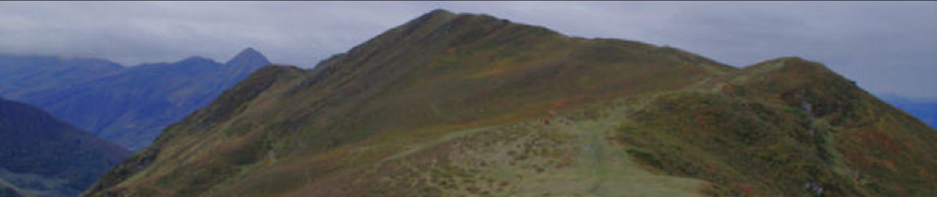
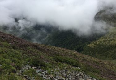
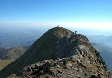
Une randonnée en boucle à partir du parking inférieur de la sation du Hautacam pour monter au Hautacam et rejoindre le Soum de Maucasau par la crête.

Elevation profile

Photos

Positioning

Country:
France
Region :
Occitania
Department/Province :
Hautespyrenees
Municipality :
Beaucens
Location:
Unknown
Start:(UTM)
743725 ; 4762401 (30T) N.

Comments

Please log in to post a review or rate the element


Trails nearby

Trail Walking Beaucens - Lac d'Ourrec depuis Hautacam - Photo
Walking
611686735

Walking

Easy
(1)
Beaucens, Occitania, Hautespyrenees, France
13 km | 20 km-effort
4h 15min
Yes
Trail Walking Gazost - Pic de Montaigu par le Col de Moulata - Photo
Walking
tracegps

Walking

Very difficult
(1)
Gazost, Occitania, Hautespyrenees, France
7 km | 14.8 km-effort
3h 0min
No
Trail Walking Beaucens - HAUTACAM lac dets plagnous
Walking
GUIDE
marmotte65

Walking

Medium
Beaucens, Occitania, Hautespyrenees, France
7.8 km | 10.9 km-effort
2h 28min
Yes
Trail Walking Beaucens - 2019-07-31_15h54m36_20190731065058-08125-data - Photo
Walking
GUIDE
harydh

Walking

Difficult
Beaucens, Occitania, Hautespyrenees, France
10.1 km | 16.9 km-effort
3h 27min
Yes
Trail Walking Beaucens - soum de lascours aléas bis - Photo
Walking
GUIDE
harydh

Walking

Medium
Beaucens, Occitania, Hautespyrenees, France
18 km | 33 km-effort
5h 55min
Yes
Trail Walking Beaucens - Retour voiture 28 juin 2023 hautacam - Photo
Walking
GUIDE
harydh

Walking

Easy
Beaucens, Occitania, Hautespyrenees, France
3.9 km | 5.3 km-effort
1h 41min
No
Trail On foot Pierrefitte-Nestalas - Voie Verte des Gaves - Photo
On foot
GUIDE+

On foot

Medium
Pierrefitte-Nestalas, Occitania, Hautespyrenees, France
18.9 km | 21 km-effort
4h 44min
No
Trail Snowshoes Beaucens - Le Pic du Mont - Hautacam - Photo
Snowshoes
tracegps

Snowshoes

Medium
Beaucens, Occitania, Hautespyrenees, France
8.7 km | 15.6 km-effort
5h 10min
Yes
Trail Walking Beaucens - Le Pic de Montaigu par les crêtes - Beaucens  - Photo
Walking
tracegps

Walking

Difficult
Beaucens, Occitania, Hautespyrenees, France
14.4 km | 24 km-effort
6h 30min
Yes


Close
My subscriptions