Trail Walking Cussangy - Circuit des petits gués - Cussangy - Photo

Circuit des petits gués - Cussangy

 tracegps
tracegps

User

© OpenStreetMap contributors
Length
Length
5.1 km
Max alt
Max alt
221 m
Uphill gradient
Uphill gradient
49 m
Km-Effort
Km-Effort  
5.7 km
Min alt
Min alt
193 m
Downhill gradient
Downhill gradient
49 m
Boucle
Boucle
Yes
Creation date :
2014-12-10 00:00:00.0
Updated on :
2014-12-10 00:00:00.0

(0 Reviews)

Walking
Walking
1h15
Difficulty : Easy

Scan this QR Code to open this trail in the SityTrail application

FREE GPS app for hiking

Logo SityTrail SityTrail

IGN / Geographical institutes

Download SityTrail from the App Store Download SityTrail from Google Play

Logo SityTrail SityTrail World

The world is yours!

Download SityTrail from the App Store Download SityTrail from Google Play Download SityTrail on Huawei AppGallery

About

Trail Walking of 5.1 km to be discovered at Grand Est, Aube, Cussangy. This trail is proposed by tracegps.

Description

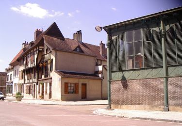
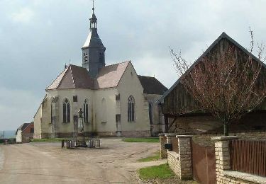
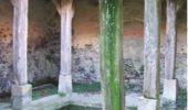
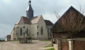
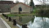
Circuit proposé par l’Office du Tourisme du Chaourçois en Pays d’Armance. Départ de la mairie de Cussangy, rue des Cannes. Un gué, dans le parler de Cussangy, ne désigne pas l’endroit où l’on traverse une rivière à pied mais un trou d’eau, une mare ; Cussangy en possédait encore 35 en 1865. Il faut bien reconnaître que ce village de 200 habitants est moins connu pour son origine gallo-romaine (Cussingéium) à la croisée de deux voies romaines, pour son élégante église peinte du XVIe siècle, pour sa belle forêt délimité par des bornes armoriées ou encore par ses 3 lavoirs avec impluvium et compluvium (dont 2 encore debouts) que par le curieux patronyme des ses habitants : les Cussangeois. Patronyme que le conseil municipal a décidé de maintenir en 1956 en ne jugeant « pas utile de procéder à un changement de nom, sous le futile prétexte de plaisanteries peu fines, changement qui ne manquerait pas d’ailleurs durant plusieurs années, d’attirer les quolibets des pays voisins ». Retrouvez ce circuit sur le site de l’Office du Tourisme.

Elevation profile

Photos

Positioning

Country:
France
Region :
Grand Est
Department/Province :
Aube
Municipality :
Cussangy
Location:
Unknown
Start:(UTM)
582277 ; 5318811 (31U) N.

Trails nearby

Trail Mountain bike Chaource - Circuit des Forêts - Chaource - Photo
Mountain bike
tracegps

Mountain bike

Easy
Chaource, Grand Est, Aube, France
22 km | 25 km-effort
1h 45min
Yes
Trail Walking Chaource - Circuit du Chaourçais - Chaource - Photo
Walking
tracegps

Walking

Very difficult
Chaource, Grand Est, Aube, France
18.5 km | 21 km-effort
4h 30min
Yes
Trail Walking Prusy - prusy  - Photo
Walking
richardetchantal

Walking

Very easy
Prusy, Grand Est, Aube, France
14.2 km | 16.6 km-effort
3h 38min
Yes
Trail Cycle Chaource - Au pays du fromage de Chaource - Photo
Cycle
tracegps

Cycle

Medium
Chaource, Grand Est, Aube, France
73 km | 86 km-effort
3h 0min
Yes
Trail Walking Prusy - prusy apres midi - Photo
Walking
richardetchantal

Walking

Easy
Prusy, Grand Est, Aube, France
8.1 km | 9.3 km-effort
1h 51min
Yes
Trail Mountain bike Chaource - Chaource. Circuit des Forêts - Photo
Mountain bike
papadoc

Mountain bike

Easy
Chaource, Grand Est, Aube, France
21 km | 24 km-effort
1h 24min
Yes
Trail Walking Cussangy - cussangy avril 24 - Photo
Walking
bougnaou

Walking

Medium
Cussangy, Grand Est, Aube, France
13.6 km | 15.6 km-effort
3h 11min
Yes
Trail Mountain bike Chaource - chaource pargues 2 - Photo
Mountain bike
joeljoseph

Mountain bike

Very difficult
Chaource, Grand Est, Aube, France
49 km | 57 km-effort
2h 37min
Yes
Trail Walking Chaource - chaource - Photo
Walking
bougnaou

Walking

Easy
Chaource, Grand Est, Aube, France
10 km | 11.4 km-effort
2h 20min
Yes


Close
My subscriptions