


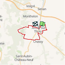

14.3 km | 17 km-effort

User


FREE GPS app for hiking
 SityTrail
IGN / Geographical institutes
SityTrail World
The world is yours!
Trail Walking of 18.9 km to be discovered at Bourgogne-Franche-Comté, Yonne, Montholon. This trail is proposed by tracegps.
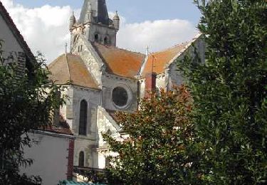
Circuit proposé par l’office du Tourisme d’Aillant-sur-Tholon . Départ de l’Office du Tourisme d’Aillant-sur-Tholon. Circuit de 20 km (dont 2,5 km sur petites routes goudronnées). Cet itinéraire emprunte partiellement les circuits la cour aux lièvres, les ferriers, et la croix de l’orme. Par prudence, évitez de pratiquer ce circuit les jours de chasse. Depuis le boulevard du Nord, prendre l’allée du Moulin Brûlé, puis le premier chemin à gauche. Franchissez le Tholon par le pont Girardot et, immédiatement après tournez à gauche. En haut du chemin, sur la droite empruntez le chemin du tacot. Une nouvelle fois, vous prenez le premier chemin à gauche jusqu’à la route de Villiers et là, encore un < droite – gauche > en direction de Montenot. (cela paraît compliqué, mais sur place c’est très simple). Traversez Montenot, puis au “stop” prenez à droite, puis le premier chemin à gauche (pour ne pas changer). Peu avant les bois, vous découvrirez une des dernières vignes d’Aillant. Tournez à gauche juste au coin après la vigne. Lorsque vous atteignez la route goudronnée, vous quittez le circuit “la cour aux lièvres” en tournant à droite. Suivez le chemin principal sur 2,6 Km dans le sous bois de la forêt aillantaise. Après le passage goudronné, le chemin est couvert de résidus ferreux provenant de l’industrie métallurgique qui, depuis la plus haute antiquité, puisait ses ressources dans le riche sous sol. L’exploitation des forges de la région dura jusqu’à la fin du XIXème siècle. On appelle “FERRIERS” les endroits où les exploitations stockaient les résidus ferreux. Tournez à gauche, et à 1 km vous découvrirez les étangs des “TROUS À TERRE”. Comme l’indique leur nom, ces deux étangs sont nés des trous créés par l’extraction d’argile qui alimentait les fabriques de tuiles et de briques situées à proximité. Retrouvez le circuit et son descriptif sur le site de l’office du Tourisme/A>. Ce circuit a été numérisé par les randonneurs du CODEPEM. Merci à Jean-Marie.


Walking
Walking
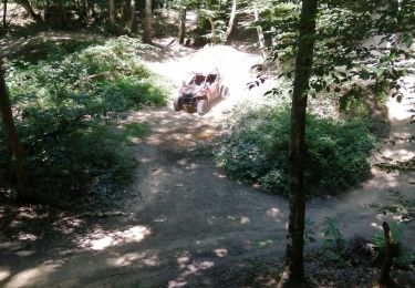
Quad
Walking

Other activity

Walking
Other activity
Walking

Electric bike