


7.8 km | 8.9 km-effort


User


FREE GPS app for hiking
 SityTrail
IGN / Geographical institutes
SityTrail World
The world is yours!
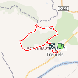
Trail Walking of 6.6 km to be discovered at New Aquitaine, Lot-et-Garonne, Trentels. This trail is proposed by tracegps.
Trentels Communauté de Communes Fumélois Lémance. Il faut monter pour mieux percevoir l’environnement accidenté des contreforts du Lot et chercher dans le paysage les richesses qui s’y cachent : bastides, pigeonniers, vergers, pechs boisés… Téléchargez la fiche de cette randonnée sur le site du Tourisme du Lot et Garonne.


Walking
Electric bike
Mountain bike
Walking
Walking
Walking

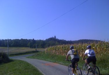
Bicycle tourism
Bien juste un peu trop de route