


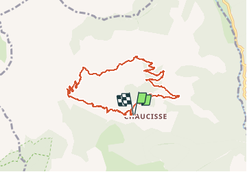

22 km | 37 km-effort


User


FREE GPS app for hiking
 SityTrail
IGN / Geographical institutes
SityTrail World
The world is yours!
Trail Snowshoes of 9.6 km to be discovered at Auvergne-Rhône-Alpes, Savoy, Saint-Nicolas-la-Chapelle. This trail is proposed by Jaceu.
randonnée raquettes non tracée
via Croix de stata et Croix Cartier

Walking

Walking

Snowshoes

Walking
Walking

Motor
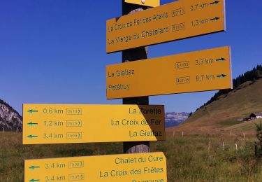
Walking
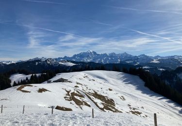
Snowshoes
Walking