![](/images/other/stat-length.png)
![Trail Walking Saint-Aubin-de-Scellon - Chemin des routoirs -- St-Aubin de Scellon - Photo](https://media.geolcdn.com/t/1900/400/ext.pjpeg?maxdim=2&url=https%3A%2F%2Fservices.sitytrail.com%2FGeolivesWS%2FDownloadMedia.ashx%3FTrailID%3D110434%26Media%3D5914_1.jpg)
Chemin des routoirs -- St-Aubin de Scellon
tracegps
User
![Length](/images/other/stat-length.png)
Length
8.7 km
![Max alt](https://static1.geolcdn.com/siteimages/upload/files/1508320355ic_sort_altitude_max_24dp.png)
Max alt
174 m
![Uphill gradient](https://static1.geolcdn.com/siteimages/upload/files/1508320355ic_sort_den_pos_24dp.png)
Uphill gradient
102 m
![Km-Effort](/images/other/stat-length.png)
Km-Effort
10 km
![Min alt](https://static1.geolcdn.com/siteimages/upload/files/1508320355ic_sort_altitude_min_24dp.png)
Min alt
118 m
![Downhill gradient](https://static1.geolcdn.com/siteimages/upload/files/1508320355ic_sort_den_neg_24dp.png)
Downhill gradient
103 m
![Boucle](https://static1.geolcdn.com/siteimages/upload/files/16400158638029165_repeat_loop_refresh_sync_direction_icon.png)
Boucle
Yes
Creation date :
2014-12-10 00:00:00.0
Updated on :
2014-12-10 00:00:00.0
![Walking](https://static1.geolcdn.com/sitytour/trail-icons/101.png)
2h15
Difficulty : Medium
![Scan this QR Code to open this trail in the SityTrail application](https://capi.geolives.com/qq0zvz2zws4bq2lad0pu/sitytour/trails/110434/qr.png?size=200)
FREE GPS app for hiking
About
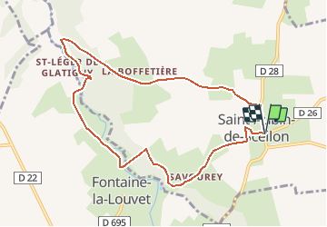
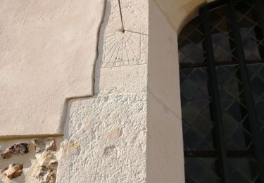
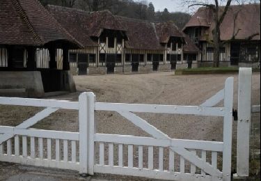
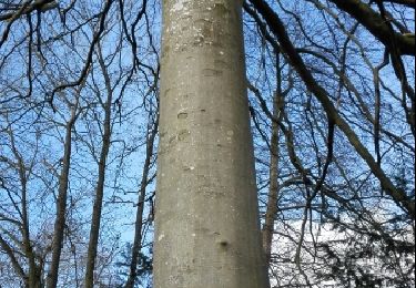
Trail Walking of 8.7 km to be discovered at Normandy, Eure, Saint-Aubin-de-Scellon. This trail is proposed by tracegps.
Description
Circuit proposé par la Communauté de Communes du canton de Thiberville . Départ de l’Eglise de St-Aubin-de-Scellon. Ce circuit a été numérisé par les randonneurs du CODEPEM. Merci à Jean-Marie.
Positioning
Country:
France
Region :
Normandy
Department/Province :
Eure
Municipality :
Saint-Aubin-de-Scellon
Location:
Unknown
Start:(Dec)
Start:(UTM)
315984 ; 5449595 (31U) N.
Comments
Trails nearby
![Trail Walking Barville - Barville - Photo](https://media.geolcdn.com/t/375/260/ext.jpg?maxdim=2&url=https%3A%2F%2Fservices.sitytrail.com%2FGeolivesWS%2FDownloadMedia.ashx%3FTrailID%3D749345%26Media%3Dfix__20170509104501.jpg)
![Walking Walking](https://static1.geolcdn.com/sitytour/trail-icons/101.png)
![Trail Walking Fontaine-la-Louvet - Circuit de la Calonne - Fontaine-la-Louvet - Photo](https://media.geolcdn.com/t/375/260/ext.jpg?maxdim=2&url=https%3A%2F%2Fservices.sitytrail.com%2FGeolivesWS%2FDownloadMedia.ashx%3FTrailID%3D110346%26Media%3D5794_6.jpg)
![Walking Walking](https://static1.geolcdn.com/sitytour/trail-icons/101.png)
Circuit de la Calonne - Fontaine-la-Louvet
Walking
Medium
Fontaine-la-Louvet,
Normandy,
Eure,
France
![](/images/other/stat-length.png)
8.2 km | 9.8 km-effort
2h 0min
![](https://static1.geolcdn.com/siteimages/upload/files/16400158638029165_repeat_loop_refresh_sync_direction_icon.png)
Yes
![Trail Cycle Fontaine-la-Louvet - Boucle du Haras de Piencourt - Fontaine la Louvet - Photo](https://media.geolcdn.com/t/375/260/ext.jpg?maxdim=2&url=https%3A%2F%2Fservices.sitytrail.com%2FGeolivesWS%2FDownloadMedia.ashx%3FTrailID%3D110259%26Media%3D5635_4.jpg)
![Cycle Cycle](https://static1.geolcdn.com/sitytour/trail-icons/200.png)
Boucle du Haras de Piencourt - Fontaine la Louvet
Cycle
Easy
Fontaine-la-Louvet,
Normandy,
Eure,
France
![](/images/other/stat-length.png)
15.3 km | 17.1 km-effort
1h 0min
![](https://static1.geolcdn.com/siteimages/upload/files/16400158638029165_repeat_loop_refresh_sync_direction_icon.png)
Yes
![Trail Walking Barville - Barville- 27 - Photo](https://media.geolcdn.com/t/375/260/3e81dea1-fca1-40f8-861f-0d0310257198.jpg&format=jpg&maxdim=2)
![Walking Walking](https://static1.geolcdn.com/sitytour/trail-icons/101.png)
![Trail Walking Bailleul-la-Vallée - Bailleul la Vallée : la randonnée qui monte - Photo](https://media.geolcdn.com/t/375/260/cd78e1c6-bdf2-43ab-bbb8-cce021baa17a.jpg&format=jpg&maxdim=2)
![Walking Walking](https://static1.geolcdn.com/sitytour/trail-icons/101.png)
Bailleul la Vallée : la randonnée qui monte
Walking
Difficult
Bailleul-la-Vallée,
Normandy,
Eure,
France
![](/images/other/stat-length.png)
11.1 km | 13.1 km-effort
2h 39min
![](https://static1.geolcdn.com/siteimages/upload/files/16400158638029165_repeat_loop_refresh_sync_direction_icon.png)
Yes
![Trail Walking Épreville-en-Lieuvin - Autour d Epreville en lieuvin - Photo](https://media.geolcdn.com/t/375/260/70d9128b-a2b6-4906-998a-9da60c3ce060.jpg&format=jpg&maxdim=2)
![Walking Walking](https://static1.geolcdn.com/sitytour/trail-icons/101.png)
Autour d Epreville en lieuvin
Walking
Very easy
Épreville-en-Lieuvin,
Normandy,
Eure,
France
![](/images/other/stat-length.png)
5.2 km | 5.5 km-effort
1h 9min
![](https://static1.geolcdn.com/siteimages/upload/files/16400158638029165_repeat_loop_refresh_sync_direction_icon.png)
Yes
![Trail Walking Bailleul-la-Vallée - bailleul la vallée raccourcie - Photo](https://media.geolcdn.com/t/375/260/ext.jpg?maxdim=2&url=https%3A%2F%2Fservices.sitytrail.com%2FGeolivesWS%2FDownloadMedia.ashx%3FTrailID%3D398795%26Media%3Dfix__20150322135206.jpg)
![Walking Walking](https://static1.geolcdn.com/sitytour/trail-icons/101.png)
bailleul la vallée raccourcie
Walking
Easy
Bailleul-la-Vallée,
Normandy,
Eure,
France
![](/images/other/stat-length.png)
7.7 km | 9.3 km-effort
1h 40min
![](https://static1.geolcdn.com/siteimages/upload/files/16400158638029165_repeat_loop_refresh_sync_direction_icon.png)
Yes
![Trail Walking Le Theil-Nolent - theil nolan version courte - Photo](https://media.geolcdn.com/t/375/260/ext.jpg?maxdim=2&url=https%3A%2F%2Fservices.sitytrail.com%2FGeolivesWS%2FDownloadMedia.ashx%3FTrailID%3D388858%26Media%3Dfix__20150222144312.jpg)
![Walking Walking](https://static1.geolcdn.com/sitytour/trail-icons/101.png)
theil nolan version courte
Walking
Easy
Le Theil-Nolent,
Normandy,
Eure,
France
![](/images/other/stat-length.png)
6.8 km | 7.2 km-effort
1h 29min
![](https://static1.geolcdn.com/siteimages/upload/files/16400158638029165_repeat_loop_refresh_sync_direction_icon.png)
Yes
![Trail Running Fresne-Cauverville - Chemin de la Forge Subtile - Fresne Cauverville - Photo](https://media.geolcdn.com/t/375/260/ext.jpg?maxdim=2&url=https%3A%2F%2Fservices.sitytrail.com%2FGeolivesWS%2FDownloadMedia.ashx%3FTrailID%3D129750%26Media%3D13288_1.jpg)
![Running Running](https://static1.geolcdn.com/sitytour/trail-icons/103.png)
Chemin de la Forge Subtile - Fresne Cauverville
Running
Medium
Fresne-Cauverville,
Normandy,
Eure,
France
![](/images/other/stat-length.png)
5.1 km | 5.9 km-effort
40min
![](https://static1.geolcdn.com/siteimages/upload/files/16400158638029165_repeat_loop_refresh_sync_direction_icon.png)
Yes
ok