![](/images/other/stat-length.png)
![Trail Mountain bike La Hague - De Urville Nacqueville à Ste Croix-Hague - Circuit n° 02 - Photo](https://media.geolcdn.com/t/1900/400/ext.pjpeg?maxdim=2&url=https%3A%2F%2Fservices.sitytrail.com%2FGeolivesWS%2FDownloadMedia.ashx%3FTrailID%3D110379%26Media%3D5836_1.jpg)
De Urville Nacqueville à Ste Croix-Hague - Circuit n° 02
tracegps
User
![Length](/images/other/stat-length.png)
![Max alt](https://static1.geolcdn.com/siteimages/upload/files/1508320355ic_sort_altitude_max_24dp.png)
![Uphill gradient](https://static1.geolcdn.com/siteimages/upload/files/1508320355ic_sort_den_pos_24dp.png)
![Km-Effort](/images/other/stat-length.png)
![Min alt](https://static1.geolcdn.com/siteimages/upload/files/1508320355ic_sort_altitude_min_24dp.png)
![Downhill gradient](https://static1.geolcdn.com/siteimages/upload/files/1508320355ic_sort_den_neg_24dp.png)
![Boucle](https://static1.geolcdn.com/siteimages/upload/files/16400158638029165_repeat_loop_refresh_sync_direction_icon.png)
![Mountain bike](https://static1.geolcdn.com/sitytour/trail-icons/202.png)
1h15
Difficulty : Medium
![Scan this QR Code to open this trail in the SityTrail application](https://capi.geolives.com/qq0zvz2zws4bq2lad0pu/sitytour/trails/110379/qr.png?size=200)
FREE GPS app for hiking
About
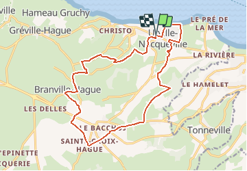
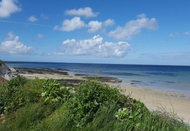
Trail Mountain bike of 17 km to be discovered at Normandy, Manche, La Hague. This trail is proposed by tracegps.
Description
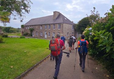
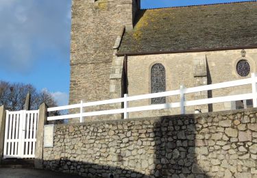
Départ de Bourg d’Urville, prendre à gauche après l’église. URVILLE NACQUEVILLE : Église d’Urville. L’église a été reconstruite en 1960 car l’ancienne a été détruite pendant la Seconde Guerre Mondiale. On peut lire au dessus du porche : « Ut omnes ununt sint, sicut tu Pater in me et ego in te » qui signifie « Que tous soient uns, comme toi, Père tu es en moi et moi en toi ». (Parole de l’Évangile de Jean). Hameau Nicolle. Hameau aux bâtisses massives, réalisées en poudingue d’Urville (conglomérat formé de cailloux et galets ronds, liés par un ciment naturel). BRANVILLE HAGUE : Maison de Branville. Cette demeure seigneuriale (surnommée « le château » par les Branvillais) possède un portail central, encadré par deux plus petits piétonniers, donne sur le parc qui subit les ravages de la tempête de 1987. Les ailes carrés aux extrémités de la demeure datent du XVIIème siècle mais le corps du logis est plus récent (rénové au XIXème siècle). L’ensemble comprend 2 tours rondes (dont une abrite à l’étage un colombier doté d’environ 200 trous), ainsi que deux bâtiments agricoles de part et d’autre du jardin, un mur d’enceinte et un puits. Les toitures du logis sont en schiste et comptent 5 souches de cheminées. La demeure fut habitée par les familles d’Ozouville, de Gigault et Vauquelin.
Positioning
Comments
Trails nearby
![Trail Cycle La Hague - La Haguarde Bitumeuse 2011 - Gréville Hague - Photo](https://media.geolcdn.com/t/375/260/ext.jpg?maxdim=2&url=https%3A%2F%2Fservices.sitytrail.com%2FGeolivesWS%2FDownloadMedia.ashx%3FTrailID%3D106083%26Media%3D10276_1.jpg)
![Cycle Cycle](https://static1.geolcdn.com/sitytour/trail-icons/200.png)
Cycle
![](/images/other/stat-length.png)
![](https://static1.geolcdn.com/siteimages/upload/files/16400158638029165_repeat_loop_refresh_sync_direction_icon.png)
![Trail On foot La Hague - Séjour Cotentin Etape 1 Hurville Nacqueville à Jobourg - Photo](https://media.geolcdn.com/t/375/260/325b52e2-ddc9-413a-80e9-916b8f145511.jpg&format=jpg&maxdim=2)
![On foot On foot](https://static1.geolcdn.com/sitytour/trail-icons/100.png)
On foot
![](/images/other/stat-length.png)
![](https://static1.geolcdn.com/siteimages/upload/files/16400158638029165_repeat_loop_refresh_sync_direction_icon.png)
![Trail Walking La Hague - landemer / goury - Photo](https://media.geolcdn.com/t/375/260/ext.jpg?maxdim=2&url=https%3A%2F%2Fstatic1.geolcdn.com%2Fsiteimages%2Fupload%2Ffiles%2F1553511878bg_sport_marche.png)
![Walking Walking](https://static1.geolcdn.com/sitytour/trail-icons/101.png)
Walking
![](/images/other/stat-length.png)
![](https://static1.geolcdn.com/siteimages/upload/files/16400158638029165_repeat_loop_refresh_sync_direction_icon.png)
![Trail Walking La Hague - Normandie étape 5 - Photo](https://media.geolcdn.com/t/375/260/ext.jpg?maxdim=2&url=https%3A%2F%2Fstatic1.geolcdn.com%2Fsiteimages%2Fupload%2Ffiles%2F1553511878bg_sport_marche.png)
![Walking Walking](https://static1.geolcdn.com/sitytour/trail-icons/101.png)
Walking
![](/images/other/stat-length.png)
![](https://static1.geolcdn.com/siteimages/upload/files/16400158638029165_repeat_loop_refresh_sync_direction_icon.png)
![Trail Walking La Hague - Tonneville - Photo](https://media.geolcdn.com/t/375/260/b7bbcc9e-4385-4231-9890-65fcbf7e84f7.jpg&format=jpg&maxdim=2)
![Walking Walking](https://static1.geolcdn.com/sitytour/trail-icons/101.png)
![Trail Walking Cherbourg-en-Cotentin - Querqueville - Photo](https://media.geolcdn.com/t/375/260/ext.jpg?maxdim=2&url=https%3A%2F%2Fservices.sitytrail.com%2FGeolivesWS%2FDownloadMedia.ashx%3FTrailID%3D756363%26Media%3Dfix__20170520160737.jpg)
![Walking Walking](https://static1.geolcdn.com/sitytour/trail-icons/101.png)
Walking
![](/images/other/stat-length.png)
![](https://static1.geolcdn.com/siteimages/upload/files/16400158638029165_repeat_loop_refresh_sync_direction_icon.png)
![Trail Running La Hague - Run and Bike Haguard 2013 - Sainte Croix Hague - Photo](https://media.geolcdn.com/t/375/260/ext.jpg?maxdim=2&url=https%3A%2F%2Fservices.sitytrail.com%2FGeolivesWS%2FDownloadMedia.ashx%3FTrailID%3D317144%26Media%3D16292_6.jpg)
![Running Running](https://static1.geolcdn.com/sitytour/trail-icons/103.png)
Running
![](/images/other/stat-length.png)
![](https://static1.geolcdn.com/siteimages/upload/files/16400158638029165_repeat_loop_refresh_sync_direction_icon.png)
![Trail Mountain bike La Hague - Run and Bike Haguard 2013 - Sainte Croix Hague - Photo](https://media.geolcdn.com/t/375/260/ext.jpg?maxdim=2&url=https%3A%2F%2Fservices.sitytrail.com%2FGeolivesWS%2FDownloadMedia.ashx%3FTrailID%3D317143%26Media%3D16292_6.jpg)
![Mountain bike Mountain bike](https://static1.geolcdn.com/sitytour/trail-icons/202.png)
Mountain bike
![](/images/other/stat-length.png)
![](https://static1.geolcdn.com/siteimages/upload/files/16400158638029165_repeat_loop_refresh_sync_direction_icon.png)
![Trail Mountain bike La Hague - Sentiers de la Hague 2013 - 35 km - Photo](https://media.geolcdn.com/t/375/260/ext.jpg?maxdim=2&url=https%3A%2F%2Fservices.sitytrail.com%2FGeolivesWS%2FDownloadMedia.ashx%3FTrailID%3D214871%26Media%3D15417_4.jpg)
![Mountain bike Mountain bike](https://static1.geolcdn.com/sitytour/trail-icons/202.png)
Mountain bike
![](/images/other/stat-length.png)
![](https://static1.geolcdn.com/siteimages/upload/files/16400158638029165_repeat_loop_refresh_sync_direction_icon.png)