Trail Mountain bike Villers-Outréaux - Circuit des vallées Cambrésiennes - Villers-Outreaux - Photo

Circuit des vallées Cambrésiennes - Villers-Outreaux

 tracegps
tracegps

User

© OpenStreetMap contributors
Length
Length
31 km
Max alt
Max alt
146 m
Uphill gradient
Uphill gradient
311 m
Km-Effort
Km-Effort  
35 km
Min alt
Min alt
77 m
Downhill gradient
Downhill gradient
312 m
Boucle
Boucle
Yes
Creation date :
2014-12-10 00:00:00.0
Updated on :
2014-12-10 00:00:00.0

(0 Reviews)

Mountain bike
Mountain bike
3h19
Difficulty : Medium

Scan this QR Code to open this trail in the SityTrail application

FREE GPS app for hiking

Logo SityTrail SityTrail

IGN / Geographical institutes

Download SityTrail from the App Store Download SityTrail from Google Play

Logo SityTrail SityTrail World

The world is yours!

Download SityTrail from the App Store Download SityTrail from Google Play Download SityTrail on Huawei AppGallery

About

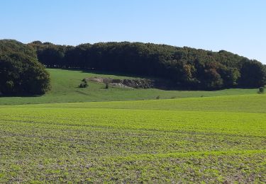
Trail Mountain bike of 31 km to be discovered at Hauts-de-France, Nord, Villers-Outréaux. This trail is proposed by tracegps.

Description

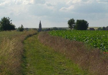
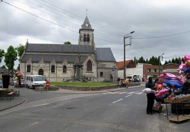
Circuit proposé par le Comité Départemental du Tourisme du Nord. Fiche n° 16 de la pochette «Les circuits VTT du Nord pour la famille et les sportifs». Départ de la place du Général de Gaulle, prés du kiosque à musique. Trois parcours de 13,5 à 29,5 km accessibles à tous. Entre Villers-Outréaux et le château d’Esnes, le circuit parcourt les fonds de vallée et le haut du plateau cambrésien. Le circuit long s’adresse à un public sportif. En période de pluie, le niveau de difficulté s’accroît sur les chemins boueux. Départ possible dans chaque ville ou village. Retrouvez ce circuit sur le site du Comité Départemental du Tourisme du Nord.

Elevation profile

Photos

Positioning

Country:
France
Region :
Hauts-de-France
Department/Province :
Nord
Municipality :
Villers-Outréaux
Location:
Unknown
Start:(UTM)
521428 ; 5542301 (31U) N.

Trails nearby

Trail Walking Le Catelet - Le berceau de l'Escaut - variante - Photo
Walking
tracegps

Walking

Medium
(1)
Le Catelet, Hauts-de-France, Aisne, France
18.9 km | 22 km-effort
4h 45min
Yes
Trail Walking Le Catelet - source de l escaut - Photo
Walking
terminio

Walking

Easy
Le Catelet, Hauts-de-France, Aisne, France
9.4 km | 10.6 km-effort
2h 53min
Yes
Trail Walking Gouy - Le berceau de l'Escaut - Photo
Walking

Walking

Very easy
Gouy, Hauts-de-France, Aisne, France
11.8 km | 13.5 km-effort
Unknown
Yes
Trail Walking Villers-Outréaux - Des Marliches au Moulin Brunet - Villers-Outréaux - Photo
Walking
tracegps

Walking

Difficult
Villers-Outréaux, Hauts-de-France, Nord, France
13.9 km | 15.7 km-effort
3h 30min
Yes
Trail Walking Villers-Outréaux - Villers Outreaux De Marliche au moulin de Brunet - Photo
Walking
mjh

Walking

Medium
Villers-Outréaux, Hauts-de-France, Nord, France
14.3 km | 16.2 km-effort
3h 42min
Yes
Trail Walking Walincourt-Selvigny - Autour de Walincourt - Selvigny - Photo
Walking
tracegps

Walking

Easy
(1)
Walincourt-Selvigny, Hauts-de-France, Nord, France
7 km | 7.9 km-effort
1h 45min
Yes
Trail Walking Gouy - Le berceau de l'Escaut - Photo
Walking
tracegps

Walking

Medium
(1)
Gouy, Hauts-de-France, Aisne, France
11.8 km | 13.5 km-effort
3h 15min
Yes
Trail On foot Beaurevoir - Autour de Beaurevoir - Photo
On foot
José800

On foot

Easy
Beaurevoir, Hauts-de-France, Aisne, France
10.6 km | 12 km-effort
2h 43min
Yes
Trail On foot Aubencheul-aux-Bois - rondo pierrot la lune - Photo
On foot
pitjet

On foot

Very easy
Aubencheul-aux-Bois, Hauts-de-France, Aisne, France
6 km | 6.7 km-effort
Unknown
Yes


Close
My subscriptions