


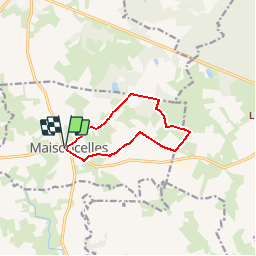

12.1 km | 14.1 km-effort

User


FREE GPS app for hiking
 SityTrail
IGN / Geographical institutes
SityTrail World
The world is yours!
Trail Walking of 8.5 km to be discovered at Pays de la Loire, Sarthe, Maisoncelles. This trail is proposed by tracegps.
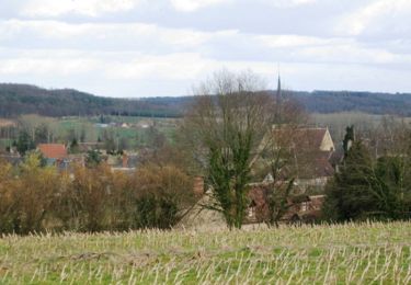
A la découverte des trésors cachés du Perche Sarthois Maisoncelles 8,5km Si vous croisez une abeille, observez la ; elle peut butiner jusqu’à 250 fleurs à l’heure soit environ 2000 fleurs en 8 heures ! A voir l’église Notre Dame avec un cadran solaire et son épure en façade sud.


Walking

Walking

Walking

Walking
Walking

Walking
Walking
Walking
Walking