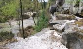
Trail Walking Saint-Sulpice-de-Favières - Les Pétales de Souzy - Photo
 tracegps
tracegps

User

© OpenStreetMap contributors
Length
Length
23 km
Max alt
Max alt
160 m
Uphill gradient
Uphill gradient
413 m
Km-Effort
Km-Effort  
29 km
Min alt
Min alt
67 m
Downhill gradient
Downhill gradient
412 m
Boucle
Boucle
Yes
Creation date :
2014-12-10 00:00:00.0
Updated on :
2014-12-10 00:00:00.0

(1 Reviews)

Walking
Walking
4h49
Difficulty : Difficult

Scan this QR Code to open this trail in the SityTrail application

FREE GPS app for hiking

Logo SityTrail SityTrail

IGN / Geographical institutes

Download SityTrail from the App Store Download SityTrail from Google Play

Logo SityTrail SityTrail World

The world is yours!

Download SityTrail from the App Store Download SityTrail from Google Play Download SityTrail on Huawei AppGallery

About

Trail Walking of 23 km to be discovered at Ile-de-France, Essonne, Saint-Sulpice-de-Favières. This trail is proposed by tracegps.

Description

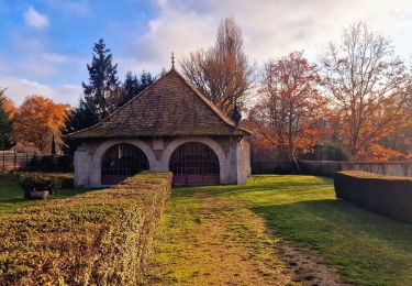
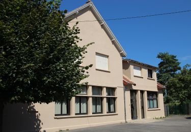
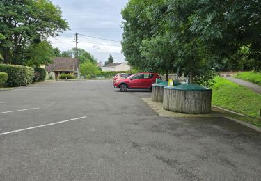
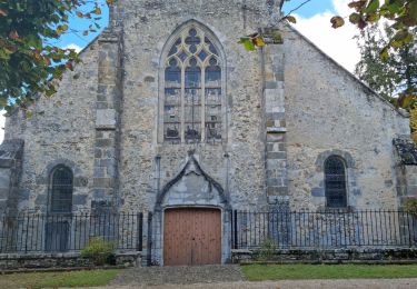
Circuit proposé par le Comité Départemental de Randonnée des Hauts de Seine. Particularités : Plaquette de la Mairie de Souzy la Briche, les Pétales de Souzy, 6 circuits balisés par des renards de couleurs différentes. Parking départ : Saint-Sulpice-de-Favières église rouge, Saint-Sulpice-de-Favières, la Remise de Saint-Sulpice .... GR1, Bois de Chantropin, Mirgaudon, Bois de la Butte de Moret, Ferme de la Bergerie, la Petite Beauce … nb, la Mare des Ruelles … orange, La Mare des Grous, la Mare Plate, GR11 cote carrefour Monamy, la Chênaye, Cote 95 Souzy la Briche.... GR11, Cote 95 .... bleu, Bois des Roches, Anciennes Carrières de Madagascar, Bois de la Saussaye, le Moulin Neuf, Souzy la Briche (14 km, lavoir couvert).... rose, bois de la Guigneraie, Bois de la Croix Boissée ... bleu, D82, la Grosse Haie,… nb, les Petites Maisons … rouge, les Emondants, Saint-Sulpice-de-Favières. Des sentiers ont pu être modifiés depuis la dernière validation et les itinéraires proposés n’engagent pas la responsabilité du Comité. Signalez-nous les modifications rencontrées pour mise à jour de la randothèque.

Elevation profile

Photos

Positioning

Country:
France
Region :
Ile-de-France
Department/Province :
Essonne
Municipality :
Saint-Sulpice-de-Favières
Location:
Unknown
Start:(UTM)
439357 ; 5376781 (31U) N.

Comments

Please log in to post a review or rate the element


Beau parcours mais quelques jolis endroit manqués par un parcours pas optimal (anciennes carrières de Madagascar par exemple).


Trails nearby

Trail On foot Saint-Sulpice-de-Favières - Boucle 18 km St Sulpice de Favières - Photo
On foot
GUIDE
chessyca

On foot

Medium
Saint-Sulpice-de-Favières, Ile-de-France, Essonne, France
18 km | 22 km-effort
4h 59min
Yes
Trail Walking Chamarande - bois de belvedere au depart de chamarande - Photo
Walking
tyjibreizh

Walking

Difficult
(1)
Chamarande, Ile-de-France, Essonne, France
12.6 km | 17.2 km-effort
3h 54min
Yes
Trail Walking Saint-Maurice-Montcouronne - Boucle St Maurice Montcouronne - Brigitte - Photo
Walking
GUIDE
chessyca

Walking

Very easy
Saint-Maurice-Montcouronne, Ile-de-France, Essonne, France
21 km | 24 km-effort
4h 19min
Yes
Trail On foot Saint-Yon - Sur les traces de la Renarde - Photo
On foot
GUIDE+

On foot

Very difficult
Saint-Yon, Ile-de-France, Essonne, France
38 km | 44 km-effort
10h 4min
No
Trail Walking Saint-Sulpice-de-Favières - St Sulpice - Photo
Walking
Auger91

Walking

Medium
(1)
Saint-Sulpice-de-Favières, Ile-de-France, Essonne, France
8 km | 10.1 km-effort
2h 18min
Yes
Trail Walking Boissy-sous-Saint-Yon - Carrière de Madagascar  - Photo
Walking
danbott

Walking

Very easy
(1)
Boissy-sous-Saint-Yon, Ile-de-France, Essonne, France
13.2 km | 16.5 km-effort
2h 59min
Yes
Trail Walking Saint-Chéron - Saint-Cheron - l'Orge - Photo
Walking
guydu41

Walking

Medium
Saint-Chéron, Ile-de-France, Essonne, France
8.3 km | 10.4 km-effort
2h 21min
Yes
Trail Walking Saint-Chéron - De Saint Chéron à Dourdan par les côteaux de la rive gauche - Photo
Walking
philippebenne

Walking

Difficult
(1)
Saint-Chéron, Ile-de-France, Essonne, France
13.5 km | 17 km-effort
3h 51min
No
Trail Walking Villeconin - Villeconin - Photo
Walking
guydu41

Walking

Medium
Villeconin, Ile-de-France, Essonne, France
8.5 km | 10.9 km-effort
2h 11min
Yes


Close
My subscriptions