Trail Walking Farbus - Le chemin de Saint Ranulphe - Farbus - Photo

Le chemin de Saint Ranulphe - Farbus

 tracegps
tracegps

User

© OpenStreetMap contributors
Length
Length
7.9 km
Max alt
Max alt
136 m
Uphill gradient
Uphill gradient
115 m
Km-Effort
Km-Effort  
9.5 km
Min alt
Min alt
65 m
Downhill gradient
Downhill gradient
115 m
Boucle
Boucle
Yes
Creation date :
2014-12-10 00:00:00.0
Updated on :
2014-12-10 00:00:00.0

(0 Reviews)

Walking
Walking
2h00
Difficulty : Medium

Scan this QR Code to open this trail in the SityTrail application

FREE GPS app for hiking

Logo SityTrail SityTrail

IGN / Geographical institutes

Download SityTrail from the App Store Download SityTrail from Google Play

Logo SityTrail SityTrail World

The world is yours!

Download SityTrail from the App Store Download SityTrail from Google Play Download SityTrail on Huawei AppGallery

About

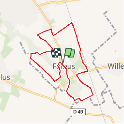
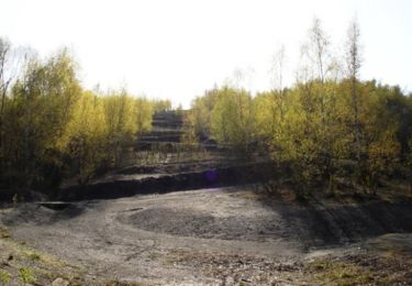
Trail Walking of 7.9 km to be discovered at Hauts-de-France, Pas-de-Calais, Farbus. This trail is proposed by tracegps.

Description

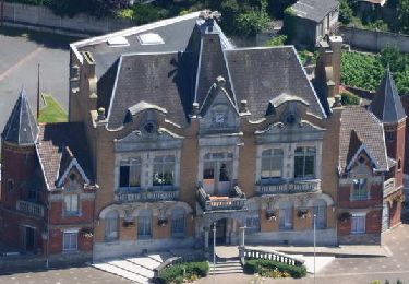
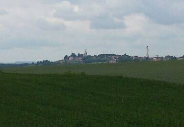
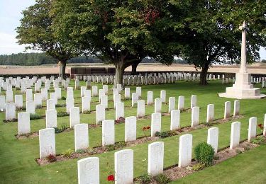
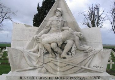
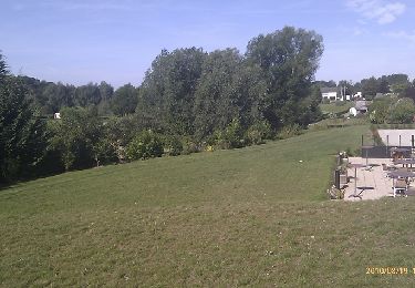
Circuit proposé par la Communauté Urbaine d’Arras et l’Office de Tourisme d’Arras. Départ de l’église de Farbus. Ce circuit vous conduit des limites de la plaine de la Gohelle aux portes du plateau d’Artois. Téléchargez la fiche du circuit.

Elevation profile

Photos

Positioning

Country:
France
Region :
Hauts-de-France
Department/Province :
Pas-de-Calais
Municipality :
Farbus
Location:
Unknown
Start:(Dec)
Start:(UTM)
487404 ; 5578405 (31U) N.

Trails nearby

Trail Walking Méricourt - MERICOURT DECOUVERTE 1er partie - Photo
Walking
PRO

Walking

Very easy
Méricourt, Hauts-de-France, Pas-de-Calais, France
8.1 km | 8.7 km-effort
1h 57min
Yes
Trail Walking Méricourt - MERICOURT DECOUVERTE 1er partie - Photo
Walking
abalcerek

Walking

Very easy
Méricourt, Hauts-de-France, Pas-de-Calais, France
8.1 km | 8.7 km-effort
2h 41min
Yes
Trail Walking Méricourt - Mericourt découverte - Photo
Walking
abalcerek

Walking

Very easy
Méricourt, Hauts-de-France, Pas-de-Calais, France
11.1 km | 12 km-effort
2h 26min
No
Trail Walking Écurie - tour de Neuville p2 - Photo
Walking
Gilbert62580

Walking

Easy
Écurie, Hauts-de-France, Pas-de-Calais, France
10.1 km | 11.1 km-effort
2h 32min
No
Trail Walking Neuville-Saint-Vaast - neuville saint vaast - Photo
Walking
Bernard.voyageur

Walking

Easy
(1)
Neuville-Saint-Vaast, Hauts-de-France, Pas-de-Calais, France
11.2 km | 12.4 km-effort
2h 35min
Yes
Trail Walking Thélus - Chemin de la couture comblée - Thélus - Photo
Walking
tracegps

Walking

Difficult
Thélus, Hauts-de-France, Pas-de-Calais, France
14.8 km | 16.3 km-effort
3h 40min
Yes
Trail Walking Neuville-Saint-Vaast -  Le sentier du souvenir (Neuville-Saint-Vaast) - Photo
Walking
tracegps

Walking

Medium
Neuville-Saint-Vaast, Hauts-de-France, Pas-de-Calais, France
13.3 km | 14.8 km-effort
3h 19min
Yes
Trail Walking Anzin-Saint-Aubin - Anzin Saint Aubin - Photo
Walking
tracegps

Walking

Medium
Anzin-Saint-Aubin, Hauts-de-France, Pas-de-Calais, France
6.2 km | 6.8 km-effort
1h 30min
No
Trail Walking Givenchy-en-Gohelle - Givenchy en Gohelle et le terril des Pinchonvalles - Photo
Walking
tracegps

Walking

Medium
Givenchy-en-Gohelle, Hauts-de-France, Pas-de-Calais, France
8.3 km | 10.3 km-effort
2h 0min
Yes


Close
My subscriptions