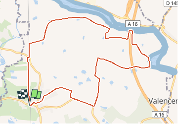
![](/images/other/stat-length.png)
![Trail Mountain bike Saint-Josse - Les Bas Champs - Villiers - Photo](https://media.geolcdn.com/t/1900/400/ext.pjpeg?maxdim=2&url=https%3A%2F%2Fservices.sitytrail.com%2FGeolivesWS%2FDownloadMedia.ashx%3FTrailID%3D110027%26Media%3D5133_4.jpg)
Les Bas Champs - Villiers
tracegps
User
![Length](/images/other/stat-length.png)
![Max alt](https://static1.geolcdn.com/siteimages/upload/files/1508320355ic_sort_altitude_max_24dp.png)
![Uphill gradient](https://static1.geolcdn.com/siteimages/upload/files/1508320355ic_sort_den_pos_24dp.png)
![Km-Effort](/images/other/stat-length.png)
![Min alt](https://static1.geolcdn.com/siteimages/upload/files/1508320355ic_sort_altitude_min_24dp.png)
![Downhill gradient](https://static1.geolcdn.com/siteimages/upload/files/1508320355ic_sort_den_neg_24dp.png)
![Boucle](https://static1.geolcdn.com/siteimages/upload/files/16400158638029165_repeat_loop_refresh_sync_direction_icon.png)
![Mountain bike](https://static1.geolcdn.com/sitytour/trail-icons/202.png)
1h10
Difficulty : Easy
![Scan this QR Code to open this trail in the SityTrail application](https://capi.geolives.com/qq0zvz2zws4bq2lad0pu/sitytour/trails/110027/qr.png?size=200)
FREE GPS app for hiking
About
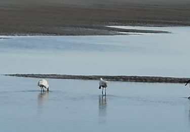
Trail Mountain bike of 10.8 km to be discovered at Hauts-de-France, Pas-de-Calais, Saint-Josse. This trail is proposed by tracegps.
Description
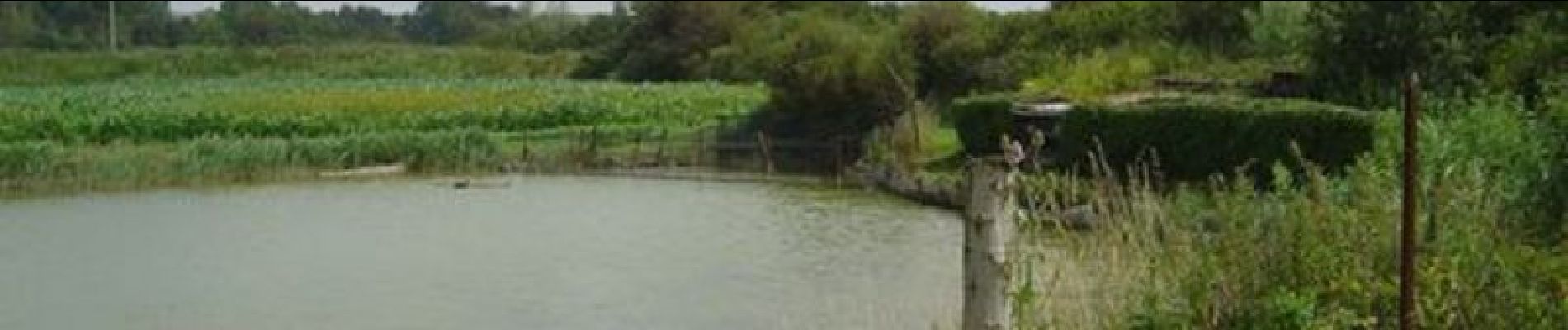
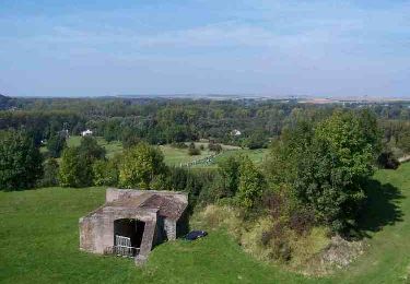
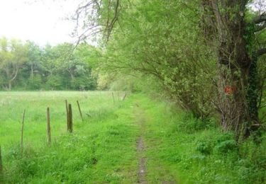
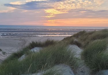
Circuit proposé par la Communauté de Communes Mer & Terres d’Opale et l’Office de Tourisme de Stella-Plage. Départ du centre de Villiers. Avec un accès facile en famille, ce petit chemin nous entraîne, comme un détour, dans un ailleurs paisible. L’alternance de cultures, pâturages, mares et belles bâtisses agricoles, nous permet de découvrir les secrets de cette plaine maritime qui s’étend de la Canche à la Somme. Retrouvez le Plan du Circuit sur le site de la Communauté de Communes Mer & Terres d’Opale. Ce circuit a été numérisé par les randonneurs du CODEPEM. Merci à Jean-Marie.
Positioning
Comments
Trails nearby
![Trail Cycle Étaples - Les Garnoulles - Etaples - Photo](https://media.geolcdn.com/t/375/260/ext.jpg?maxdim=2&url=https%3A%2F%2Fservices.sitytrail.com%2FGeolivesWS%2FDownloadMedia.ashx%3FTrailID%3D110038%26Media%3D5140_6.jpg)
![Cycle Cycle](https://static1.geolcdn.com/sitytour/trail-icons/200.png)
Cycle
![](/images/other/stat-length.png)
![](https://static1.geolcdn.com/siteimages/upload/files/16400158638029165_repeat_loop_refresh_sync_direction_icon.png)
![Trail Walking Étaples - Le sentier du Rombly - Etaples - Photo](https://media.geolcdn.com/t/375/260/ext.jpg?maxdim=2&url=https%3A%2F%2Fservices.sitytrail.com%2FGeolivesWS%2FDownloadMedia.ashx%3FTrailID%3D110030%26Media%3D5135_5.jpg)
![Walking Walking](https://static1.geolcdn.com/sitytour/trail-icons/101.png)
Walking
![](/images/other/stat-length.png)
![](https://static1.geolcdn.com/siteimages/upload/files/16400158638029165_repeat_loop_refresh_sync_direction_icon.png)
![Trail Walking Merlimont - Le sentier de la forêt - Merlimont - Photo](https://media.geolcdn.com/t/375/260/ext.jpg?maxdim=2&url=https%3A%2F%2Fservices.sitytrail.com%2FGeolivesWS%2FDownloadMedia.ashx%3FTrailID%3D110025%26Media%3D5132_5.jpg)
![Walking Walking](https://static1.geolcdn.com/sitytour/trail-icons/101.png)
Walking
![](/images/other/stat-length.png)
![](https://static1.geolcdn.com/siteimages/upload/files/16400158638029165_repeat_loop_refresh_sync_direction_icon.png)
![Walking Walking](https://static1.geolcdn.com/sitytour/trail-icons/101.png)
Walking
![](/images/other/stat-length.png)
![](https://static1.geolcdn.com/siteimages/upload/files/16400158638029165_repeat_loop_refresh_sync_direction_icon.png)
![Trail On foot Étaples - Sentier de Rombly - Photo](https://media.geolcdn.com/t/375/260/91fe37b4-244e-4fc8-8ef4-3e25b2d6c241.jpeg&format=jpg&maxdim=2)
![On foot On foot](https://static1.geolcdn.com/sitytour/trail-icons/100.png)
On foot
![](/images/other/stat-length.png)
![](https://static1.geolcdn.com/siteimages/upload/files/16400158638029165_repeat_loop_refresh_sync_direction_icon.png)
![Trail On foot Sorrus - Sentier Les Pyroles - Photo](https://media.geolcdn.com/t/375/260/2d43b8dd-8de3-4768-a347-d63ecb6aacf3.jpeg&format=jpg&maxdim=2)
![On foot On foot](https://static1.geolcdn.com/sitytour/trail-icons/100.png)
On foot
![](/images/other/stat-length.png)
![](https://static1.geolcdn.com/siteimages/upload/files/16400158638029165_repeat_loop_refresh_sync_direction_icon.png)
![Trail Nordic walking Le Touquet-Paris-Plage - Marche nordique : Boucle 12 km Le Touquet - Merlimont - Photo](https://media.geolcdn.com/t/375/260/3f68287f-5493-43e5-98e0-b8e122cf61f9.jpg&format=jpg&maxdim=2)
![Nordic walking Nordic walking](https://static1.geolcdn.com/sitytour/trail-icons/102.png)
Nordic walking
![](/images/other/stat-length.png)
![](https://static1.geolcdn.com/siteimages/upload/files/16400158638029165_repeat_loop_refresh_sync_direction_icon.png)
![Trail Walking Le Touquet-Paris-Plage - Sur la route du musée - Photo](https://media.geolcdn.com/t/375/260/62c5aadb-0410-4785-8e61-ddcf957a5ea7.jpg&format=jpg&maxdim=2)
![Walking Walking](https://static1.geolcdn.com/sitytour/trail-icons/101.png)
Walking
![](/images/other/stat-length.png)
![](https://static1.geolcdn.com/siteimages/upload/files/16400158638029165_repeat_loop_refresh_sync_direction_icon.png)
![Trail Walking Le Touquet-Paris-Plage - Balade dans la baie de Canche - Photo](https://media.geolcdn.com/t/375/260/3dc28a84-57d0-46cf-b02e-bd5974f0e2ec.jpg&format=jpg&maxdim=2)
![Walking Walking](https://static1.geolcdn.com/sitytour/trail-icons/101.png)
Walking
![](/images/other/stat-length.png)
![](https://static1.geolcdn.com/siteimages/upload/files/16400158638029165_repeat_loop_refresh_sync_direction_icon.png)