![](/images/other/stat-length.png)
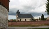
![Trail Cycle Corbie - Les trois vallées - Corbie - Bavelincourt - Photo](https://media.geolcdn.com/t/1900/400/ext.pjpeg?maxdim=2&url=https%3A%2F%2Fservices.sitytrail.com%2FGeolivesWS%2FDownloadMedia.ashx%3FTrailID%3D109977%26Media%3D5058_1.jpg)
Les trois vallées - Corbie - Bavelincourt
tracegps
User
![Length](/images/other/stat-length.png)
![Max alt](https://static1.geolcdn.com/siteimages/upload/files/1508320355ic_sort_altitude_max_24dp.png)
![Uphill gradient](https://static1.geolcdn.com/siteimages/upload/files/1508320355ic_sort_den_pos_24dp.png)
![Km-Effort](/images/other/stat-length.png)
![Min alt](https://static1.geolcdn.com/siteimages/upload/files/1508320355ic_sort_altitude_min_24dp.png)
![Downhill gradient](https://static1.geolcdn.com/siteimages/upload/files/1508320355ic_sort_den_neg_24dp.png)
![Boucle](https://static1.geolcdn.com/siteimages/upload/files/16400158638029165_repeat_loop_refresh_sync_direction_icon.png)
![Cycle](https://static1.geolcdn.com/sitytour/trail-icons/200.png)
2h00
Difficulty : Difficult
![Scan this QR Code to open this trail in the SityTrail application](https://capi.geolives.com/qq0zvz2zws4bq2lad0pu/sitytour/trails/109977/qr.png?size=200)
FREE GPS app for hiking
About
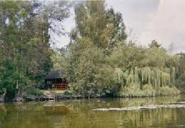
Trail Cycle of 34 km to be discovered at Hauts-de-France, Somme, Corbie. This trail is proposed by tracegps.
Description
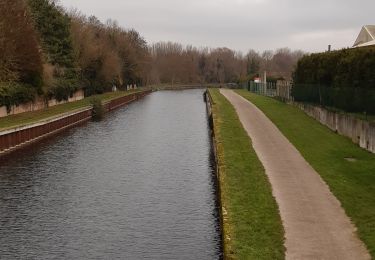
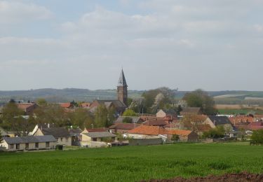
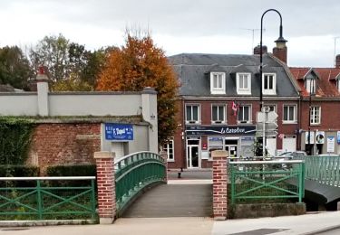
Les trois vallées - Corbie - Bavelincourt Départ : place de la République à Corbie. Une boucle pour découvrir la vallée de la Somme, la vallée de l’Ancre et la vallée de l’Hallue. À voir : Corbie : Abbatiale Saint-Pierre XVIè siècle, hôtel de ville, porte monumentale place de la République, musée d’histoire locale.
Positioning
Comments
Trails nearby
![Trail Mountain bike Corbie - 50 km la SOMALUANCRE Corbie 2014 - Photo](https://media.geolcdn.com/t/375/260/ext.jpg?maxdim=2&url=https%3A%2F%2Fstatic1.geolcdn.com%2Fsiteimages%2Fupload%2Ffiles%2F1524743154velo.jpg)
![Mountain bike Mountain bike](https://static1.geolcdn.com/sitytour/trail-icons/202.png)
Mountain bike
![](/images/other/stat-length.png)
![](https://static1.geolcdn.com/siteimages/upload/files/16400158638029165_repeat_loop_refresh_sync_direction_icon.png)
![Trail Walking Corbie - Les rives de Somme de Corbie à Amiens - Photo](https://media.geolcdn.com/t/375/260/b950c723-196c-4705-b4c8-c7caaabdf39d.jpg&format=jpg&maxdim=2)
![Walking Walking](https://static1.geolcdn.com/sitytour/trail-icons/101.png)
Walking
![](/images/other/stat-length.png)
![](https://static1.geolcdn.com/siteimages/upload/files/16400158638029165_repeat_loop_refresh_sync_direction_icon.png)
![Trail On foot Le Hamel - Les Deux Chapelles - Photo](https://media.geolcdn.com/t/375/260/09925899-bea9-47f2-987e-ad34e8477089.jpeg&format=jpg&maxdim=2)
![On foot On foot](https://static1.geolcdn.com/sitytour/trail-icons/100.png)
On foot
![](/images/other/stat-length.png)
![](https://static1.geolcdn.com/siteimages/upload/files/16400158638029165_repeat_loop_refresh_sync_direction_icon.png)
![Trail On foot Corbie - Les Étangs de Corbie - Photo](https://media.geolcdn.com/t/375/260/352d23ef-b126-41ef-bb6c-5ffcf70c62a3.jpeg&format=jpg&maxdim=2)
![On foot On foot](https://static1.geolcdn.com/sitytour/trail-icons/100.png)
On foot
![](/images/other/stat-length.png)
![](https://static1.geolcdn.com/siteimages/upload/files/16400158638029165_repeat_loop_refresh_sync_direction_icon.png)
![Trail On foot Daours - Le Passage aux Loups - Photo](https://media.geolcdn.com/t/375/260/c0a6c8f5-02d2-4dbd-8744-0550644a54a7.jpeg&format=jpg&maxdim=2)
![On foot On foot](https://static1.geolcdn.com/sitytour/trail-icons/100.png)
On foot
![](/images/other/stat-length.png)
![](https://static1.geolcdn.com/siteimages/upload/files/16400158638029165_repeat_loop_refresh_sync_direction_icon.png)
![Trail Quad Fouilloy - 30 juil. 2019 14:04:21 - Photo](https://media.geolcdn.com/t/375/260/2fe84f10-c8aa-4a4e-9c7d-13d62879c110.jpg&format=jpg&maxdim=2)
![Quad Quad](https://static1.geolcdn.com/sitytour/trail-icons/404.png)
Quad
![](/images/other/stat-length.png)
![](https://static1.geolcdn.com/siteimages/upload/files/16400158638029165_repeat_loop_refresh_sync_direction_icon.png)
![Trail Quad Corbie - quad sortie de vaux sur somme - Photo](https://media.geolcdn.com/t/375/260/ae351dfb-69e0-4653-980d-0a876a929654.jpg&format=jpg&maxdim=2)
![Quad Quad](https://static1.geolcdn.com/sitytour/trail-icons/404.png)
Quad
![](/images/other/stat-length.png)
![](https://static1.geolcdn.com/siteimages/upload/files/16400158638029165_repeat_loop_refresh_sync_direction_icon.png)
![Trail Quad Vaux-sur-Somme - quad_sortie_de_vaux_sur_somme - Photo](https://media.geolcdn.com/t/375/260/f2394ebf-224c-421f-b2a0-3ab7f694da53.jpg&format=jpg&maxdim=2)
![Quad Quad](https://static1.geolcdn.com/sitytour/trail-icons/404.png)
Quad
![](/images/other/stat-length.png)
![](https://static1.geolcdn.com/siteimages/upload/files/16400158638029165_repeat_loop_refresh_sync_direction_icon.png)
![Trail Quad Corbie - quad Corbie Naours heilly - Photo](https://media.geolcdn.com/t/375/260/d25db014-3de5-4c5c-9b7a-0318f71698ab.jpg&format=jpg&maxdim=2)
![Quad Quad](https://static1.geolcdn.com/sitytour/trail-icons/404.png)
Quad
![](/images/other/stat-length.png)
![](https://static1.geolcdn.com/siteimages/upload/files/16400158638029165_repeat_loop_refresh_sync_direction_icon.png)