![](/images/other/stat-length.png)
![Trail Cycle Crécy-en-Ponthieu - Les Vieux Chênes - Crécy en Ponthieu - Photo](https://media.geolcdn.com/t/1900/400/ext.pjpeg?maxdim=2&url=https%3A%2F%2Fservices.sitytrail.com%2FGeolivesWS%2FDownloadMedia.ashx%3FTrailID%3D109915%26Media%3D4931_1.jpg)
Les Vieux Chênes - Crécy en Ponthieu
tracegps
User
![Length](/images/other/stat-length.png)
Length
49 km
![Max alt](https://static1.geolcdn.com/siteimages/upload/files/1508320355ic_sort_altitude_max_24dp.png)
Max alt
96 m
![Uphill gradient](https://static1.geolcdn.com/siteimages/upload/files/1508320355ic_sort_den_pos_24dp.png)
Uphill gradient
416 m
![Km-Effort](/images/other/stat-length.png)
Km-Effort
54 km
![Min alt](https://static1.geolcdn.com/siteimages/upload/files/1508320355ic_sort_altitude_min_24dp.png)
Min alt
6 m
![Downhill gradient](https://static1.geolcdn.com/siteimages/upload/files/1508320355ic_sort_den_neg_24dp.png)
Downhill gradient
424 m
![Boucle](https://static1.geolcdn.com/siteimages/upload/files/16400158638029165_repeat_loop_refresh_sync_direction_icon.png)
Boucle
Yes
Creation date :
2014-12-10 00:00:00.0
Updated on :
2014-12-10 00:00:00.0
![Cycle](https://static1.geolcdn.com/sitytour/trail-icons/200.png)
3h00
Difficulty : Difficult
![Scan this QR Code to open this trail in the SityTrail application](https://capi.geolives.com/qq0zvz2zws4bq2lad0pu/sitytour/trails/109915/qr.png?size=200)
FREE GPS app for hiking
About
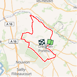
Trail Cycle of 49 km to be discovered at Hauts-de-France, Somme, Crécy-en-Ponthieu. This trail is proposed by tracegps.
Description
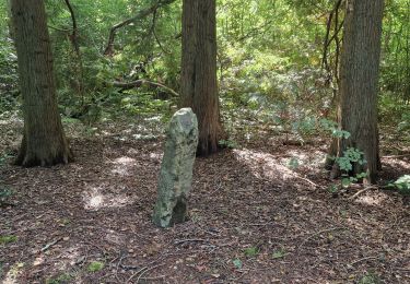
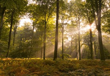
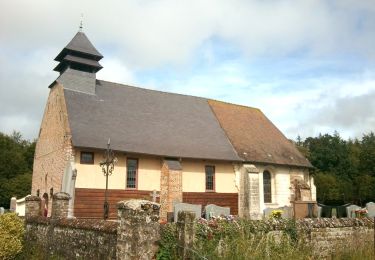
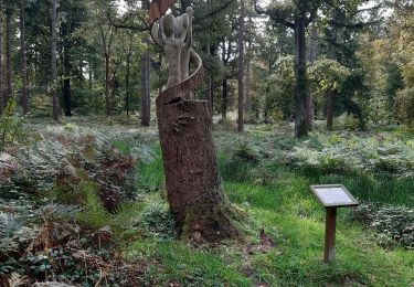
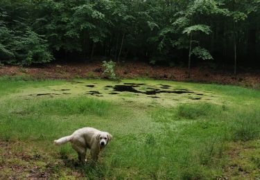
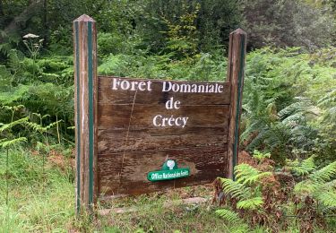
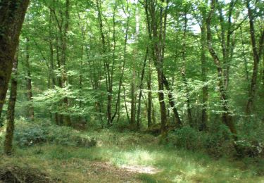
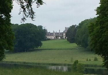
Les Vieux Chênes Une randonnée à la découverte de 2 fleuves côtiers surprenants : l’Authie et la Maye. Un détour au coeur de la forêt de Crécy qui abrite plusieurs arbres remarquables. Départ : Crécy-en-Ponthieu, parking de la salle des fêtes, dite « du Casino ».
Positioning
Country:
France
Region :
Hauts-de-France
Department/Province :
Somme
Municipality :
Crécy-en-Ponthieu
Location:
Crécy-en-Ponthieu
Start:(Dec)
Start:(UTM)
420546 ; 5567222 (31U) N.
Comments
Trails nearby
![Trail Walking Crécy-en-Ponthieu - Forêt de Crécy-en-Ponthieu - Photo](https://media.geolcdn.com/t/375/260/fd05b009-a0e0-48d9-b30d-737c848f8a0a.jpg&format=jpg&maxdim=2)
![Walking Walking](https://static1.geolcdn.com/sitytour/trail-icons/101.png)
Forêt de Crécy-en-Ponthieu
Walking
Medium
Crécy-en-Ponthieu,
Hauts-de-France,
Somme,
France
![](/images/other/stat-length.png)
18.8 km | 22 km-effort
4h 38min
![](https://static1.geolcdn.com/siteimages/upload/files/16400158638029165_repeat_loop_refresh_sync_direction_icon.png)
Yes
![Trail Walking Forest-l'Abbaye - À la découverte d'arbres remarquables en Forêt de Crécy - Photo](https://media.geolcdn.com/t/375/260/8a9c9e06-a466-4037-92ca-f29b0b2e52d6.jpeg&format=jpg&maxdim=2)
![Walking Walking](https://static1.geolcdn.com/sitytour/trail-icons/101.png)
À la découverte d'arbres remarquables en Forêt de Crécy
Walking
Medium
Forest-l'Abbaye,
Hauts-de-France,
Somme,
France
![](/images/other/stat-length.png)
7.9 km | 8.8 km-effort
1h 59min
![](https://static1.geolcdn.com/siteimages/upload/files/16400158638029165_repeat_loop_refresh_sync_direction_icon.png)
Yes
![Trail Walking Crécy-en-Ponthieu - Forêt de Crécy - Photo](https://media.geolcdn.com/t/375/260/f1b387ad-8151-48dc-8a2f-cae702cbbcd3.jpeg&format=jpg&maxdim=2)
![Walking Walking](https://static1.geolcdn.com/sitytour/trail-icons/101.png)
Forêt de Crécy
Walking
Medium
Crécy-en-Ponthieu,
Hauts-de-France,
Somme,
France
![](/images/other/stat-length.png)
6.3 km | 7 km-effort
2h 21min
![](https://static1.geolcdn.com/siteimages/upload/files/16400158638029165_repeat_loop_refresh_sync_direction_icon.png)
Yes
![Trail On foot Forest-l'Abbaye - Le Hallot - Photo](https://media.geolcdn.com/t/375/260/55088aac-3fac-47bc-a0c5-00e9894c90f2.jpeg&format=jpg&maxdim=2)
![On foot On foot](https://static1.geolcdn.com/sitytour/trail-icons/100.png)
Le Hallot
On foot
Easy
Forest-l'Abbaye,
Hauts-de-France,
Somme,
France
![](/images/other/stat-length.png)
4.3 km | 4.9 km-effort
1h 6min
![](https://static1.geolcdn.com/siteimages/upload/files/16400158638029165_repeat_loop_refresh_sync_direction_icon.png)
Yes
![Trail Walking Crécy-en-Ponthieu - LP80_Crecy Ponthieu_Scultures bois - Photo](https://media.geolcdn.com/t/375/260/85252c58-db6b-4eda-bb40-73441ade40b9.jpg&format=jpg&maxdim=2)
![Walking Walking](https://static1.geolcdn.com/sitytour/trail-icons/101.png)
LP80_Crecy Ponthieu_Scultures bois
Walking
Very easy
Crécy-en-Ponthieu,
Hauts-de-France,
Somme,
France
![](/images/other/stat-length.png)
4.2 km | 4.7 km-effort
1h 41min
![](https://static1.geolcdn.com/siteimages/upload/files/16400158638029165_repeat_loop_refresh_sync_direction_icon.png)
No
![Trail Walking Crécy-en-Ponthieu - forêt de Crecy - Photo](https://media.geolcdn.com/t/375/260/63501a4c-5e7d-4485-abe4-dbf7d7ae3149.jpg&format=jpg&maxdim=2)
![Walking Walking](https://static1.geolcdn.com/sitytour/trail-icons/101.png)
forêt de Crecy
Walking
Very easy
Crécy-en-Ponthieu,
Hauts-de-France,
Somme,
France
![](/images/other/stat-length.png)
7.1 km | 8.3 km-effort
1h 44min
![](https://static1.geolcdn.com/siteimages/upload/files/16400158638029165_repeat_loop_refresh_sync_direction_icon.png)
Yes
![Mountain bike Mountain bike](https://static1.geolcdn.com/sitytour/trail-icons/202.png)
activity_5258602101
Mountain bike
Very easy
Crécy-en-Ponthieu,
Hauts-de-France,
Somme,
France
![](/images/other/stat-length.png)
12.6 km | 14.1 km-effort
40min
![](https://static1.geolcdn.com/siteimages/upload/files/16400158638029165_repeat_loop_refresh_sync_direction_icon.png)
Yes
![Trail Walking Forest-l'Abbaye - LP80_FOREST-L'ABBAYE_7.9Km - Photo](https://media.geolcdn.com/t/375/260/850fc8db-eca0-4824-b9eb-923ba67d45f6.jpg&format=jpg&maxdim=2)
![Walking Walking](https://static1.geolcdn.com/sitytour/trail-icons/101.png)
LP80_FOREST-L'ABBAYE_7.9Km
Walking
Medium
Forest-l'Abbaye,
Hauts-de-France,
Somme,
France
![](/images/other/stat-length.png)
7.9 km | 8.8 km-effort
1h 56min
![](https://static1.geolcdn.com/siteimages/upload/files/16400158638029165_repeat_loop_refresh_sync_direction_icon.png)
Yes
![Trail Walking Crécy-en-Ponthieu - Forêt de Crecy 2 - Photo](https://media.geolcdn.com/t/375/260/ext.jpg?maxdim=2&url=https%3A%2F%2Fservices.sitytrail.com%2FGeolivesWS%2FDownloadMedia.ashx%3FTrailID%3D306945%26Media%3Dfix__20140529134733.jpg)
![Walking Walking](https://static1.geolcdn.com/sitytour/trail-icons/101.png)
Forêt de Crecy 2
Walking
Difficult
(1)
Crécy-en-Ponthieu,
Hauts-de-France,
Somme,
France
![](/images/other/stat-length.png)
18.8 km | 21 km-effort
4h 41min
![](https://static1.geolcdn.com/siteimages/upload/files/16400158638029165_repeat_loop_refresh_sync_direction_icon.png)
Yes
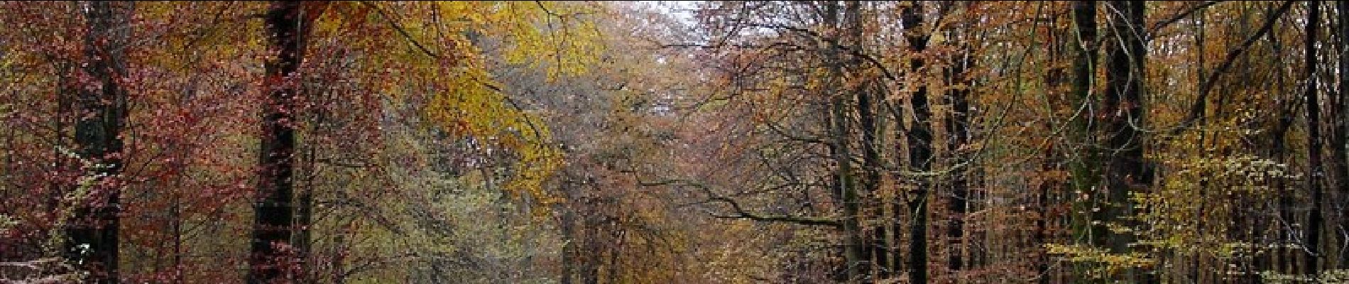
attention une partie non revêtue dans la forêt de Crecy